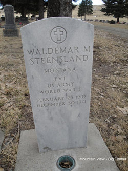
Waldemar M “Walt” Steensland
| Birth | : | 23 Feb 1910 Big Timber, Sweet Grass County, Montana, USA |
| Death | : | 30 Dec 1974 Fort William Henry Harrison, Lewis and Clark County, Montana, USA |
| Burial | : | Chestnut Hill Cemetery, Portville, Cattaraugus County, USA |
| Coordinate | : | 42.0409012, -78.3321991 |
| Plot | : | Section 6, Block 9, Lot 2, Grave 6 |
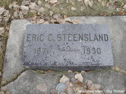
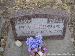
| Description | : | Waldemar M. (Walt) Steensland, 61, died early Thursday morning of last week at the Veterans Hospital at Fort Harrison, Montana where he had been a patient since Christmas. Funeral services were held Monday, Jan 3, at 2pm from the big Timber Lutheran Church. He was born February 23, 1910 at Big Timber, Montana, a son of Mr. and Mrs. Eric Steenslands. He was married to Beulah Branae on December 15, 1934 at Big Timber. Survivors include his widow; a son, Robert Steensland, of the U.S. Navy at Smyrna, Georgia; three daughters , Mrs. Dick (Patsy) Prather of Chevy Chase, MD.,... Read More |
frequently asked questions (FAQ):
-
Where is Waldemar M “Walt” Steensland's memorial?
Waldemar M “Walt” Steensland's memorial is located at: Chestnut Hill Cemetery, Portville, Cattaraugus County, USA.
-
When did Waldemar M “Walt” Steensland death?
Waldemar M “Walt” Steensland death on 30 Dec 1974 in Fort William Henry Harrison, Lewis and Clark County, Montana, USA
-
Where are the coordinates of the Waldemar M “Walt” Steensland's memorial?
Latitude: 42.0409012
Longitude: -78.3321991
Family Members:
Parent
Spouse
Siblings
Flowers:
Nearby Cemetories:
1. Chestnut Hill Cemetery
Portville, Cattaraugus County, USA
Coordinate: 42.0409012, -78.3321991
2. Pine Street Cemetery
Portville, Cattaraugus County, USA
Coordinate: 42.0308990, -78.3415985
3. East Portville Cemetery
Main Settlement, Cattaraugus County, USA
Coordinate: 42.0135002, -78.3151016
4. Portville Cemetery
Westons Mills, Cattaraugus County, USA
Coordinate: 42.0769005, -78.3716965
5. Artline Road Cemetery
Eldred, McKean County, USA
Coordinate: 41.9929000, -78.3794000
6. Ceres Cemetery
McKean County, USA
Coordinate: 41.9991400, -78.2719600
7. Evergreen Cemetery
McKean County, USA
Coordinate: 41.9875100, -78.2914500
8. West Genesee Cemetery
Obi, Allegany County, USA
Coordinate: 42.0807991, -78.2636032
9. Cooks Cemetery
Eldred, McKean County, USA
Coordinate: 41.9798700, -78.4024070
10. Mount View Cemetery
Olean, Cattaraugus County, USA
Coordinate: 42.0681000, -78.4341965
11. Saint Mary of the Angels Church Grounds
Olean, Cattaraugus County, USA
Coordinate: 42.0753090, -78.4310530
12. Bowler Memorial Cemetery
Little Genesee, Allegany County, USA
Coordinate: 42.0162600, -78.2281800
13. Oak Hill Cemetery (Defunct)
Olean, Cattaraugus County, USA
Coordinate: 42.0792400, -78.4366000
14. Saint Raphael Cemetery
Eldred, McKean County, USA
Coordinate: 41.9589000, -78.3758000
15. Little Genesee Cemetery
Allegany County, USA
Coordinate: 42.0374985, -78.2063980
16. Little Rhode Island Cemetery
Little Genesee, Allegany County, USA
Coordinate: 42.0375800, -78.2060100
17. Haskel Flats Cemetery
Haskell Flats, Cattaraugus County, USA
Coordinate: 42.1349983, -78.3441010
18. Loop Parmeter Cemetery
Eldred Township, McKean County, USA
Coordinate: 41.9659000, -78.4108000
19. Myrtle Cemetery
McKean County, USA
Coordinate: 41.9787000, -78.2349000
20. Oak Hill Cemetery
Eldred, McKean County, USA
Coordinate: 41.9510994, -78.3824997
21. Lamphier Cemetery
Eldred, McKean County, USA
Coordinate: 41.9491997, -78.3807983
22. Wells Cemetery
Little Genesee, Allegany County, USA
Coordinate: 42.0321999, -78.1994019
23. Pleasant Valley Cemetery
Olean, Cattaraugus County, USA
Coordinate: 42.1255989, -78.4107971
24. Bnai Israel Cemetery
North Olean, Cattaraugus County, USA
Coordinate: 42.1245995, -78.4131012

