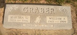
William A Graber
| Birth | : | 17 May 1913 |
| Death | : | 2 Nov 1999 |
| Burial | : | Withyditch Baptist Chapel, Bath, Bath and North East Somerset Unitary Authority, England |
| Coordinate | : | 51.3328833, -2.4273859 |
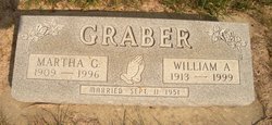
| Inscription | : | Married Sept. 11, 1951 |
frequently asked questions (FAQ):
-
Where is William A Graber's memorial?
William A Graber's memorial is located at: Withyditch Baptist Chapel, Bath, Bath and North East Somerset Unitary Authority, England.
-
When did William A Graber death?
William A Graber death on 2 Nov 1999 in
-
Where are the coordinates of the William A Graber's memorial?
Latitude: 51.3328833
Longitude: -2.4273859
Family Members:
Parent
Spouse
Siblings
Flowers:
Nearby Cemetories:
1. Withyditch Baptist Chapel
Bath, Bath and North East Somerset Unitary Authority, England
Coordinate: 51.3328833, -2.4273859
2. All Saints Church
Dunkerton, Bath and North East Somerset Unitary Authority, England
Coordinate: 51.3320390, -2.4158600
3. Saint Luke & Saint Andrew
Priston, Bath and North East Somerset Unitary Authority, England
Coordinate: 51.3419170, -2.4421910
4. Ashgrove Cemetery
Peasedown St John, Bath and North East Somerset Unitary Authority, England
Coordinate: 51.3181600, -2.4150760
5. St. John the Baptist Churchyard
Peasedown St John, Bath and North East Somerset Unitary Authority, England
Coordinate: 51.3164630, -2.4327370
6. St. Peter's Churchyard
Camerton, Bath and North East Somerset Unitary Authority, England
Coordinate: 51.3150300, -2.4503700
7. Wellow & Shoscombe Cemetery
Wellow, Bath and North East Somerset Unitary Authority, England
Coordinate: 51.3165527, -2.3916632
8. Combe Hay Parish Churchyard
Combe Hay, Bath and North East Somerset Unitary Authority, England
Coordinate: 51.3371120, -2.3817390
9. Combe Hay Cemetery
Combe Hay, Bath and North East Somerset Unitary Authority, England
Coordinate: 51.3397819, -2.3814323
10. St Mary Church Cemetery
Timsbury, Bath and North East Somerset Unitary Authority, England
Coordinate: 51.3268300, -2.4784070
11. Blessed Virgin Mary Churchyard
Timsbury, Bath and North East Somerset Unitary Authority, England
Coordinate: 51.3257710, -2.4782750
12. St Peter Churchyard
Englishcombe, Bath and North East Somerset Unitary Authority, England
Coordinate: 51.3640600, -2.4088700
13. St Julian's Churchyard
Wellow, Bath and North East Somerset Unitary Authority, England
Coordinate: 51.3240160, -2.3717630
14. Foxcote St James' The Less Churchyard
Shoscombe, Bath and North East Somerset Unitary Authority, England
Coordinate: 51.2985762, -2.4092987
15. St. James the Less Churchyard
Foxcote, Mendip District, England
Coordinate: 51.2985540, -2.4093370
16. Holy Trinity Churchyard
Clandown, Bath and North East Somerset Unitary Authority, England
Coordinate: 51.3024050, -2.4611700
17. Saint Lawrence of Stanton Prior
Keynsham, Bath and North East Somerset Unitary Authority, England
Coordinate: 51.3626830, -2.4638780
18. Saint Lawrence Churchyard
Stanton Prior, Bath and North East Somerset Unitary Authority, England
Coordinate: 51.3627780, -2.4638890
19. All Saints Churchyard
Farmborough, Bath and North East Somerset Unitary Authority, England
Coordinate: 51.3430620, -2.4876590
20. St. Mary Magdalene Churchyard
Writhlington, Bath and North East Somerset Unitary Authority, England
Coordinate: 51.2938240, -2.4262230
21. Bath Union Workhouse Burial Ground
Bath, Bath and North East Somerset Unitary Authority, England
Coordinate: 51.3570889, -2.3773370
22. Haycombe Cemetery and Crematorium
Bath, Bath and North East Somerset Unitary Authority, England
Coordinate: 51.3703430, -2.4014760
23. St. Peter's Church Cemetery
Marksbury, Bath and North East Somerset Unitary Authority, England
Coordinate: 51.3591670, -2.4802780
24. St. James' Churchyard
South Stoke, Bath and North East Somerset Unitary Authority, England
Coordinate: 51.3497220, -2.3652780


