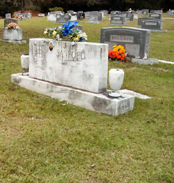
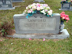
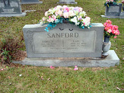
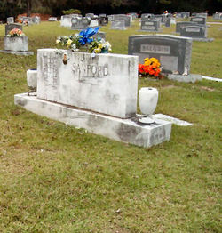
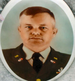
William Bunyon Sanford
| Birth | : | 24 Sep 1916 Orangeburg County, South Carolina, USA |
| Death | : | 3 Dec 1974 Columbia, Richland County, South Carolina, USA |
| Burial | : | Pleasant Ridge Cemetery, Goddard, Sedgwick County, USA |
| Coordinate | : | 37.6777992, -97.5627975 |
| Inscription | : | PVT US ARMY WWII |
| Description | : | Cordova - William B. Sanford, retired textile employee, died Tuesday in a Columbia hospital. The funeral will be 4 p.m. Thursday at the Thompson Funeral Home Chapel. Burial will be in Memorial Park Cemetery. Mr. Sanford was born in Orangeburg County, a son of Mrs. Cora Ezekiel Sanford and the late Earl Sanford. He was a veteran of World War II. Surviving, in addition to his widow, Mrs. Leoma Harley Sanford of Cordova and his mother of Orangeburg, are: four daughters, Mrs. Harold Tobias of Wagener, Mrs. George Herron and Mrs. Johnny Crosby, Mrs. Thomas Morris of Orangeburg; three sons,... Read More |
frequently asked questions (FAQ):
-
Where is William Bunyon Sanford's memorial?
William Bunyon Sanford's memorial is located at: Pleasant Ridge Cemetery, Goddard, Sedgwick County, USA.
-
When did William Bunyon Sanford death?
William Bunyon Sanford death on 3 Dec 1974 in Columbia, Richland County, South Carolina, USA
-
Where are the coordinates of the William Bunyon Sanford's memorial?
Latitude: 37.6777992
Longitude: -97.5627975
Family Members:
Parent
Spouse
Siblings
Children
Flowers:
Nearby Cemetories:
1. Pleasant Ridge Cemetery
Goddard, Sedgwick County, USA
Coordinate: 37.6777992, -97.5627975
2. Afton Cemetery
Goddard, Sedgwick County, USA
Coordinate: 37.6338997, -97.6057968
3. Saint Marks Cemetery
Saint Marks, Sedgwick County, USA
Coordinate: 37.7363014, -97.5613022
4. Resthaven Gardens of Memory
Wichita, Sedgwick County, USA
Coordinate: 37.6666985, -97.4772034
5. Saint Marys Cemetery
Garden Plain, Sedgwick County, USA
Coordinate: 37.7068300, -97.6430500
6. Resurrection Cemetery and Mausoleum
Wichita, Sedgwick County, USA
Coordinate: 37.7131250, -97.4623780
7. Saint Peters Cemetery
Schulte, Sedgwick County, USA
Coordinate: 37.6244700, -97.4705600
8. Old Saint Johns Cemetery
Viola, Sedgwick County, USA
Coordinate: 37.5822868, -97.5706635
9. Saint Anthony Cemetery
Garden Plain, Sedgwick County, USA
Coordinate: 37.6535988, -97.6838989
10. Calvary Methodist Cemetery
Garden Plain, Sedgwick County, USA
Coordinate: 37.6528015, -97.6841965
11. Jamesburg Park Cemetery
Wichita, Sedgwick County, USA
Coordinate: 37.7160988, -97.4449997
12. Covenant Presbyterian Church Columbarium
Wichita, Sedgwick County, USA
Coordinate: 37.7152678, -97.4436548
13. Sacred Heart Catholic Cemetery
Colwich, Sedgwick County, USA
Coordinate: 37.7798004, -97.5447006
14. Mulkey Cemetery
Garden Plain, Sedgwick County, USA
Coordinate: 37.7071495, -97.6878967
15. Good Shepherd Episcopal Memorial Garden
Wichita, Sedgwick County, USA
Coordinate: 37.7222700, -97.4362300
16. Saint John's Cemetery
Viola, Sedgwick County, USA
Coordinate: 37.5644302, -97.5557480
17. Maize Cemetery
Maize, Sedgwick County, USA
Coordinate: 37.7792015, -97.4897003
18. Ruby Cemetery
Clearwater, Sedgwick County, USA
Coordinate: 37.5621986, -97.5158005
19. Saint Joseph Cemetery
Andale, Sedgwick County, USA
Coordinate: 37.7938004, -97.6376038
20. Greenwood Cemetery
Wichita, Sedgwick County, USA
Coordinate: 37.6067009, -97.4156036
21. Eldridge Cemetery
Colwich, Sedgwick County, USA
Coordinate: 37.8166008, -97.5372009
22. Saint Paul Lutheran Cemetery
Cheney, Sedgwick County, USA
Coordinate: 37.6628000, -97.7424500
23. Adorers of The Blood of Christ Convent Cemetery
Wichita, Sedgwick County, USA
Coordinate: 37.6677700, -97.3787800
24. Saint Joseph Church Cemetery
Ost, Reno County, USA
Coordinate: 37.7485100, -97.7316550

