
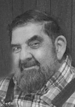
William Charles “Bill” Denton
| Birth | : | 4 Sep 1945 Creston, Union County, Iowa, USA |
| Death | : | 6 Jun 2016 Creston, Union County, Iowa, USA |
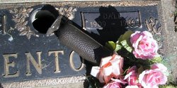
| Burial | : | Greenlawn Cemetery, Afton, Union County, USA |
| Coordinate | : | 41.0335999, -94.1856003 |
| Description | : | Powers Funeral Home William "Bill" Denton, 70, of Afton died Monday, June 6, 2016 at Greater Regional Hospice Home in Creston. Celebration of Life Services will be 3:00 p.m. Friday, June 10, at Powers Funeral Home in Creston. Burial will be at Greenlawn Cemetery in Afton. Rev. Jim Morris will officiate. Visitation with family receiving friends will be from 1:00 – 3:00 service time, Friday at Powers Funeral Home in Creston. William Charles Denton was born September 4, 1945 in Creston, to Wilda Marie (Henry) Denton and B. Dale Denton. He attended Dodge #6 Country school and graduated from East Union High School in... Read More |
frequently asked questions (FAQ):
-
Where is William Charles “Bill” Denton's memorial?
William Charles “Bill” Denton's memorial is located at: Greenlawn Cemetery, Afton, Union County, USA.
-
When did William Charles “Bill” Denton death?
William Charles “Bill” Denton death on 6 Jun 2016 in Creston, Union County, Iowa, USA
-
Where are the coordinates of the William Charles “Bill” Denton's memorial?
Latitude: 41.0335999
Longitude: -94.1856003
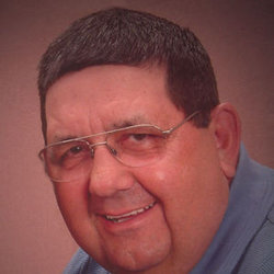
Family Members:
Parent
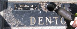
Spouse

Siblings
Flowers:


Nearby Cemetories:
1. Greenlawn Cemetery
Afton, Union County, USA
Coordinate: 41.0335999, -94.1856003
2. Civil War Era Cemetery
Afton, Union County, USA
Coordinate: 41.0460854, -94.2025299
3. Saint Edwards Catholic Cemetery
Afton, Union County, USA
Coordinate: 41.0359993, -94.2129974
4. Norris Plot Cemetery
Afton, Union County, USA
Coordinate: 41.0079994, -94.1579971
5. Rollins Plot Cemetery
Afton, Union County, USA
Coordinate: 41.0040283, -94.2234802
6. County Home Cemetery
Creston, Union County, USA
Coordinate: 41.0449982, -94.2590027
7. Abel Cemetery
Arispe, Union County, USA
Coordinate: 40.9790001, -94.1429977
8. Mount Pisgah Cemetery
Thayer, Union County, USA
Coordinate: 41.0511017, -94.1007996
9. Browns Mountain Cemetery
Thayer, Union County, USA
Coordinate: 41.0499992, -94.0999985
10. Otterbein Cemetery
Thayer, Union County, USA
Coordinate: 40.9990005, -94.0879974
11. Beulah Cemetery
Thayer, Union County, USA
Coordinate: 41.0589981, -94.0759964
12. West Union Cemetery
Thayer, Union County, USA
Coordinate: 41.0191994, -94.0721970
13. Groesbeck Cemetery
Lorimor, Union County, USA
Coordinate: 41.1100006, -94.1230011
14. Cedar Grove Cemetery
Lorimor, Union County, USA
Coordinate: 41.1209984, -94.2200012
15. Bethel Cemetery
Thayer, Union County, USA
Coordinate: 41.0600014, -94.0693970
16. Dodge Center Cemetery
Afton, Union County, USA
Coordinate: 41.1279984, -94.1829987
17. Monette Cemetery
Lorimor, Union County, USA
Coordinate: 41.0800743, -94.0715866
18. Bragg Cemetery
Lorimor, Union County, USA
Coordinate: 41.1282997, -94.1433029
19. Evergreen Cemetery
Creston, Union County, USA
Coordinate: 41.1139984, -94.2839966
20. Thayer Catholic Cemetery
Thayer, Union County, USA
Coordinate: 41.0374985, -94.0357971
21. Claypool Cemetery
Thayer, Union County, USA
Coordinate: 41.0126114, -94.0303497
22. Old Jerusalem Cemetery
Creston, Union County, USA
Coordinate: 41.1159401, -94.3084335
23. Graceland Cemetery
Creston, Union County, USA
Coordinate: 41.0369987, -94.3519974
24. Lorimor Cemetery
Lorimor, Union County, USA
Coordinate: 41.1128006, -94.0516968