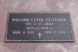
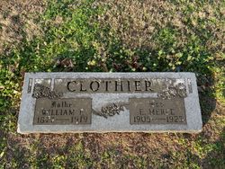
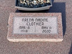
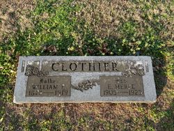
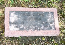
William Clyde Clothier
| Birth | : | 4 Mar 1916 Pittsburg, Crawford County, Kansas, USA |
| Death | : | 13 Feb 2011 Pittsburg, Crawford County, Kansas, USA |
| Burial | : | Moorcroft Cemetery, Moorcroft, Crook County, USA |
| Coordinate | : | 44.2685510, -104.9461810 |
| Description | : | William Clyde Clothier (04 March 1916 ~ 13 February 2011) William C. Clothier, 94, of Pittsburg, passed away at 2:56 a.m. Sunday, February 13, 2011 at Via Christi Hospital. He was born March 4, 1916 in rural Pittsburg to William Fredrick and Florence Ella (Wagner) Clothier. He attended Pittsburg schools and graduated from Pittsburg High School. On April 3, 1942, he enlisted in the United States Army, where he served in the European Theatre. He served in the 109th Antiaircraft Artillery Group and was honorably discharged on November 8, 1945. On December 2, 1945, he was united in marriage to... Read More |
frequently asked questions (FAQ):
-
Where is William Clyde Clothier's memorial?
William Clyde Clothier's memorial is located at: Moorcroft Cemetery, Moorcroft, Crook County, USA.
-
When did William Clyde Clothier death?
William Clyde Clothier death on 13 Feb 2011 in Pittsburg, Crawford County, Kansas, USA
-
Where are the coordinates of the William Clyde Clothier's memorial?
Latitude: 44.2685510
Longitude: -104.9461810
Family Members:
Parent
Spouse
Siblings
Flowers:
Nearby Cemetories:
1. Moorcroft Cemetery
Moorcroft, Crook County, USA
Coordinate: 44.2685510, -104.9461810
2. Pine Haven Area Cemetery
Pine Haven, Crook County, USA
Coordinate: 44.3431950, -104.8095490
3. Pleasant Valley Cemetery
Rozet, Campbell County, USA
Coordinate: 44.3739014, -105.1046982
4. Rozet Cemetery
Rozet, Campbell County, USA
Coordinate: 44.2666000, -105.2060000
5. Pine Grove Cemetery
Oshoto, Crook County, USA
Coordinate: 44.5594000, -104.9023000
6. Greenwood Cemetery
Upton, Weston County, USA
Coordinate: 44.0894012, -104.6132965
7. Miller Creek Cemetery
Crook County, USA
Coordinate: 44.4510994, -104.6136017
8. Greenwood Cemetery
Crook County, USA
Coordinate: 44.2355995, -104.4886017
9. Tower Cemetery
Devils Tower, Crook County, USA
Coordinate: 44.5651200, -104.6603400
10. Mount Pisgah Cemetery
Gillette, Campbell County, USA
Coordinate: 44.2853012, -105.4981003
11. Mount Moriah Cemetery
Sundance, Crook County, USA
Coordinate: 44.4049988, -104.3942032
12. Green Mountain Cemetery
Sundance, Crook County, USA
Coordinate: 44.3964005, -104.3452988
13. Inyan Kara Cemetery
Sundance, Crook County, USA
Coordinate: 44.2613983, -104.2994003
14. New Haven Cemetery
New Haven, Crook County, USA
Coordinate: 44.7256012, -104.8242035
15. Garhart Cemetery
Osage, Weston County, USA
Coordinate: 43.9793600, -104.4265200
16. Kintz Cemetery
Wyodak, Campbell County, USA
Coordinate: 43.8619000, -105.2828000
17. Soldiers Gravesite
Crook County, USA
Coordinate: 44.2185000, -104.2674000
18. Moore Hill Cemetery
Crook County, USA
Coordinate: 44.7235985, -104.6731033
19. Hulett Cemetery
Hulett, Crook County, USA
Coordinate: 44.6955986, -104.5867004
20. Bethlehem Cemetery
Gillette, Campbell County, USA
Coordinate: 44.1780000, -105.6308000
21. Green Mountain Cemetery
Horton, Weston County, USA
Coordinate: 44.1646996, -104.2397003
22. Freel Gravesite
Weston County, USA
Coordinate: 43.9779000, -104.2996000
23. Pollat Ranch Cemetery
Newcastle, Weston County, USA
Coordinate: 43.7563900, -104.6588300
24. Alva Cemetery
Alva, Crook County, USA
Coordinate: 44.6945480, -104.4453690

