
| Memorials | : | 0 |
| Location | : | Weston County, USA |
| Coordinate | : | 43.9779000, -104.2996000 |
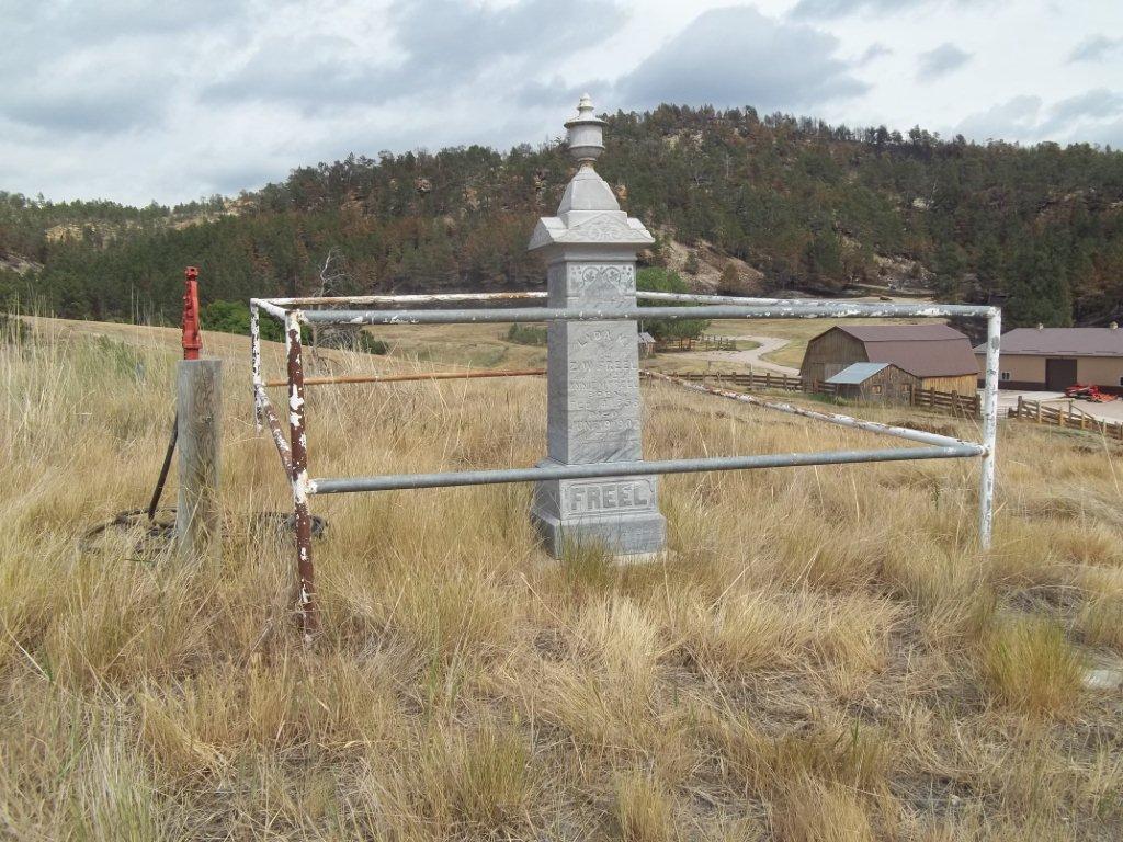
| Description | : | Highway 15 west of Newscastle to the Airport, turn North on Oil Creek Road, go three and a half miles to Bob Allen's, turn to the left and go four miles, the grave is behind the barn. |
frequently asked questions (FAQ):
-
Where is Freel Gravesite?
Freel Gravesite is located at Township 46 Range62 NE1/4SE1/4 4,Sec9 Weston County ,Wyoming ,USA.
-
Freel Gravesite cemetery's updated grave count on graveviews.com?
0 memorials
-
Where are the coordinates of the Freel Gravesite?
Latitude: 43.9779000
Longitude: -104.2996000
Nearby Cemetories:
1. Cambria Cemetery
Weston County, USA
Coordinate: 43.9543991, -104.2133026
2. Garhart Cemetery
Osage, Weston County, USA
Coordinate: 43.9793600, -104.4265200
3. Greenwood Cemetery
Newcastle, Weston County, USA
Coordinate: 43.8518982, -104.1943970
4. Old Ridge Cemetery
Newcastle, Weston County, USA
Coordinate: 43.8359000, -104.2280600
5. Boyd Cemetery
Weston County, USA
Coordinate: 44.0774994, -104.1192017
6. Saint Alberts Catholic Cemetery
Weston County, USA
Coordinate: 44.1082340, -104.1581150
7. Green Mountain Cemetery
Horton, Weston County, USA
Coordinate: 44.1646996, -104.2397003
8. Soldiers Gravesite
Crook County, USA
Coordinate: 44.2185000, -104.2674000
9. Greenwood Cemetery
Upton, Weston County, USA
Coordinate: 44.0894012, -104.6132965
10. Inyan Kara Cemetery
Sundance, Crook County, USA
Coordinate: 44.2613983, -104.2994003
11. Greenwood Cemetery
Crook County, USA
Coordinate: 44.2355995, -104.4886017
12. Pollat Ranch Cemetery
Newcastle, Weston County, USA
Coordinate: 43.7563900, -104.6588300
13. Reynolds Ranch Cemetery
Rochford, Pennington County, USA
Coordinate: 44.0875667, -103.8027265
14. Carr Cemetery
Hanna, Lawrence County, USA
Coordinate: 44.2411003, -103.8606033
15. Bell Park Cemetery
Rochford, Pennington County, USA
Coordinate: 44.1116982, -103.7466965
16. Green Mountain Cemetery
Sundance, Crook County, USA
Coordinate: 44.3964005, -104.3452988
17. Mount Moriah Cemetery
Sundance, Crook County, USA
Coordinate: 44.4049988, -104.3942032
18. Dumont Cemetery
Lawrence County, USA
Coordinate: 44.2270000, -103.7860000
19. Bear Gulch Cemetery
Lawrence County, USA
Coordinate: 44.3819008, -104.0325012
20. Holy Cross Cemetery
Englewood, Lawrence County, USA
Coordinate: 44.2818985, -103.8047028
21. Mountain Lawn Cemetery
Englewood, Lawrence County, USA
Coordinate: 44.2818985, -103.8047028
22. Preston Ghost Town Cemetery
Preston, Lawrence County, USA
Coordinate: 44.3577500, -103.8871670
23. Terry Cemetery
Terry, Lawrence County, USA
Coordinate: 44.3344290, -103.8165110
24. Thunderhead Mountain
Custer, Custer County, USA
Coordinate: 43.8346510, -103.6221890