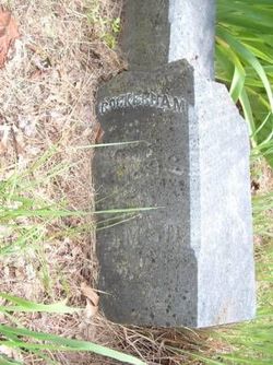
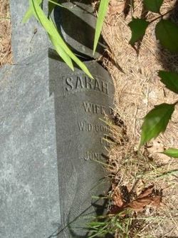
William Decatur Cockerham
| Birth | : | 3 May 1831 Macon County, North Carolina, USA |
| Death | : | 8 Sep 1893 Decatur County, Iowa, USA |
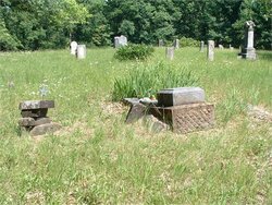
| Burial | : | Penistone-Stottercliffe Cemetery, Penistone, Metropolitan Borough of Barnsley, England |
| Coordinate | : | 53.5276600, -1.6380900 |
| Plot | : | Row 4 |
| Description | : | He was the son of Daniel Stewart Cockerham and Celia Gibbs. He would married Sarah Jane Farrens in 1854 in Iowa. William enlisted in the Union Army during the Civil War in Leon County, Iowa on 22 Aug 1862 as a Full 8th Corporal and was assigned to Company K, 39th Iowa Infantry Regiment. He was promoted to 4th Sergeant on 03 May 1865 and was mustered out of the service on 05 Jun 1865 in Washington, DC. William and Sarah would have 4-children: 1) B Cockerham B: 1856, Iowa 2) William Frank Cockerham B: Mar 1857, Iowa 3) Mary E Cockerham B: 1860,... Read More |
frequently asked questions (FAQ):
-
Where is William Decatur Cockerham's memorial?
William Decatur Cockerham's memorial is located at: Penistone-Stottercliffe Cemetery, Penistone, Metropolitan Borough of Barnsley, England.
-
When did William Decatur Cockerham death?
William Decatur Cockerham death on 8 Sep 1893 in Decatur County, Iowa, USA
-
Where are the coordinates of the William Decatur Cockerham's memorial?
Latitude: 53.5276600
Longitude: -1.6380900
Family Members:
Spouse
Siblings
Children
Flowers:
Nearby Cemetories:
1. Penistone-Stottercliffe Cemetery
Penistone, Metropolitan Borough of Barnsley, England
Coordinate: 53.5276600, -1.6380900
2. Netherfield Congregational Chapelyard
Penistone, Metropolitan Borough of Barnsley, England
Coordinate: 53.5313600, -1.6356700
3. St. John the Baptist Churchyard
Penistone, Metropolitan Borough of Barnsley, England
Coordinate: 53.5259280, -1.6296990
4. St. Saviours Churchyard
Thurlstone, Metropolitan Borough of Barnsley, England
Coordinate: 53.5268583, -1.6552996
5. Hoylandswaine Churchyard
Sheffield, Metropolitan Borough of Sheffield, England
Coordinate: 53.5431500, -1.6087800
6. St. John the Evangelist Churchyard
Denby Dale, Metropolitan Borough of Kirklees, England
Coordinate: 53.5608580, -1.6595360
7. St. James' Churchyard
Stocksbridge, Metropolitan Borough of Sheffield, England
Coordinate: 53.4919040, -1.6475040
8. Friends Meeting House
Penistone, Metropolitan Borough of Barnsley, England
Coordinate: 53.5627869, -1.6817849
9. Quaker Bottom Burial Ground
Huddersfield, Metropolitan Borough of Kirklees, England
Coordinate: 53.5633390, -1.6809182
10. Silkstone Cemetery
Barnsley, Metropolitan Borough of Barnsley, England
Coordinate: 53.5424410, -1.5629520
11. Holy Trinity Churchyard
Thurgoland, Metropolitan Borough of Barnsley, England
Coordinate: 53.5055900, -1.5669500
12. All Saints & St James Churchyard
Silkstone, Metropolitan Borough of Barnsley, England
Coordinate: 53.5485560, -1.5627890
13. Christ Church Churchyard
Stocksbridge, Metropolitan Borough of Sheffield, England
Coordinate: 53.4835600, -1.5975800
14. St. Nicholas' Churchyard
Upper Cumberworth, Metropolitan Borough of Kirklees, England
Coordinate: 53.5755000, -1.6827450
15. Cawthorne Cemetery
Barnsley, Metropolitan Borough of Barnsley, England
Coordinate: 53.5673699, -1.5713055
16. Skelmanthorpe Cemetery
Skelmanthorpe, Metropolitan Borough of Kirklees, England
Coordinate: 53.5884340, -1.6385120
17. Gatehead Methodist Chapelyard
Hepworth, Metropolitan Borough of Kirklees, England
Coordinate: 53.5497100, -1.7359500
18. St Augustine Churchyard
Scissett, Metropolitan Borough of Kirklees, England
Coordinate: 53.5896520, -1.6254190
19. Gatehead Primitive Methodist Chapelyard
Hepworth, Metropolitan Borough of Kirklees, England
Coordinate: 53.5494500, -1.7369400
20. Dodworth Cemetery
Barnsley, Metropolitan Borough of Barnsley, England
Coordinate: 53.5417500, -1.5331500
21. Skelmanthorpe Primitive Methodist Church Cemetery
Skelmanthorpe, Metropolitan Borough of Kirklees, England
Coordinate: 53.5928110, -1.6460640
22. St John the Baptist Church
Dodworth, Metropolitan Borough of Barnsley, England
Coordinate: 53.5410200, -1.5303300
23. St. Mary's Churchyard
Bolsterstone, Metropolitan Borough of Sheffield, England
Coordinate: 53.4673770, -1.5935860
24. All Saint's (Clayton West with High Hoyland)
Clayton West, Metropolitan Borough of Kirklees, England
Coordinate: 53.5946154, -1.6097522


