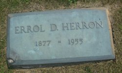
| Birth | : | 10 Mar 1848 Fayette, Lafayette County, Wisconsin, USA |
| Death | : | 4 Dec 1896 Le Mars, Plymouth County, Iowa, USA |
| Burial | : | Bury St Edmunds Cemetery, Bury St Edmunds, St Edmundsbury Borough, England |
| Coordinate | : | 52.2438030, 0.7014930 |
| Plot | : | Block 9 Lot 60 |
| Description | : | Sioux City Journal, Dec 3, 1896 Plymouth Sheriff Killed W. E. Herron Foun Dead by the Railroad Track Near LeMars Body Discovered By Train Men He Evidentally Fell Off the Platform in the Dark and Rolled Down a Forty-Five Foot Embankment - Coroner's Jury Renders Verdict to that Effect. LeMars, Dec. 2. - Special: W. E. Herron, sheriff of Plymouth county was found dead by the railroad track this morning by the crew of the Illinois Central Freight No. 94 that arrived in LeMars from Sioux City this morning. The body was frozen stiff and evidentally lain there for some time. An ugly gash was... Read More |
frequently asked questions (FAQ):
-
Where is William E Herron's memorial?
William E Herron's memorial is located at: Bury St Edmunds Cemetery, Bury St Edmunds, St Edmundsbury Borough, England.
-
When did William E Herron death?
William E Herron death on 4 Dec 1896 in Le Mars, Plymouth County, Iowa, USA
-
Where are the coordinates of the William E Herron's memorial?
Latitude: 52.2438030
Longitude: 0.7014930
Family Members:
Parent
Spouse
Siblings
Children
Flowers:
Nearby Cemetories:
1. Bury St Edmunds Cemetery
Bury St Edmunds, St Edmundsbury Borough, England
Coordinate: 52.2438030, 0.7014930
2. St. Edmundsbury Cathedral
Bury St Edmunds, St Edmundsbury Borough, England
Coordinate: 52.2439340, 0.7170190
3. St. Mary's Churchyard
Bury St Edmunds, St Edmundsbury Borough, England
Coordinate: 52.2424630, 0.7172480
4. Bury St Edmunds Abbey
Bury St Edmunds, St Edmundsbury Borough, England
Coordinate: 52.2441060, 0.7192360
5. Saint Mary's Churchyard
Westley, St Edmundsbury Borough, England
Coordinate: 52.2486230, 0.6701530
6. Saint Leonard's Churchyard
Horringer, St Edmundsbury Borough, England
Coordinate: 52.2250540, 0.6750640
7. Saint Martin's Churchyard
Fornham St Martin, St Edmundsbury Borough, England
Coordinate: 52.2695570, 0.7133080
8. West Suffolk Crematorium
Risby, St Edmundsbury Borough, England
Coordinate: 52.2600280, 0.6648640
9. All Saints Churchyard
Fornham St Genevieve, St Edmundsbury Borough, England
Coordinate: 52.2759800, 0.6920480
10. All Saints Fornham Churchyard
Bury St Edmunds, St Edmundsbury Borough, England
Coordinate: 52.2760548, 0.6920269
11. St Peter's Churchyard
Nowton, St Edmundsbury Borough, England
Coordinate: 52.2109220, 0.7257590
12. St. Mary's Churchyard
Ickworth, St Edmundsbury Borough, England
Coordinate: 52.2184440, 0.6516990
13. St Nicholas Churchyard
Little Saxham, St Edmundsbury Borough, England
Coordinate: 52.2421640, 0.6338780
14. Holy Innocents Churchyard
Great Barton, St Edmundsbury Borough, England
Coordinate: 52.2600380, 0.7678410
15. St Giles War Memorial - Risby
Risby, St Edmundsbury Borough, England
Coordinate: 52.2660130, 0.6396260
16. St Giles Churchyard
Risby, St Edmundsbury Borough, England
Coordinate: 52.2661320, 0.6397400
17. All Saints Churchyard
Hawstead, St Edmundsbury Borough, England
Coordinate: 52.1998300, 0.7143900
18. Church of the Reconciliation
Hengrave, St Edmundsbury Borough, England
Coordinate: 52.2850270, 0.6733120
19. St Nicholas Churchyard
Rushbrooke, St Edmundsbury Borough, England
Coordinate: 52.2193810, 0.7704070
20. Church of St. Thomas à Becket
Great Whelnetham, St Edmundsbury Borough, England
Coordinate: 52.2003200, 0.7468860
21. St Andrew Church
Great Saxham, St Edmundsbury Borough, England
Coordinate: 52.2343860, 0.6179690
22. St. Andrew's Churchyard
Timworth, St Edmundsbury Borough, England
Coordinate: 52.2940830, 0.7269200
23. Whepstead Cemetery
Whepstead, St Edmundsbury Borough, England
Coordinate: 52.1922830, 0.6806830
24. St Mary Magdalene Churchyard
Little Whelnetham, St Edmundsbury Borough, England
Coordinate: 52.2062540, 0.7628880


