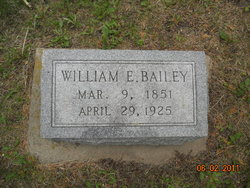
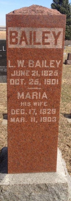
William Edmund Bailey
| Birth | : | 9 Mar 1851 Sheffield, Franklin County, Iowa, USA |
| Death | : | 29 Apr 1925 Edgemont, Fall River County, South Dakota, USA |
| Burial | : | Pittsburg Hollow Cemetery, Pittsburg, Coos County, USA |
| Coordinate | : | 45.0574300, -71.3437300 |
| Description | : | William E. Bailey was one of the cowboys in Captain Seth Bullock's Cowboy Brigade. They took their horses to Washington DC in March of 1905 to ride in the inaugural parade to honor President Teddy Roosevelt. He later ranched in Oelricks, Fall River County, SD. William E. Bailey died Wednesday from injuries when the team he was driving ran away and he was cut by a bale of barbed wire in the wagon. (This part is unclear the way it is written)...Father Ace west of Edgemont near the Wyoming line, Gail and Mrs. Been Gooden, wife and several... Read More |
frequently asked questions (FAQ):
-
Where is William Edmund Bailey's memorial?
William Edmund Bailey's memorial is located at: Pittsburg Hollow Cemetery, Pittsburg, Coos County, USA.
-
When did William Edmund Bailey death?
William Edmund Bailey death on 29 Apr 1925 in Edgemont, Fall River County, South Dakota, USA
-
Where are the coordinates of the William Edmund Bailey's memorial?
Latitude: 45.0574300
Longitude: -71.3437300
Family Members:
Parent
Spouse
Siblings
Children
Flowers:
Nearby Cemetories:
1. Pittsburg Hollow Cemetery
Pittsburg, Coos County, USA
Coordinate: 45.0574300, -71.3437300
2. French Family Cemetery
Pittsburg, Coos County, USA
Coordinate: 45.0507740, -71.3854510
3. Lake Cemetery
Pittsburg, Coos County, USA
Coordinate: 45.0883200, -71.2926200
4. Young Cemetery
Clarksville, Coos County, USA
Coordinate: 45.0107651, -71.4158096
5. Indian Stream Cemetery
Pittsburg, Coos County, USA
Coordinate: 45.0497400, -71.4439400
6. Gideon Tirrill Cemetery
Stewartstown, Coos County, USA
Coordinate: 44.9831390, -71.4171260
7. Perry Cemetery
Clarksville, Coos County, USA
Coordinate: 45.0060300, -71.4518900
8. North Hill Cemetery
Stewartstown, Coos County, USA
Coordinate: 44.9749700, -71.4208300
9. Old Hall Stream Cemetery
East Hereford, Estrie Region, Canada
Coordinate: 45.0336900, -71.4985700
10. Cimetière Saint-Henri
East Hereford, Estrie Region, Canada
Coordinate: 45.0799500, -71.5015800
11. Stewartstown Hollow Cemetery
Stewartstown, Coos County, USA
Coordinate: 44.9676700, -71.4433800
12. Herbert Lawton Memorial Advent Cemetery
East Hereford, Estrie Region, Canada
Coordinate: 45.0426400, -71.5044900
13. Field Cemetery
Stewartstown, Coos County, USA
Coordinate: 44.9652780, -71.4444440
14. South Hill Cemetery
Stewartstown, Coos County, USA
Coordinate: 44.9393540, -71.4215790
15. Saint Alberts Cemetery
West Stewartstown, Coos County, USA
Coordinate: 44.9718400, -71.5163000
16. Canaan Village Cemetery
Canaan, Essex County, USA
Coordinate: 44.9972684, -71.5373076
17. Piper Hill Cemetery
Stewartstown, Coos County, USA
Coordinate: 44.9696600, -71.5153100
18. Coos County Alms House Cemetery
West Stewartstown, Coos County, USA
Coordinate: 44.9844930, -71.5318490
19. Parker Cemetery
West Stewartstown, Coos County, USA
Coordinate: 44.9820300, -71.5307520
20. Old Hereford Cemetery
Hereford, Estrie Region, Canada
Coordinate: 45.0160910, -71.5559415
21. Alice Hunt Cemetery
Canaan, Essex County, USA
Coordinate: 45.0060100, -71.5553300
22. All Saints Anglican Cemetery
Hereford, Estrie Region, Canada
Coordinate: 45.0148340, -71.5622840
23. Reed Cemetery
Colebrook, Coos County, USA
Coordinate: 44.8999000, -71.4227000
24. Wilson Graveyard
Canaan, Essex County, USA
Coordinate: 44.9377990, -71.5256320

