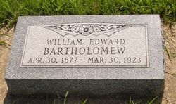
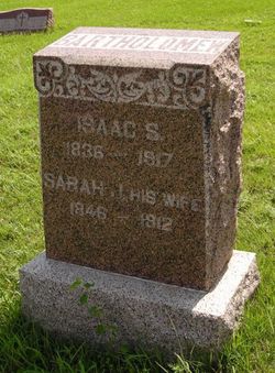
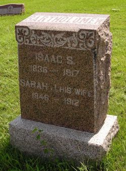
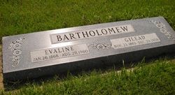
William Edward Bartholomew
| Birth | : | 30 Apr 1877 Hancock County, Illinois, USA |
| Death | : | 30 Mar 1923 Wichita, Sedgwick County, Kansas, USA |
| Burial | : | Highland Cemetery, Meeker, Rio Blanco County, USA |
| Coordinate | : | 40.0311012, -107.9111023 |
| Description | : | Married Nannie Shull on 04 Oct 1905 in Mulvane, Sumner Co., KS |
frequently asked questions (FAQ):
-
Where is William Edward Bartholomew's memorial?
William Edward Bartholomew's memorial is located at: Highland Cemetery, Meeker, Rio Blanco County, USA.
-
When did William Edward Bartholomew death?
William Edward Bartholomew death on 30 Mar 1923 in Wichita, Sedgwick County, Kansas, USA
-
Where are the coordinates of the William Edward Bartholomew's memorial?
Latitude: 40.0311012
Longitude: -107.9111023
Family Members:
Parent
Spouse
Siblings
Children
Flowers:
Nearby Cemetories:
1. Highland Cemetery
Meeker, Rio Blanco County, USA
Coordinate: 40.0311012, -107.9111023
2. Camp on White River Cemetery
Meeker, Rio Blanco County, USA
Coordinate: 40.0380100, -107.9131000
3. Strawberry Cemetery
Rio Blanco County, USA
Coordinate: 40.1081009, -107.9781036
4. Miller Hill Cemetery
Rio Blanco County, USA
Coordinate: 39.8847008, -108.2906036
5. Iles Grove Burial Site
Hamilton, Moffat County, USA
Coordinate: 40.3352000, -107.6873000
6. Black Sulphur Cemetery
Meeker, Rio Blanco County, USA
Coordinate: 39.8600800, -108.3109500
7. Buckner and Hart Gravesite
Pagoda, Routt County, USA
Coordinate: 40.3229400, -107.4068000
8. Pagoda Cemetery
Routt County, USA
Coordinate: 40.3398000, -107.4152000
9. Rose Hill Cemetery
Rifle, Garfield County, USA
Coordinate: 39.5381012, -107.7742004
10. Three Springs Ranch Cemetery
Elk Springs, Moffat County, USA
Coordinate: 40.5289000, -108.0861000
11. Maybell Cemetery
Moffat County, USA
Coordinate: 40.5289000, -108.0861000
12. Skyline Cemetery
Silt, Garfield County, USA
Coordinate: 39.5520060, -107.6575300
13. Highland Cemetery
New Castle, Garfield County, USA
Coordinate: 39.5875015, -107.5192032
14. Rulison Cemetery
Rulison, Garfield County, USA
Coordinate: 39.4768000, -107.9357000
15. Fairview Cemetery
Moffat County, USA
Coordinate: 40.5159280, -107.5268290
16. Craig Cemetery
Craig, Moffat County, USA
Coordinate: 40.5164000, -107.5260000
17. Russey-Hurlburt Cemetery
Parachute, Garfield County, USA
Coordinate: 39.4522018, -108.0575027
18. Fairview Cemetery
Moffat County, USA
Coordinate: 40.6086390, -108.0958610
19. Pyramid Cemetery
Steamboat Springs, Routt County, USA
Coordinate: 40.1992100, -107.1603900
20. Battlement Cemetery
Parachute, Garfield County, USA
Coordinate: 39.4380989, -108.0291977
21. Union Divide Creek Cemetery
Silt, Garfield County, USA
Coordinate: 39.4508018, -107.6200027
22. Rangely Cemetery
Rangely, Rio Blanco County, USA
Coordinate: 40.0905495, -108.7677841
23. Farnum Holt Columbarium
Glenwood Springs, Garfield County, USA
Coordinate: 39.5469640, -107.3299900
24. Pioneer Cemetery
Glenwood Springs, Garfield County, USA
Coordinate: 39.5392000, -107.3192000

