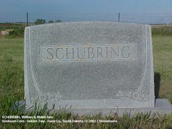
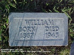
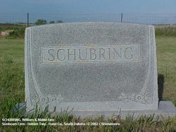
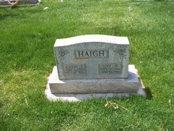
William Frederick Schubring
| Birth | : | 19 Aug 1867 Pella, Marion County, Iowa, USA |
| Death | : | 10 Jan 1945 Hand County, South Dakota, USA |
| Burial | : | Sunbeam Cemetery, Hand County, USA |
| Coordinate | : | 44.6777992, -98.8407974 |
| Description | : | William Schubring was born August 19, 1867, at Pella, Iowwa, the son of Mr. & Mrs. Ernest Schubring. He was married to Jessie Hewett at Peoria, Iowa, and one child, Inez, was born to this union. * In the summer of 1897, William came to Hand County, South Dakota and engaged in farming in Holden Township. On July 9, 1898, he married Ethel Mabel Halloway of Redfield, Spink Co. SD. They were the parents of six children: Ernest N., Esther M., Otho N., Lucy W., James E., Catherine M. William farmed in Holden Township for 44 years. He spent the... Read More |
frequently asked questions (FAQ):
-
Where is William Frederick Schubring's memorial?
William Frederick Schubring's memorial is located at: Sunbeam Cemetery, Hand County, USA.
-
When did William Frederick Schubring death?
William Frederick Schubring death on 10 Jan 1945 in Hand County, South Dakota, USA
-
Where are the coordinates of the William Frederick Schubring's memorial?
Latitude: 44.6777992
Longitude: -98.8407974
Family Members:
Spouse
Children
Flowers:
Nearby Cemetories:
1. Sunbeam Cemetery
Hand County, USA
Coordinate: 44.6777992, -98.8407974
2. Burdette Cemetery
Burdette, Hand County, USA
Coordinate: 44.7002983, -98.7869034
3. Beulah Cemetery
Vayland, Hand County, USA
Coordinate: 44.6060982, -98.8060989
4. Buffalo Cemetery
Spink County, USA
Coordinate: 44.6918983, -98.6853027
5. Saint Johns Cemetery
Tulare, Spink County, USA
Coordinate: 44.7202988, -98.6600037
6. Howell Cemetery
Miller, Hand County, USA
Coordinate: 44.7757988, -98.9766998
7. Saint Lawrence Cemetery
Saint Lawrence, Hand County, USA
Coordinate: 44.5292015, -98.9321976
8. Saint Ann's Cemetery
Miller, Hand County, USA
Coordinate: 44.5222015, -98.9732971
9. Cottonwood Cemetery
Redfield, Spink County, USA
Coordinate: 44.8078800, -98.6579600
10. Hillcrest Cemetery
Miller, Hand County, USA
Coordinate: 44.5207000, -99.0006100
11. Alden Cemetery
Hand County, USA
Coordinate: 44.6775017, -99.1203003
12. G A R Cemetery
Miller, Hand County, USA
Coordinate: 44.5078011, -98.9858017
13. Garfield Cemetery
Spink County, USA
Coordinate: 44.6622009, -98.5535965
14. Mount Calvary Cemetery
Polo, Hand County, USA
Coordinate: 44.7827988, -99.1097031
15. Saint Marys Catholic Cemetery
Zell, Faulk County, USA
Coordinate: 44.8943340, -98.7283210
16. Rockham Cemetery
Rockham, Faulk County, USA
Coordinate: 44.9118996, -98.8375015
17. Saint Josephs Catholic Cemetery
Hand County, USA
Coordinate: 44.4574400, -98.7100400
18. Wessington Cemetery
Hand County, USA
Coordinate: 44.4569016, -98.7102966
19. Saint Michaels Cemetery
Hand County, USA
Coordinate: 44.8302994, -99.1106033
20. Tulare Cemetery
Tulare, Spink County, USA
Coordinate: 44.7486000, -98.4922028
21. Prairie View Cemetery
Hand County, USA
Coordinate: 44.8806000, -99.0888977
22. Bonilla Cemetery
Bonilla, Beadle County, USA
Coordinate: 44.5830994, -98.4835968
23. Saint Josephs Cemetery
Orient, Faulk County, USA
Coordinate: 44.9015500, -99.0920300
24. Morningside Cemetery
Ree Heights, Hand County, USA
Coordinate: 44.5147018, -99.1903000

