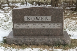
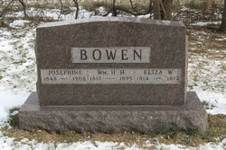
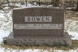
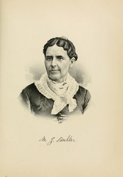
William Henry Harrison Bowen
| Birth | : | 28 Jul 1812 Hamilton County, Ohio, USA |
| Death | : | 18 Dec 1895 Benton Township, Cass County, Iowa, USA |
| Burial | : | Kadina Cemetery, Kadina, District Council of Copper Coast, Australia |
| Coordinate | : | -33.9475370, 137.7096720 |
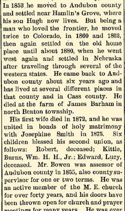
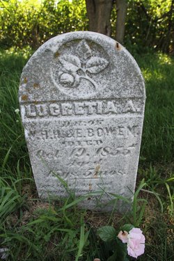
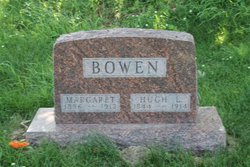
| Description | : | William gave a section of his land to create the Bowen Cemetery. William H.H. Bowen came to the frontier known now as Audubon County and settled near the town of Oakfield in 1853. At the newly-formed county's first election on 6 April 1855, William H.H. Bowen was elected the county's first Assessor.--Source: "100 Years in Exira, 1857-1957". 1st Spouse Eliza W. Watson 1814–1872 Children Nancy Jane Bowen 1834–1895 Rachel Elizabeth Bowen 1835– John Wesley Bowen 1838–1864 Lucretia Anne Bowen 1840–1855 Sarah Ellen Bowen 1842–1865 Hugh Legare Bowen 1844–1914 Juliette Bowen 1847–1938 Emma Caroline Bowen 1851–1936 James William Bowen... Read More |
frequently asked questions (FAQ):
-
Where is William Henry Harrison Bowen's memorial?
William Henry Harrison Bowen's memorial is located at: Kadina Cemetery, Kadina, District Council of Copper Coast, Australia.
-
When did William Henry Harrison Bowen death?
William Henry Harrison Bowen death on 18 Dec 1895 in Benton Township, Cass County, Iowa, USA
-
Where are the coordinates of the William Henry Harrison Bowen's memorial?
Latitude: -33.9475370
Longitude: 137.7096720
Family Members:
Spouse
Children
Flowers:
Nearby Cemetories:
1. Kadina Cemetery
Kadina, District Council of Copper Coast, Australia
Coordinate: -33.9475370, 137.7096720
2. Wallaroo Cemetery
Wallaroo, District Council of Copper Coast, Australia
Coordinate: -33.9403210, 137.6203380
3. Greens Plains West Cemetery
Paskeville, District Council of Copper Coast, Australia
Coordinate: -34.0281650, 137.8644800
4. Moonta Cemetery
Moonta, District Council of Copper Coast, Australia
Coordinate: -34.0750300, 137.5855800
5. Alford Cemetery
Alford, District Council of Barunga West, Australia
Coordinate: -33.8174130, 137.8387910
6. Bute Cemetery
Bute, District Council of Barunga West, Australia
Coordinate: -33.8716030, 137.9918400
7. Saint Pauls Lutheran Church Cemetery
Yorke Peninsula Council, Australia
Coordinate: -34.1773530, 137.8452840
8. Kulpara Cemetery
Kulpara, District Council of Barunga West, Australia
Coordinate: -34.0564360, 138.0223820
9. St. Agatha's Catholic Church Cemetery
Arthurton, Yorke Peninsula Council, Australia
Coordinate: -34.2570190, 137.7576140
10. Arthurton General Cemetery
Arthurton, Yorke Peninsula Council, Australia
Coordinate: -34.2696000, 137.7663000
11. Clinton Centre Uniting Church Cemetery
Clinton Centre, Yorke Peninsula Council, Australia
Coordinate: -34.2344150, 137.9191710
12. Winulta Anglican Cemetery
Winulta, Yorke Peninsula Council, Australia
Coordinate: -34.2779380, 137.8690500
13. Barunga Gap Cemetery
Barunga Gap, Wakefield Regional Council, Australia
Coordinate: -33.8298400, 138.1150070
14. Lochiel Cemetery
Wakefield Regional Council, Australia
Coordinate: -33.9475210, 138.1576680
15. Price Cemetery
Price, Yorke Peninsula Council, Australia
Coordinate: -34.2975830, 137.9779040
16. Salt Lake Cemetery
Bumbunga, Wakefield Regional Council, Australia
Coordinate: -33.8504642, 138.2017451
17. Maitland Cemetery
Maitland, Yorke Peninsula Council, Australia
Coordinate: -34.3674980, 137.6764060
18. Port Wakefield Public Cemetery
Port Wakefield, Wakefield Regional Council, Australia
Coordinate: -34.1665820, 138.1479110
19. St. John's Lutheran Cemetery
South Kilkerran, Yorke Peninsula Council, Australia
Coordinate: -34.4301600, 137.6031500
20. Condowie Cemetery
Condowie, Wakefield Regional Council, Australia
Coordinate: -33.7770500, 138.2748200
21. Keilli Cemetery
Mundoora, District Council of Barunga West, Australia
Coordinate: -33.6002884, 138.1451721
22. Point Pearce Cemetery
Point Pearce, Yorke Peninsula Council, Australia
Coordinate: -34.4208080, 137.5056740
23. Ardrossan Cemetery
Ardrossan, Yorke Peninsula Council, Australia
Coordinate: -34.4244600, 137.9074770
24. Whitwarta Public Cemetery
Whitwarta, Wakefield Regional Council, Australia
Coordinate: -34.0989650, 138.3547620

