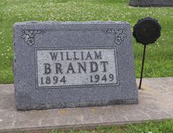
William J. “Pat” Brandt
| Birth | : | 19 Jun 1894 Rock Rapids, Lyon County, Iowa, USA |
| Death | : | 24 Jan 1949 Minneapolis, Hennepin County, Minnesota, USA |
| Burial | : | Rose Hill Cemetery, Manson, Calhoun County, USA |
| Coordinate | : | 42.5228004, -94.5243988 |
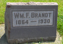
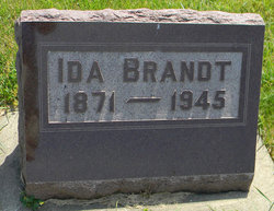
| Description | : | WWI VET He m1. Ruth Watters on 22 Dec 1920 at Farmersburg. She was with him in the 1930 census. Postville Herald, February 2, 1949: William Brandt Is Interred Here Funeral services were held Thursday for William "Pat" Brandt at the Schutte Funeral Home with Rev. F. R. Ludwig officiating. Burial was made in the Postville cemetery. Pat Brandt, a resident of this community since 1899, passed away at Veterans Hospital at Minneapolis, Minnesota on January v24, following a lingering illness. William Brandt, son of William F. Brandt and Ida Schultz Brandt, was born June 19, 1894 at Rock Rapids, Iowa. He... Read More |
frequently asked questions (FAQ):
-
Where is William J. “Pat” Brandt's memorial?
William J. “Pat” Brandt's memorial is located at: Rose Hill Cemetery, Manson, Calhoun County, USA.
-
When did William J. “Pat” Brandt death?
William J. “Pat” Brandt death on 24 Jan 1949 in Minneapolis, Hennepin County, Minnesota, USA
-
Where are the coordinates of the William J. “Pat” Brandt's memorial?
Latitude: 42.5228004
Longitude: -94.5243988
Family Members:
Parent
Spouse
Siblings
Flowers:
Nearby Cemetories:
1. Rose Hill Cemetery
Manson, Calhoun County, USA
Coordinate: 42.5228004, -94.5243988
2. Saint Thomas Cemetery
Manson, Calhoun County, USA
Coordinate: 42.5208500, -94.5365000
3. Hope Cemetery
Manson, Calhoun County, USA
Coordinate: 42.4994011, -94.5199966
4. Saint Paul Lutheran Cemetery
Pocahontas County, USA
Coordinate: 42.5610000, -94.5392000
5. Leith Cemetery
Manson, Calhoun County, USA
Coordinate: 42.4878006, -94.5667038
6. Swedish Cemetery
Manson, Calhoun County, USA
Coordinate: 42.5426295, -94.5992013
7. Trinity Cemetery
Calhoun County, USA
Coordinate: 42.4747200, -94.4555588
8. Memorial Park Cemetery
Calhoun County, USA
Coordinate: 42.5189018, -94.6194000
9. Lizard Cemetery
Palmer, Pocahontas County, USA
Coordinate: 42.5875015, -94.4796982
10. Greenfield Cemetery
Knierim, Calhoun County, USA
Coordinate: 42.4495000, -94.4565000
11. Saint Patricks Cemetery
Clare, Webster County, USA
Coordinate: 42.5943985, -94.4419022
12. Saint Johns Lutheran Cemetery
Palmer, Pocahontas County, USA
Coordinate: 42.6268997, -94.5205994
13. Palmer Cemetery
Palmer, Pocahontas County, USA
Coordinate: 42.6166992, -94.5894012
14. Saint Paul Lutheran Cemetery
Palmer, Pocahontas County, USA
Coordinate: 42.6176000, -94.5893500
15. Saint Josephs Cemetery
Barnum, Webster County, USA
Coordinate: 42.5172000, -94.3769000
16. Calvary Presbyterian Cemetery
Barnum, Webster County, USA
Coordinate: 42.4742810, -94.3835020
17. Union Cemetery
Pomeroy, Calhoun County, USA
Coordinate: 42.5539017, -94.6789017
18. Jackson Center Cemetery
Clare, Webster County, USA
Coordinate: 42.5783005, -94.3741989
19. Saint Marys Catholic Cemetery
Pomeroy, Calhoun County, USA
Coordinate: 42.5558014, -94.6889038
20. Saint James Cemetery
Clare, Webster County, USA
Coordinate: 42.5691986, -94.3644028
21. Saint Josephs Cemetery
Palmer, Pocahontas County, USA
Coordinate: 42.6342010, -94.6188965
22. Saint Francis Cemetery
Rockwell City, Calhoun County, USA
Coordinate: 42.4055000, -94.6127000
23. Rosehill Cemetery
Rockwell City, Calhoun County, USA
Coordinate: 42.4042015, -94.6128006
24. Reformatory Cemetery
Rockwell City, Calhoun County, USA
Coordinate: 42.3952570, -94.6038660


