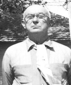
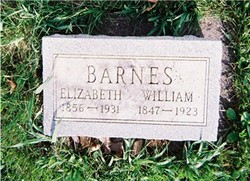
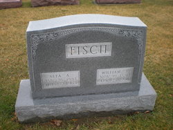
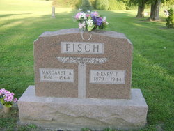
William Jacob “Bill” Fisch
| Birth | : | 19 Nov 1880 Scott County, Iowa, USA |
| Death | : | 23 Apr 1966 Poweshiek County, Iowa, USA |
| Burial | : | Escott Cemetery, Escott, Leeds and Grenville United Counties, Canada |
| Coordinate | : | 44.4403740, -75.9378900 |
| Description | : | Funeral services were held Monday afternoon April 25th, at 1:30 at the Methodist Church in Keswick for William Jacob Fisch, 85, a long time resident of that community, with Rev. Roy Hoover in charge. Burial was in the Goldenrod cemetery in Deep River. William Jacob Fisch, son of John and Elizabeth Sauter Fisch was born in Iowa County, Ia., November 19, 1880 and moved with his parents to a farm near Guernsey, where he grew into manhood. On Dec. 1, 1901, he was married to Alta Cheney of near Millersburg. They started housekeeping on a farm 7 miles north of Keswick. On Mar. 1, 1909 they... Read More |
frequently asked questions (FAQ):
-
Where is William Jacob “Bill” Fisch's memorial?
William Jacob “Bill” Fisch's memorial is located at: Escott Cemetery, Escott, Leeds and Grenville United Counties, Canada.
-
When did William Jacob “Bill” Fisch death?
William Jacob “Bill” Fisch death on 23 Apr 1966 in Poweshiek County, Iowa, USA
-
Where are the coordinates of the William Jacob “Bill” Fisch's memorial?
Latitude: 44.4403740
Longitude: -75.9378900
Family Members:
Parent
Spouse
Siblings
Children
Flowers:
Nearby Cemetories:
1. Escott Cemetery
Escott, Leeds and Grenville United Counties, Canada
Coordinate: 44.4403740, -75.9378900
2. Union Cemetery
Lansdowne, Leeds and Grenville United Counties, Canada
Coordinate: 44.4335300, -75.9864900
3. Buell Cemetery
Rockport, Leeds and Grenville United Counties, Canada
Coordinate: 44.4120000, -75.9051940
4. LaRue Family Cemetery
Escott, Leeds and Grenville United Counties, Canada
Coordinate: 44.4314860, -75.8859600
5. Old McNickle Cemetery
Holland, Leeds and Grenville United Counties, Canada
Coordinate: 44.4040500, -75.9574670
6. Warren Burial Site
Rockfield, Leeds and Grenville United Counties, Canada
Coordinate: 44.4795030, -75.9478100
7. Grenadier Island Cemetery
Front of Escott, Leeds and Grenville United Counties, Canada
Coordinate: 44.4134660, -75.8812830
8. Ruttle-Warburton Cemetery
Lansdowne, Leeds and Grenville United Counties, Canada
Coordinate: 44.4662366, -76.0087640
9. Hunt Family Cemetery
Rockport, Leeds and Grenville United Counties, Canada
Coordinate: 44.3815510, -75.9361480
10. Rockport Protestant Cemetery Old
Rockport, Leeds and Grenville United Counties, Canada
Coordinate: 44.3812890, -75.9370750
11. Saint Brendans Roman Catholic Cemetery
Rockport, Leeds and Grenville United Counties, Canada
Coordinate: 44.3807870, -75.9363580
12. Rockport Protestant Cemetery New
Rockport, Leeds and Grenville United Counties, Canada
Coordinate: 44.3800170, -75.9387340
13. Mallorytown Cemetery
Mallorytown, Leeds and Grenville United Counties, Canada
Coordinate: 44.4837420, -75.8727320
14. Dulcemaine Cemetery
Dulcemaine, Leeds and Grenville United Counties, Canada
Coordinate: 44.4480110, -76.0434560
15. Saint Patrick's Roman Catholic Cemetery
Lansdowne, Leeds and Grenville United Counties, Canada
Coordinate: 44.4265600, -76.0520200
16. Saint Luke's Cemetery
Ballycanoe, Leeds and Grenville United Counties, Canada
Coordinate: 44.5328400, -75.9076700
17. Caintown Cemetery
Caintown, Leeds and Grenville United Counties, Canada
Coordinate: 44.5269760, -75.8814680
18. Lansdowne Cemetery
Ebenezer, Leeds and Grenville United Counties, Canada
Coordinate: 44.3852740, -76.0507110
19. Walton Street Cemetery
Alexandria Bay, Jefferson County, USA
Coordinate: 44.3375000, -75.9127900
20. Sand Bay Cemetery
Sand Bay Corner, Leeds and Grenville United Counties, Canada
Coordinate: 44.4637600, -76.0830400
21. Church Street Cemetery
Alexandria Bay, Jefferson County, USA
Coordinate: 44.3308300, -75.9136100
22. Saint Cyril's Cemetery
Alexandria Bay, Jefferson County, USA
Coordinate: 44.3300018, -75.9085999
23. Highland Park Cemetery
Alexandria Bay, Jefferson County, USA
Coordinate: 44.3294400, -75.9084800
24. Barnes Settlement Cemetery
Alexandria Bay, Jefferson County, USA
Coordinate: 44.3405991, -75.8463974

