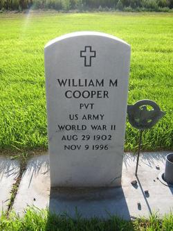
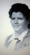
William M. “Bill” Cooper
| Birth | : | 29 Aug 1902 USA |
| Death | : | 9 Nov 1996 Alliance, Box Butte County, Nebraska, USA |
| Burial | : | Colebrook Center Cemetery, Colebrook, Litchfield County, USA |
| Coordinate | : | 41.9929428, -73.0983276 |
frequently asked questions (FAQ):
-
Where is William M. “Bill” Cooper's memorial?
William M. “Bill” Cooper's memorial is located at: Colebrook Center Cemetery, Colebrook, Litchfield County, USA.
-
When did William M. “Bill” Cooper death?
William M. “Bill” Cooper death on 9 Nov 1996 in Alliance, Box Butte County, Nebraska, USA
-
Where are the coordinates of the William M. “Bill” Cooper's memorial?
Latitude: 41.9929428
Longitude: -73.0983276
Family Members:
Spouse
Flowers:
Nearby Cemetories:
1. Colebrook Center Cemetery
Colebrook, Litchfield County, USA
Coordinate: 41.9929428, -73.0983276
2. South Cemetery
Colebrook, Litchfield County, USA
Coordinate: 41.9838982, -73.0847015
3. Beech Hill Cemetery
Colebrook, Litchfield County, USA
Coordinate: 42.0165520, -73.0805664
4. Hitchcock Cemetery
Colebrook, Litchfield County, USA
Coordinate: 42.0208590, -73.1143280
5. Baptist Cemetery
Colebrook, Litchfield County, USA
Coordinate: 42.0221977, -73.1155396
6. Cobb City Cemetery
Colebrook, Litchfield County, USA
Coordinate: 42.0286300, -73.0959100
7. Hemlock Cemetery
Colebrook, Litchfield County, USA
Coordinate: 41.9655991, -73.0492020
8. New Colebrook Cemetery
Colebrook, Litchfield County, USA
Coordinate: 41.9838982, -73.0361023
9. Pond Town Cemetery
Norfolk, Litchfield County, USA
Coordinate: 42.0254745, -73.1605911
10. Roberts Cemetery
Sandisfield, Berkshire County, USA
Coordinate: 42.0489006, -73.1188965
11. Danbury Quarter Cemetery
Winchester, Litchfield County, USA
Coordinate: 41.9369011, -73.1339035
12. Old North Road Burying Ground
Winsted, Litchfield County, USA
Coordinate: 41.9435997, -73.0456009
13. Old Riverton Cemetery
Riverton, Litchfield County, USA
Coordinate: 41.9621700, -73.0200200
14. Riverton Cemetery
Barkhamsted, Litchfield County, USA
Coordinate: 41.9600906, -73.0166931
15. John Darbe Cemetery
Winsted, Litchfield County, USA
Coordinate: 41.9297170, -73.0561320
16. Saint Josephs Old Catholic Cemetery
Winsted, Litchfield County, USA
Coordinate: 41.9253006, -73.0635529
17. Grantville Cemetery
Norfolk, Litchfield County, USA
Coordinate: 41.9533005, -73.1828003
18. Winsted Old Burying Ground
Winsted, Litchfield County, USA
Coordinate: 41.9226700, -73.0607400
19. Center Cemetery
Norfolk, Litchfield County, USA
Coordinate: 41.9959717, -73.2047195
20. Old Saint Mary Cemetery
Norfolk, Litchfield County, USA
Coordinate: 42.0058746, -73.2035675
21. Deerspring Cemetery
Norfolk, Litchfield County, USA
Coordinate: 41.9796410, -73.2037048
22. Saint Marys Cemetery
Norfolk, Litchfield County, USA
Coordinate: 42.0064011, -73.2052994
23. Forest View Cemetery
Winsted, Litchfield County, USA
Coordinate: 41.9171982, -73.0610962
24. Burt Hill Cemetery
Tolland Center, Hampden County, USA
Coordinate: 42.0613403, -73.0356369


