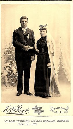
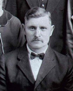
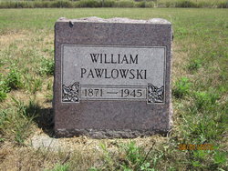
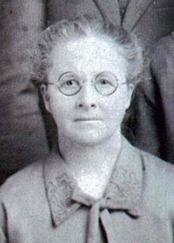
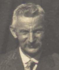
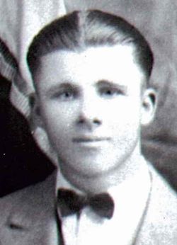
William Pawlowski
| Birth | : | 12 Sep 1871 Germany |
| Death | : | 24 Aug 1945 Lane, Jerauld County, South Dakota, USA |
| Burial | : | Shiloh Cemetery, Windsor, Sonoma County, USA |
| Coordinate | : | 38.5256004, -122.8142014 |
| Description | : | Carried by his six sons, the mortal remains of William Pawlowski were brought to their final resting place in the Feistner cemetery, south of Lane, last Sunday afternoon. Brief prayers were spoken at the home of the deceased immediately preceding the main service which was held at Zion Emmanuel Lutheran Church, Lane, at 2:30 p.m. The services were in charge of Pastor Nagel. Mrs. Arthur Schroeder served as organist, several hymns were sung by the congregation and the choir sang "Asleep in Jesus". All of Mr. Pawlowski's children were present as well as numerous other relatives... Read More |
frequently asked questions (FAQ):
-
Where is William Pawlowski's memorial?
William Pawlowski's memorial is located at: Shiloh Cemetery, Windsor, Sonoma County, USA.
-
When did William Pawlowski death?
William Pawlowski death on 24 Aug 1945 in Lane, Jerauld County, South Dakota, USA
-
Where are the coordinates of the William Pawlowski's memorial?
Latitude: 38.5256004
Longitude: -122.8142014
Family Members:
Parent
Spouse
Siblings
Children
Flowers:
Nearby Cemetories:
1. Shiloh Cemetery
Windsor, Sonoma County, USA
Coordinate: 38.5256004, -122.8142014
2. Santa Rosa Memorial Park Shiloh Annex
Windsor, Sonoma County, USA
Coordinate: 38.5247993, -122.8143005
3. Faught Cemetery
Santa Rosa, Sonoma County, USA
Coordinate: 38.5186005, -122.7574005
4. Fulton Cemetery
Fulton, Sonoma County, USA
Coordinate: 38.4888000, -122.7786026
5. Pioneer Cemetery
Windsor, Sonoma County, USA
Coordinate: 38.5624500, -122.7769700
6. Steele Family Cemetery
Santa Rosa, Sonoma County, USA
Coordinate: 38.4523730, -122.8065610
7. Mark West Cemetery
Santa Rosa, Sonoma County, USA
Coordinate: 38.5482830, -122.7229580
8. Forestview Cemetery
Forestville, Sonoma County, USA
Coordinate: 38.4677010, -122.8834000
9. McPeak Cemetery
Hacienda, Sonoma County, USA
Coordinate: 38.5097008, -122.9272003
10. McPeak Cemetery
Forestville, Sonoma County, USA
Coordinate: 38.5098190, -122.9280929
11. Catron Cemetery
Santa Rosa, Sonoma County, USA
Coordinate: 38.4796982, -122.7083969
12. Oak Mound Cemetery
Healdsburg, Sonoma County, USA
Coordinate: 38.6164017, -122.8578033
13. Green Valley Cemetery
Sebastopol, Sonoma County, USA
Coordinate: 38.4424019, -122.8869019
14. Old County Cemetery
Santa Rosa, Sonoma County, USA
Coordinate: 38.4669991, -122.7083969
15. Shomrei Torah Cemetery
Santa Rosa, Sonoma County, USA
Coordinate: 38.4593760, -122.7086480
16. Beth Ami Cemetery
Santa Rosa, Sonoma County, USA
Coordinate: 38.4590920, -122.7086070
17. Santa Rosa Memorial Park
Santa Rosa, Sonoma County, USA
Coordinate: 38.4597015, -122.7071991
18. Gilliam Cemetery
Graton, Sonoma County, USA
Coordinate: 38.4314995, -122.8816986
19. Santa Rosa Odd Fellows Cemetery
Santa Rosa, Sonoma County, USA
Coordinate: 38.4573690, -122.7066530
20. Santa Rosa Rural Cemetery
Santa Rosa, Sonoma County, USA
Coordinate: 38.4557991, -122.7039032
21. County of Sonoma Cemetery
Santa Rosa, Sonoma County, USA
Coordinate: 38.4552780, -122.7027780
22. Sharp Creek Cemetery
Santa Rosa, Sonoma County, USA
Coordinate: 38.5505981, -122.6713028
23. Luther Burbank Memorial Home and Gardens Cemetery
Santa Rosa, Sonoma County, USA
Coordinate: 38.4355810, -122.7118050
24. Sebastopol Memorial Lawn Cemetery
Sebastopol, Sonoma County, USA
Coordinate: 38.3981018, -122.8366013

