
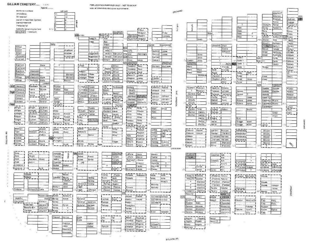
| Memorials | : | 22 |
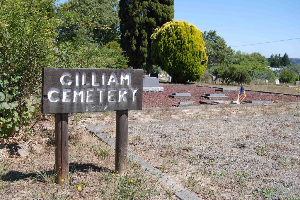
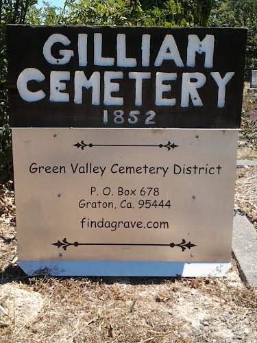
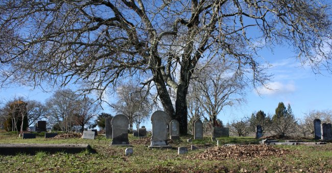
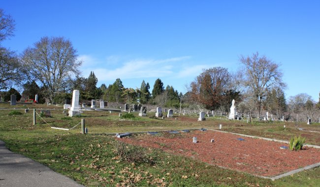
| Location | : | Graton, Sonoma County, USA |
| Coordinate | : | 38.4314995, -122.8816986 |
| Description | : | Highway 101 north Exit Steele Lane west. After Fulton Road Steele Lane becomes Guerneville Road. Turn left on Highway 116. Turn right on Graton Road. Left on Dyer Road. Where Dyer Rd. intersects Sullivan Rd., Cemetery is up on the right. |
frequently asked questions (FAQ):
-
Where is Gilliam Cemetery?
Gilliam Cemetery is located at Dyer Road Graton, Sonoma County ,California ,USA.
-
Gilliam Cemetery cemetery's updated grave count on graveviews.com?
22 memorials
-
Where are the coordinates of the Gilliam Cemetery?
Latitude: 38.4314995
Longitude: -122.8816986
Nearby Cemetories:
1. Green Valley Cemetery
Sebastopol, Sonoma County, USA
Coordinate: 38.4424019, -122.8869019
2. Forestview Cemetery
Forestville, Sonoma County, USA
Coordinate: 38.4677010, -122.8834000
3. Spring Hill Cemetery
Sebastopol, Sonoma County, USA
Coordinate: 38.3968010, -122.8637009
4. Sebastopol Memorial Lawn Cemetery
Sebastopol, Sonoma County, USA
Coordinate: 38.3981018, -122.8366013
5. Druids Occidental Cemetery
Occidental, Sonoma County, USA
Coordinate: 38.4104996, -122.9419022
6. Jasper O'Farrell Ranch Cemetery
Freestone, Sonoma County, USA
Coordinate: 38.3758300, -122.9090300
7. Steele Family Cemetery
Santa Rosa, Sonoma County, USA
Coordinate: 38.4523730, -122.8065610
8. Pleasant Hills Memorial Park and Mortuary
Sebastopol, Sonoma County, USA
Coordinate: 38.3792000, -122.8350983
9. McPeak Cemetery
Hacienda, Sonoma County, USA
Coordinate: 38.5097008, -122.9272003
10. McPeak Cemetery
Forestville, Sonoma County, USA
Coordinate: 38.5098190, -122.9280929
11. Canfield Cemetery
Sebastopol, Sonoma County, USA
Coordinate: 38.3512430, -122.8147040
12. Fulton Cemetery
Fulton, Sonoma County, USA
Coordinate: 38.4888000, -122.7786026
13. Santa Rosa Memorial Park Shiloh Annex
Windsor, Sonoma County, USA
Coordinate: 38.5247993, -122.8143005
14. Saint Catherines Church Cemetery
Monte Rio, Sonoma County, USA
Coordinate: 38.4691010, -123.0104980
15. Shiloh Cemetery
Windsor, Sonoma County, USA
Coordinate: 38.5256004, -122.8142014
16. Saint Theresa of Avila Church Cemetery
Bodega, Sonoma County, USA
Coordinate: 38.3461342, -122.9723663
17. Macedonia Methodist Episcopal Church Cemetery
Sebastopol, Sonoma County, USA
Coordinate: 38.3594860, -122.7727270
18. Redwood Memorial Gardens
Guerneville, Sonoma County, USA
Coordinate: 38.5071983, -122.9927979
19. Calvary Cemetery
Bodega, Sonoma County, USA
Coordinate: 38.3414993, -122.9749985
20. Bloomfield Cemetery
Bloomfield, Sonoma County, USA
Coordinate: 38.3135986, -122.8583984
21. Faught Cemetery
Santa Rosa, Sonoma County, USA
Coordinate: 38.5186005, -122.7574005
22. Chapel of the Chimes Cemetery and Mausoleum
Santa Rosa, Sonoma County, USA
Coordinate: 38.4141998, -122.7137985
23. Luther Burbank Memorial Home and Gardens Cemetery
Santa Rosa, Sonoma County, USA
Coordinate: 38.4355810, -122.7118050
24. Beth Ami Cemetery
Santa Rosa, Sonoma County, USA
Coordinate: 38.4590920, -122.7086070