

William Servey
| Birth | : | 30 Nov 1810 Sutton, Worcester County, Massachusetts, USA |
| Death | : | 21 Feb 1836 Uxbridge, Worcester County, Massachusetts, USA |
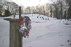
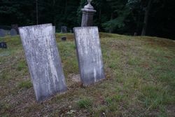
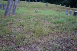
| Burial | : | Priest Cemetery, McColl, Marlboro County, USA |
| Coordinate | : | 34.6447100, -79.4885200 |
| Plot | : | Section 6 (on 2010 Cox sectional plan), Terrace 6 |
| Description | : | The surname is spelled Sarvay in the birth record, Servey in the marriage and death record. Son of Eli & Mary (Hall) Sarvay/Servey. He and Adeline Barnes married in Sutton on November 20, 1833. |
frequently asked questions (FAQ):
-
Where is William Servey's memorial?
William Servey's memorial is located at: Priest Cemetery, McColl, Marlboro County, USA.
-
When did William Servey death?
William Servey death on 21 Feb 1836 in Uxbridge, Worcester County, Massachusetts, USA
-
Where are the coordinates of the William Servey's memorial?
Latitude: 34.6447100
Longitude: -79.4885200
Family Members:
Parent
Spouse

Flowers:


Nearby Cemetories:
1. Bowen Family Cemetery
Laurinburg, Scotland County, USA
Coordinate: 34.6527500, -79.4887100
2. Brown Cemetery #2
McColl, Marlboro County, USA
Coordinate: 34.6415140, -79.5130430
3. Bethel Bible Believing Church Cemetery
McColl, Marlboro County, USA
Coordinate: 34.6389610, -79.5123580
4. Reedy Branch Baptist Church
Marlboro County, USA
Coordinate: 34.6254900, -79.4757300
5. Good News Chapel Church Cemetery
Laurinburg, Scotland County, USA
Coordinate: 34.6671200, -79.4822700
6. Smiling Family Cemetery
Laurinburg, Scotland County, USA
Coordinate: 34.6649550, -79.5036320
7. Daniels Chapel Cemetery
Marlboro County, USA
Coordinate: 34.6192000, -79.4993600
8. Oak Grove Cemetery
Scotland County, USA
Coordinate: 34.6685000, -79.4691200
9. Old Reedy Branch Cemetery
Clio, Marlboro County, USA
Coordinate: 34.6160300, -79.4836400
10. Smyrna Presbyterian Church Cemetery
Johns, Scotland County, USA
Coordinate: 34.6588554, -79.4526520
11. Britt-Brock Cemetery
Clio, Marlboro County, USA
Coordinate: 34.6121670, -79.5049090
12. Red Bluff Cemetery
Clio, Marlboro County, USA
Coordinate: 34.6117783, -79.5053711
13. Greater Fair Plains AME Zion Church Cemetery
McColl, Marlboro County, USA
Coordinate: 34.6650590, -79.5321980
14. Locklear Native Cemetery
Johns, Scotland County, USA
Coordinate: 34.6818761, -79.4581009
15. Ivey Cemetery
Tatum, Marlboro County, USA
Coordinate: 34.5985550, -79.4979030
16. Pee Dee Chapel Baptist Church Cemetery
Carolina, Dillon County, USA
Coordinate: 34.6074638, -79.4516678
17. McLaurin Cemetery
McColl, Marlboro County, USA
Coordinate: 34.6688995, -79.5417023
18. Mount Misery Cemetery
McColl, Marlboro County, USA
Coordinate: 34.6725520, -79.5395280
19. Syrian Baptist Church Cemetery
McColl, Marlboro County, USA
Coordinate: 34.6207700, -79.5426200
20. Sarion Church Cemetery
Clio, Marlboro County, USA
Coordinate: 34.6207470, -79.5426330
21. Gibson Cemetery
McColl, Marlboro County, USA
Coordinate: 34.6639230, -79.5518280
22. Hickory Grove United Methodist Church Cemetery
Clio, Marlboro County, USA
Coordinate: 34.6069100, -79.5409500
23. Norton Family Cemetery
McColl, Marlboro County, USA
Coordinate: 34.6687200, -79.5529000
24. Beaver Dam Cemetery
McColl, Marlboro County, USA
Coordinate: 34.6617012, -79.5575027