| Birth | : | 12 May 1926 Jonesville, Union County, South Carolina, USA |
| Death | : | 29 Jan 2010 Union, Union County, South Carolina, USA |
| Burial | : | Calvinia Cemetery, Calvinia, Namakwa District Municipality, South Africa |
| Coordinate | : | -31.4761889, 19.7780932 |
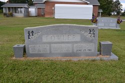
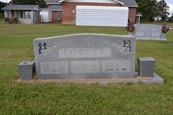
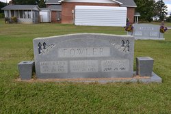
| Description | : | UNION, SC Mrs. Wilma F. Howell, 83, wife of Ned E. Howell of 245 Ponderosa Road, Union, SC, died Friday, January 29, 2010 at her home. Mrs. Howell was born in Jonesville, SC, on May 12, 1926, a daughter of the late James David Fowler and Amanda Jones Fowler. She was a member of Mt. Joy Baptist Church. Mr. and Mrs. Howell were residents of Sylvania, GA, for 25 years where they were active members of the First Baptist Church. Mrs. Howell was a member of the Bible Witness Sunday School Class and the WMU. Surviving, in addition to her husband of 67... Read More |
frequently asked questions (FAQ):
-
Where is Wilma Fowler Howell's memorial?
Wilma Fowler Howell's memorial is located at: Calvinia Cemetery, Calvinia, Namakwa District Municipality, South Africa.
-
When did Wilma Fowler Howell death?
Wilma Fowler Howell death on 29 Jan 2010 in Union, Union County, South Carolina, USA
-
Where are the coordinates of the Wilma Fowler Howell's memorial?
Latitude: -31.4761889
Longitude: 19.7780932
Family Members:
Parent
Spouse
Siblings
Children
Flowers:
Nearby Cemetories:
1. Calvinia Cemetery
Calvinia, Namakwa District Municipality, South Africa
Coordinate: -31.4761889, 19.7780932
2. Hoogekraal Farm Cemetery
Calvinia, Namakwa District Municipality, South Africa
Coordinate: -31.4767098, 19.7783071
3. Plessis Street Cemetery
Calvinia, Namakwa District Municipality, South Africa
Coordinate: -31.4705481, 19.7643484
4. Nieuwoudtville Cemetery
Nieuwoudtville, Namakwa District Municipality, South Africa
Coordinate: -31.3760996, 19.1272025
5. British Anglo Boer War Memorial
Kompromise, Namakwa District Municipality, South Africa
Coordinate: -31.9052670, 20.2307500
6. Spitsberg Farm Cemetery
Loeriesfontein, Namakwa District Municipality, South Africa
Coordinate: -30.9217100, 19.5529100
7. Windkloof Street Cemetery
Loeriesfontein, Namakwa District Municipality, South Africa
Coordinate: -30.9528469, 19.4319591
8. Loeriesfontein Old Cemetery
Loeriesfontein, Namakwa District Municipality, South Africa
Coordinate: -30.9476587, 19.4351083
9. Loeriesfontein Cemetery
Loeriesfontein, Namakwa District Municipality, South Africa
Coordinate: -30.9451000, 19.4386830
10. Doringbos Cemetery
Cederberg, West Coast District Municipality, South Africa
Coordinate: -31.9750292, 19.2235993
11. Sevilla 135 Cemetery
Clanwilliam, West Coast District Municipality, South Africa
Coordinate: -32.0661255, 19.1273011
12. Vanrhynsdorp North Cemetery
Vanrhynsdorp, West Coast District Municipality, South Africa
Coordinate: -31.5954406, 18.7571635
13. NG Kerk - Vanrhynsdorp Gedenkmuur
Vanrhynsdorp, West Coast District Municipality, South Africa
Coordinate: -31.6087299, 18.7369811
14. Vanrhynsdorp South Cemetery
Vanrhynsdorp, West Coast District Municipality, South Africa
Coordinate: -31.6130650, 18.7354200
15. Wupperthal
Wupperthal, West Coast District Municipality, South Africa
Coordinate: -32.2761252, 19.2180976
16. Williston Cemetery
Williston, Namakwa District Municipality, South Africa
Coordinate: -31.3474721, 20.9063914
17. Williston Municipal Cemetery
Central Karoo District Municipality, South Africa
Coordinate: -31.3521678, 20.9088723
18. NG Kerk - Williston Kerkhof
Williston, Namakwa District Municipality, South Africa
Coordinate: -31.3409716, 20.9164241
19. Amandelboom Cemetery
Williston, Namakwa District Municipality, South Africa
Coordinate: -31.3423081, 20.9239760
20. Klawer Cemetery
Klawer, West Coast District Municipality, South Africa
Coordinate: -31.7793410, 18.6284070
21. St John's Anglican Cemetery
Clanwilliam, West Coast District Municipality, South Africa
Coordinate: -32.1789010, 18.8928590
22. NG Kerk - Clanwilliam Kerkhof
Clanwilliam, West Coast District Municipality, South Africa
Coordinate: -32.1804460, 18.8933760
23. Trawal Cemetery
West Coast District Municipality, South Africa
Coordinate: -31.8802609, 18.6369698
24. Vredendal North Cemetery
Vredendal, West Coast District Municipality, South Africa
Coordinate: -31.6387861, 18.5210770


