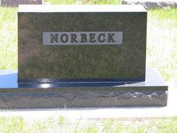
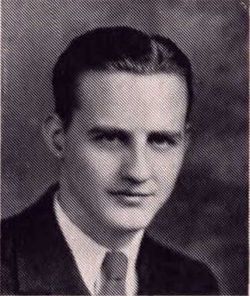
Winfree Virginia Farmer Norbeck
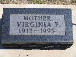
| Birth | : | 12 Jun 1912 Shelbyville, Shelby County, Missouri, USA |
| Death | : | 29 Sep 1995 Redfield, Spink County, South Dakota, USA |
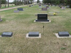
| Burial | : | Cooperstown Cemetery, Cooperstown, Griggs County, USA |
| Coordinate | : | 47.4631004, -98.1119003 |
| Plot | : | Div F Blk 026 Lot 002 Grave 009 |
frequently asked questions (FAQ):
-
Where is Winfree Virginia Farmer Norbeck's memorial?
Winfree Virginia Farmer Norbeck's memorial is located at: Cooperstown Cemetery, Cooperstown, Griggs County, USA.
-
When did Winfree Virginia Farmer Norbeck death?
Winfree Virginia Farmer Norbeck death on 29 Sep 1995 in Redfield, Spink County, South Dakota, USA
-
Where are the coordinates of the Winfree Virginia Farmer Norbeck's memorial?
Latitude: 47.4631004
Longitude: -98.1119003
Family Members:
Parent
Spouse
Siblings
Flowers:
Nearby Cemetories:
1. Cooperstown Cemetery
Cooperstown, Griggs County, USA
Coordinate: 47.4631004, -98.1119003
2. Saint George Cemetery
Cooperstown, Griggs County, USA
Coordinate: 47.4565030, -98.1238960
3. Hero Cemetery
Cooperstown, Griggs County, USA
Coordinate: 47.5008011, -98.1772003
4. Swedish Lutheran Cemetery
Cooperstown, Griggs County, USA
Coordinate: 47.4467670, -98.2178500
5. Opheim Cemetery
Cooperstown, Griggs County, USA
Coordinate: 47.4730830, -97.9989830
6. Ness Lutheran Cemetery
Cooperstown, Griggs County, USA
Coordinate: 47.4209170, -97.9953220
7. Ringsaker Cemetery
Cooperstown, Griggs County, USA
Coordinate: 47.5341450, -98.0279770
8. Westley Cemetery
Cooperstown, Griggs County, USA
Coordinate: 47.3688670, -98.0747670
9. Romness Cemetery
Romness Township, Griggs County, USA
Coordinate: 47.5571347, -98.0606293
10. Sheyenne Valley Cemetery
Finley, Steele County, USA
Coordinate: 47.4859980, -97.9646370
11. Lake Johnson State Historic Site
Griggs County, USA
Coordinate: 47.3556910, -98.1361000
12. Saron Evangelical Cemetery
Cooperstown, Griggs County, USA
Coordinate: 47.3557350, -98.0809270
13. Saint Lawrence Cemetery
Griggs County, USA
Coordinate: 47.5447006, -98.2228012
14. Hofva Cemetery
Pickert, Steele County, USA
Coordinate: 47.4276300, -97.9318300
15. Union Cemetery
Hannaford, Griggs County, USA
Coordinate: 47.3265950, -98.1128920
16. Ottawa Lutheran Church Cemetery
Griggs County, USA
Coordinate: 47.6027710, -98.1128130
17. Faith Lutheran Cemetery
Hannaford, Griggs County, USA
Coordinate: 47.3264500, -98.1897810
18. Zion Cemetery
Binford, Griggs County, USA
Coordinate: 47.4714590, -98.3359300
19. Iverson Family Cemetery
Binford, Griggs County, USA
Coordinate: 47.5177640, -98.3341820
20. Hannaford Cemetery
Hannaford, Griggs County, USA
Coordinate: 47.3152170, -98.2062510
21. Camp Atchison State Historic Site
Binford, Griggs County, USA
Coordinate: 47.5412900, -98.3292900
22. West Prairie Cemetery
Griggs County, USA
Coordinate: 47.6162680, -98.2336580
23. Lyster Cemetery
Hannaford, Griggs County, USA
Coordinate: 47.2991982, -98.2332993
24. Hartman Cemetery
Sutton, Griggs County, USA
Coordinate: 47.3984470, -98.3708800


