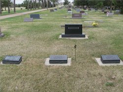
| Birth | : | 11 Feb 1890 La Grange, Lewis County, Missouri, USA |
| Death | : | 31 Aug 1973 Vermillion, Clay County, South Dakota, USA |
| Burial | : | Bluff View Cemetery, Vermillion, Clay County, USA |
| Coordinate | : | 42.7714000, -96.9056000 |
| Description | : | Vermillion, SD – Funeral services were held Tuesday, 4 September 1973, at the United Church of Christ for John G. Farmer III, 83, Vermillion, who died Friday evening in a Vermillion hospital. Mr. Farmer was born in La Grange, MO. He married Roma J. Moore in October, 1911, at Bethel, MO. The couple came to South Dakota in 1919. Mr. Farmer taught in the Bonesteel and Gregory areas. In 1928 they moved to Vermillion where Mr. Farmer was employed by the Equitable Life Insurance Co. for 45 years. He served on the Vermillion School Board and... Read More |
frequently asked questions (FAQ):
-
Where is John Goode Farmer III's memorial?
John Goode Farmer III's memorial is located at: Bluff View Cemetery, Vermillion, Clay County, USA.
-
When did John Goode Farmer III death?
John Goode Farmer III death on 31 Aug 1973 in Vermillion, Clay County, South Dakota, USA
-
Where are the coordinates of the John Goode Farmer III's memorial?
Latitude: 42.7714000
Longitude: -96.9056000
Family Members:
Parent
Spouse
Siblings
Children
Flowers:
Nearby Cemetories:
1. Bluff View Cemetery
Vermillion, Clay County, USA
Coordinate: 42.7714000, -96.9056000
2. Saint Agnes Calvary Cemetery
Vermillion, Clay County, USA
Coordinate: 42.7715900, -96.9072100
3. Saint Agnes Cemetery
Vermillion, Clay County, USA
Coordinate: 42.7872009, -96.8499985
4. Dowlin Cemetery
Burbank, Clay County, USA
Coordinate: 42.7789001, -96.8107986
5. Gibb's Cemetery
Newcastle, Dixon County, USA
Coordinate: 42.6985100, -96.8518400
6. Saint Peter Greenfield Cemetery
Vermillion, Clay County, USA
Coordinate: 42.8608017, -96.8644028
7. Clay Creek Cemetery
Clay County, USA
Coordinate: 42.8516998, -96.9788971
8. Ionia Cemetery
Newcastle, Dixon County, USA
Coordinate: 42.6893997, -96.8300018
9. Maskell Cemetery
Maskell, Dixon County, USA
Coordinate: 42.6878014, -96.9916992
10. Halverson Cemetery
Maskell, Dixon County, USA
Coordinate: 42.6908600, -97.0013500
11. Ahlsborg Lutheran Cemetery
Union County, USA
Coordinate: 42.8228000, -96.7612000
12. Saint Mary Cemetery
Union County, USA
Coordinate: 42.8520584, -96.7877502
13. Newcastle Cemetery
Newcastle, Dixon County, USA
Coordinate: 42.6550500, -96.8708700
14. Saint Peters Calvary Cemetery
Newcastle, Dixon County, USA
Coordinate: 42.6533800, -96.8744700
15. Spirit Mound Cemetery
Clay County, USA
Coordinate: 42.8885994, -96.9424973
16. Clay Point Cemetery
Prairie Center Township, Clay County, USA
Coordinate: 42.8987700, -96.9065600
17. Lime Grove Cemetery
Maskell, Dixon County, USA
Coordinate: 42.6632400, -96.9990500
18. Lime Creek Cemetery
Maskell, Dixon County, USA
Coordinate: 42.6569600, -97.0004700
19. Obert Cemetery
Obert, Cedar County, USA
Coordinate: 42.6702995, -97.0289001
20. Evergreen Cemetery
Meckling, Clay County, USA
Coordinate: 42.7896996, -97.0903015
21. Brule Creek Cemetery
Spink Township, Union County, USA
Coordinate: 42.8346510, -96.7324350
22. Taylor Cemetery
Clay County, USA
Coordinate: 42.8372002, -97.0785980
23. Union County Poor Farm Cemetery
Union County, USA
Coordinate: 42.7649210, -96.7077580
24. Saint Paul Cemetery
Elk Point, Union County, USA
Coordinate: 42.7641983, -96.7061005


