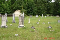
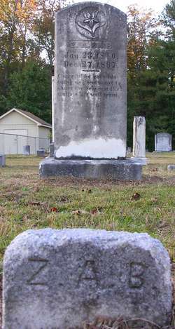
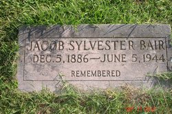
Zachariah Alonzo “Zach” Bair
| Birth | : | 23 Jan 1840 Orangeburg County, South Carolina, USA |
| Death | : | 27 Dec 1897 Orangeburg County, South Carolina, USA |
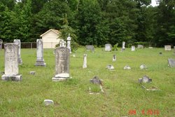
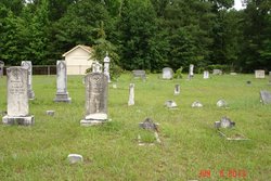
| Burial | : | Quabbin Park Cemetery, Ware, Hampshire County, USA |
| Coordinate | : | 42.2792015, -72.3056030 |
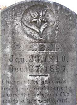
| Inscription | : | Cheerfully he gave his being up - and went to share the holy rest that waits a life well spent. |
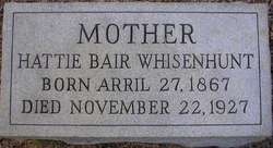
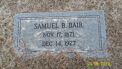
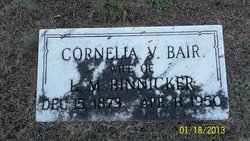
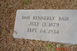
| Description | : | Son of Samuel Bair & Frances Catherine Kemmerlin Bair Father of Harriet E "Hattie" Bair Maggie Malacy "M C" Bair Rebecca Bair Samuel B Bair Cornelia Bair Daniel Kennerly Bair Ann Bair Jacob Sylvester Bair, Sr "Zachariah Alonzo Bair died December 27th, 1897, aged fifty-seven years..another survivor of the Lost Cause has crossed the river... Zachariah Alonzo Bair was born in Orangeburg County January 23d, 1840, and lived quietly upon the farm 'till 1861, when..he volunteered for twelve months in Co. C (Glover Guards,) Capt. Kemmerlin Heagan, First Regiment, So. Ca. Infrantry. At the expiration of his term of service he... Read More |
frequently asked questions (FAQ):
-
Where is Zachariah Alonzo “Zach” Bair's memorial?
Zachariah Alonzo “Zach” Bair's memorial is located at: Quabbin Park Cemetery, Ware, Hampshire County, USA.
-
When did Zachariah Alonzo “Zach” Bair death?
Zachariah Alonzo “Zach” Bair death on 27 Dec 1897 in Orangeburg County, South Carolina, USA
-
Where are the coordinates of the Zachariah Alonzo “Zach” Bair's memorial?
Latitude: 42.2792015
Longitude: -72.3056030
Family Members:
Spouse
Children
Flowers:
Nearby Cemetories:
1. Quabbin Park Cemetery
Ware, Hampshire County, USA
Coordinate: 42.2792015, -72.3056030
2. West Cemetery
Ware, Hampshire County, USA
Coordinate: 42.2651860, -72.2757270
3. Ware Center Cemetery
Ware, Hampshire County, USA
Coordinate: 42.2641180, -72.2744130
4. Blue Meadow Cemetery (Defunct)
Belchertown, Hampshire County, USA
Coordinate: 42.2802300, -72.3530000
5. Mount Carmel Cemetery
Ware, Hampshire County, USA
Coordinate: 42.2694016, -72.2491989
6. New Saint William Cemetery
Ware, Hampshire County, USA
Coordinate: 42.2597400, -72.2526400
7. Holy Cross Polish National Catholic Cemetery
Ware, Hampshire County, USA
Coordinate: 42.2595300, -72.2508200
8. West Street Burial Ground
Ware, Hampshire County, USA
Coordinate: 42.2533800, -72.2554700
9. Woodlawn Cemetery (Defunct)
Enfield, Hampshire County, USA
Coordinate: 42.3112100, -72.3512400
10. Cemetery Hill (Defunct)
Enfield, Hampshire County, USA
Coordinate: 42.3217500, -72.3310700
11. Aspen Grove Cemetery
Ware, Hampshire County, USA
Coordinate: 42.2653008, -72.2450027
12. Old Saint William Cemetery
Ware, Hampshire County, USA
Coordinate: 42.2582380, -72.2472420
13. Hardwick Baptist Cemetery
Hardwick, Worcester County, USA
Coordinate: 42.3082700, -72.2479600
14. Walnut Grove Cemetery
Ware, Hampshire County, USA
Coordinate: 42.2623430, -72.2367810
15. Saint Marys Cemetery
Ware, Hampshire County, USA
Coordinate: 42.2472000, -72.2438965
16. South Cemetery
Belchertown, Hampshire County, USA
Coordinate: 42.2686005, -72.3874969
17. Mount Hope Cemetery
Belchertown, Hampshire County, USA
Coordinate: 42.2792015, -72.4008026
18. Methodist Cemetery
West Brookfield, Worcester County, USA
Coordinate: 42.2833700, -72.2061400
19. Hillcrest Cemetery
Belchertown, Hampshire County, USA
Coordinate: 42.2137600, -72.3636000
20. Greenwich Cemetery (Defunct)
Greenwich, Hampshire County, USA
Coordinate: 42.3588000, -72.3017100
21. Warner Pine Grove Memorial Cemetery
Belchertown, Hampshire County, USA
Coordinate: 42.2678500, -72.4172500
22. Packardsville Church Cemetery (Defunct)
Enfield, Hampshire County, USA
Coordinate: 42.3430700, -72.3790900
23. Saints Peter and Paul Cemetery
Bondsville, Hampden County, USA
Coordinate: 42.2020690, -72.3524170
24. Packardsville Cemetery (Defunct)
Enfield, Hampshire County, USA
Coordinate: 42.3464920, -72.3790030

