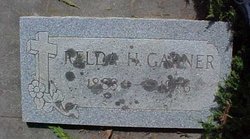
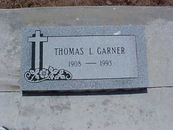
Zerelda “Relda” Henderson Garner
| Birth | : | 14 Apr 1883 California, USA |
| Death | : | 27 Oct 1976 San Mateo, San Mateo County, California, USA |
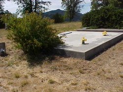
| Burial | : | Hix Cemetery, Jackson County, USA |
| Coordinate | : | 36.4580810, -85.5815000 |
frequently asked questions (FAQ):
-
Where is Zerelda “Relda” Henderson Garner's memorial?
Zerelda “Relda” Henderson Garner's memorial is located at: Hix Cemetery, Jackson County, USA.
-
When did Zerelda “Relda” Henderson Garner death?
Zerelda “Relda” Henderson Garner death on 27 Oct 1976 in San Mateo, San Mateo County, California, USA
-
Where are the coordinates of the Zerelda “Relda” Henderson Garner's memorial?
Latitude: 36.4580810
Longitude: -85.5815000
Family Members:
Parent
Spouse
Siblings
Children
Flowers:
Nearby Cemetories:
1. Hix Cemetery
Jackson County, USA
Coordinate: 36.4580810, -85.5815000
2. Amos Kirkpatrick-Tinsley Cemetery
Jackson County, USA
Coordinate: 36.4715080, -85.5867230
3. Rich-Lynn Family Cemetery
Butlers Landing, Clay County, USA
Coordinate: 36.4794140, -85.5987380
4. Bedford-Hall Family Cemetery
Gainesboro, Jackson County, USA
Coordinate: 36.4440500, -85.6101800
5. High Cedar Cemetery
Clay County, USA
Coordinate: 36.4827710, -85.5974970
6. John Fowler Cemetery
Butlers Landing, Clay County, USA
Coordinate: 36.4910900, -85.5972590
7. Goolsby Cemetery
Clay County, USA
Coordinate: 36.4603640, -85.5368040
8. Williamson Family Cemetery
Gainesboro, Jackson County, USA
Coordinate: 36.4213510, -85.5925170
9. William Billy Harris Family Graveyard
Gainesboro, Jackson County, USA
Coordinate: 36.4347000, -85.6211500
10. Kirk Cemetery
Clay County, USA
Coordinate: 36.4960670, -85.5661650
11. Butlers Landing Cemetery
Celina, Clay County, USA
Coordinate: 36.4941300, -85.5600410
12. John Hamilton Cemetery
Butlers Landing, Clay County, USA
Coordinate: 36.4916010, -85.5489080
13. Anderson-Bybee Cemetery
Jackson County, USA
Coordinate: 36.4340700, -85.6270800
14. Pleasant Hill Cemetery
Carlock, Jackson County, USA
Coordinate: 36.4150009, -85.5667038
15. Flynn Cemetery
Gainesboro, Jackson County, USA
Coordinate: 36.4211410, -85.5501760
16. William A Hix Cemetery
Gainesboro, Jackson County, USA
Coordinate: 36.4172680, -85.5546780
17. Armstrong Family Cemetery
Hurricane, Jackson County, USA
Coordinate: 36.4186160, -85.6156390
18. Roberts Cemetery
Celina, Clay County, USA
Coordinate: 36.5066986, -85.5727997
19. McGlasson Cemetery
Clay County, USA
Coordinate: 36.4904900, -85.6286800
20. Turkeytown Cemetery
Clay County, USA
Coordinate: 36.4569016, -85.5177994
21. Moss Family Cemetery
Hurricane, Jackson County, USA
Coordinate: 36.4129670, -85.6118360
22. Cal Spivey Cemetery
Hurricane, Jackson County, USA
Coordinate: 36.4280370, -85.6356950
23. M R Cemetery
Baptist Ridge, Clay County, USA
Coordinate: 36.4769100, -85.5196770
24. Emberton Cemetery
Celina, Clay County, USA
Coordinate: 36.4862150, -85.5237040

