
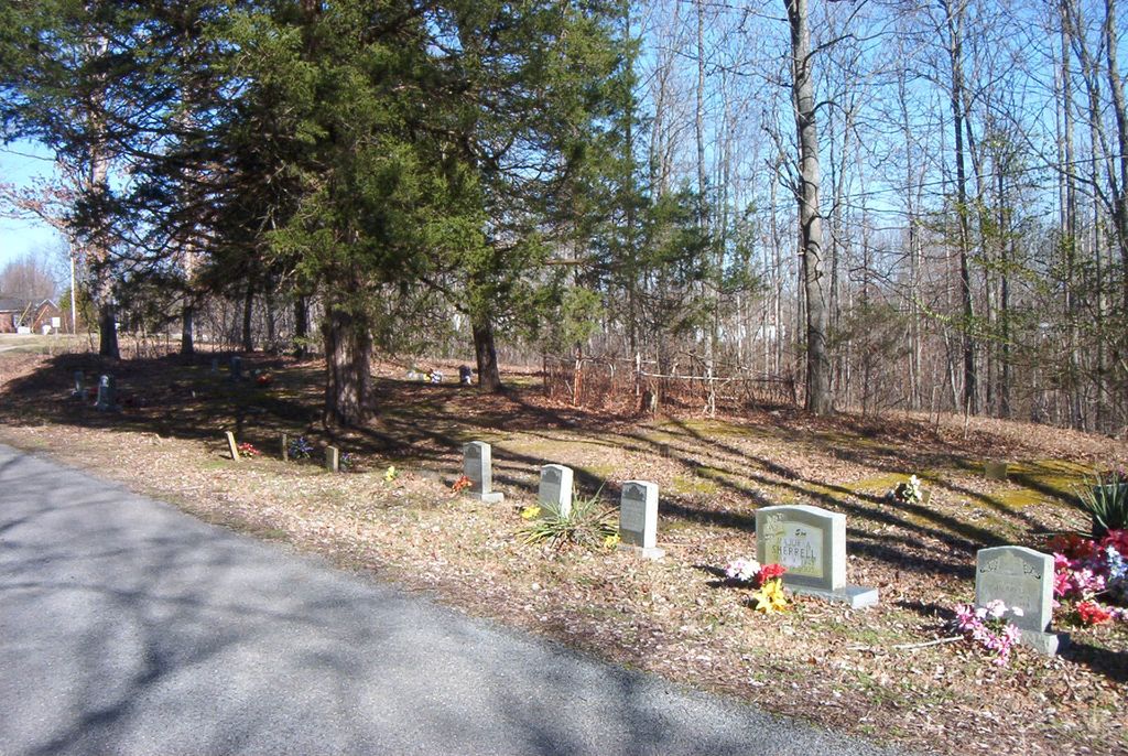
| Memorials | : | 15 |
| Location | : | Celina, Clay County, USA |
| Coordinate | : | 36.4862150, -85.5237040 |
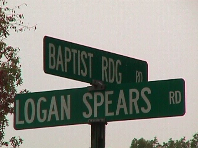
| Description | : | This cemetery is listed as Cemetery Emerton in Clay County Tax Assessors Records (Hilham, Tennessee 38568). May be a mis-spelling since members of the Emberton family are buried here. At the junction of Logan Spears Road and Baptist Ridge Road. |
frequently asked questions (FAQ):
-
Where is Emberton Cemetery?
Emberton Cemetery is located at Celina, Clay County ,Tennessee ,USA.
-
Emberton Cemetery cemetery's updated grave count on graveviews.com?
15 memorials
-
Where are the coordinates of the Emberton Cemetery?
Latitude: 36.4862150
Longitude: -85.5237040
Nearby Cemetories:
1. McDonald Cemetery
Baptist Ridge, Clay County, USA
Coordinate: 36.4855995, -85.5119019
2. M R Cemetery
Baptist Ridge, Clay County, USA
Coordinate: 36.4769100, -85.5196770
3. Hall Cemetery
Clay County, USA
Coordinate: 36.4994011, -85.5366974
4. Doc Hall Cemetery
Clay County, USA
Coordinate: 36.4995390, -85.5369270
5. John Hamilton Cemetery
Butlers Landing, Clay County, USA
Coordinate: 36.4916010, -85.5489080
6. Rich Cemetery
Baptist Ridge, Clay County, USA
Coordinate: 36.4757080, -85.4991700
7. Goolsby Cemetery
Clay County, USA
Coordinate: 36.4603640, -85.5368040
8. Turkeytown Cemetery
Clay County, USA
Coordinate: 36.4569016, -85.5177994
9. Butlers Landing Cemetery
Celina, Clay County, USA
Coordinate: 36.4941300, -85.5600410
10. Hamilton Cemetery
Clay County, USA
Coordinate: 36.5181007, -85.5338974
11. Mabry Cemetery
Clay County, USA
Coordinate: 36.5139008, -85.5464020
12. Kirk Cemetery
Clay County, USA
Coordinate: 36.4960670, -85.5661650
13. McColgan Cemetery
Clay County, USA
Coordinate: 36.5163994, -85.5560989
14. Lester Brown Family Cemetery
Arcott, Clay County, USA
Coordinate: 36.5205700, -85.5547530
15. McClain Cemetery
Baptist Ridge, Clay County, USA
Coordinate: 36.4562840, -85.4838270
16. Roberts Cemetery
Celina, Clay County, USA
Coordinate: 36.5066986, -85.5727997
17. Archibald Plumlee Cemetery
Pine Hill, Clay County, USA
Coordinate: 36.5203018, -85.5682983
18. Dale Davis Cemetery
Clay County, USA
Coordinate: 36.5143600, -85.4685300
19. Amos Kirkpatrick-Tinsley Cemetery
Jackson County, USA
Coordinate: 36.4715080, -85.5867230
20. Hix Cemetery
Jackson County, USA
Coordinate: 36.4580810, -85.5815000
21. John Fowler Cemetery
Butlers Landing, Clay County, USA
Coordinate: 36.4910900, -85.5972590
22. High Cedar Cemetery
Clay County, USA
Coordinate: 36.4827710, -85.5974970
23. Peterman Bend Cemetery
Celina, Clay County, USA
Coordinate: 36.5370750, -85.4846300
24. Rich-Lynn Family Cemetery
Butlers Landing, Clay County, USA
Coordinate: 36.4794140, -85.5987380