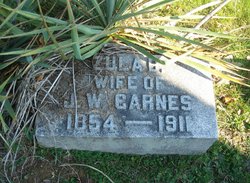
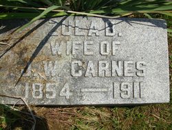
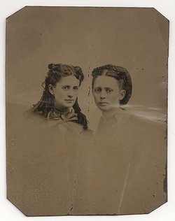
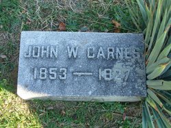
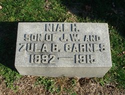
Zula Bright Carnes
| Birth | : | 14 Jul 1854 Baltimore, Fairfield County, Ohio, USA |
| Death | : | 11 Aug 1911 Carroll, Fairfield County, Ohio, USA |
| Burial | : | Lakeside Cemetery, Decatur, Van Buren County, USA |
| Coordinate | : | 42.1130000, -85.9770000 |
| Plot | : | Sec. B1 Lot 46 |
| Description | : | Zula Bright was the daughter of John Bright and Harriet Chamberlain Stuter. She was married to John W. Carnes and had 4 children. Death Cert# 42638. She was 57 years o months and 28 days. She was born in Liberty twp. and was a housewife. Death Certificate says her mother was Harriet Chamberlain and her father was John Bright. Her Mother was actually Harriet Chamberlain Stuter. She was widowed from Jacob Stuter and had three children before she married John Bright. If you use any of my personal pictures anywhere or my information and research,please cite me as your source. Samantha Stuter... Read More |
frequently asked questions (FAQ):
-
Where is Zula Bright Carnes's memorial?
Zula Bright Carnes's memorial is located at: Lakeside Cemetery, Decatur, Van Buren County, USA.
-
When did Zula Bright Carnes death?
Zula Bright Carnes death on 11 Aug 1911 in Carroll, Fairfield County, Ohio, USA
-
Where are the coordinates of the Zula Bright Carnes's memorial?
Latitude: 42.1130000
Longitude: -85.9770000
Family Members:
Parent
Spouse
Siblings
Children
Flowers:
Nearby Cemetories:
1. Lakeside Cemetery
Decatur, Van Buren County, USA
Coordinate: 42.1130000, -85.9770000
2. Luv Pet Cemetery
Decatur, Van Buren County, USA
Coordinate: 42.1131350, -85.9750070
3. Harrison Cemetery
Decatur, Van Buren County, USA
Coordinate: 42.1070000, -85.9610000
4. Hamilton Cemetery
Decatur, Van Buren County, USA
Coordinate: 42.1191063, -86.0511017
5. Cuddeback Cemetery
Paw Paw, Van Buren County, USA
Coordinate: 42.1753006, -85.9518967
6. Charleston Cemetery
Volinia, Cass County, USA
Coordinate: 42.0560989, -85.9274979
7. Anderson Cemetery
Decatur Township, Van Buren County, USA
Coordinate: 42.0764008, -85.8961029
8. Prospect Lake Cemetery
Lawrence, Van Buren County, USA
Coordinate: 42.1780000, -86.0210000
9. North Wayne Cemetery
Dowagiac, Cass County, USA
Coordinate: 42.0633000, -86.0692000
10. Crane Cemetery
Volinia, Cass County, USA
Coordinate: 42.0269012, -85.9747009
11. Chamberlin Cemetery
Lawton, Van Buren County, USA
Coordinate: 42.1349983, -85.8535995
12. Rose Hill Cemetery
Nicholsville, Cass County, USA
Coordinate: 42.0408325, -85.8947220
13. South Wayne Cemetery
Dowagiac, Cass County, USA
Coordinate: 42.0194440, -85.9963890
14. Wildey Cemetery
Paw Paw, Van Buren County, USA
Coordinate: 42.2216988, -85.9567032
15. Haight Cemetery
Marcellus, Cass County, USA
Coordinate: 42.0322142, -85.8761059
16. Goff Cemetery
Marcellus, Cass County, USA
Coordinate: 42.0268100, -85.8835300
17. Prospect Hill Cemetery
Paw Paw, Van Buren County, USA
Coordinate: 42.2019005, -85.8874969
18. White Cemetery
Dowagiac, Cass County, USA
Coordinate: 42.0054893, -86.0307617
19. Saint Marys Cemetery
Paw Paw, Van Buren County, USA
Coordinate: 42.2080994, -85.8852997
20. Gage Cemetery
Dowagiac, Cass County, USA
Coordinate: 42.0194440, -86.0791670
21. Oak Grove Cemetery
Lawton, Van Buren County, USA
Coordinate: 42.1707993, -85.8339005
22. Lawrence Village Pioneer Cemetery
Lawrence, Van Buren County, USA
Coordinate: 42.2200000, -86.0540000
23. Allen Cemetery
Dowagiac, Cass County, USA
Coordinate: 42.0421860, -86.1181780
24. Saint Marks Episcopal Church Columbarium
Paw Paw, Van Buren County, USA
Coordinate: 42.2208060, -85.8863340

