
| Memorials | : | 0 |
| Location | : | Lone Pine, Inyo County, USA |
| Coordinate | : | 36.6183701, -118.0686493 |
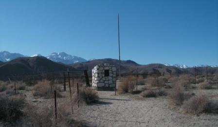
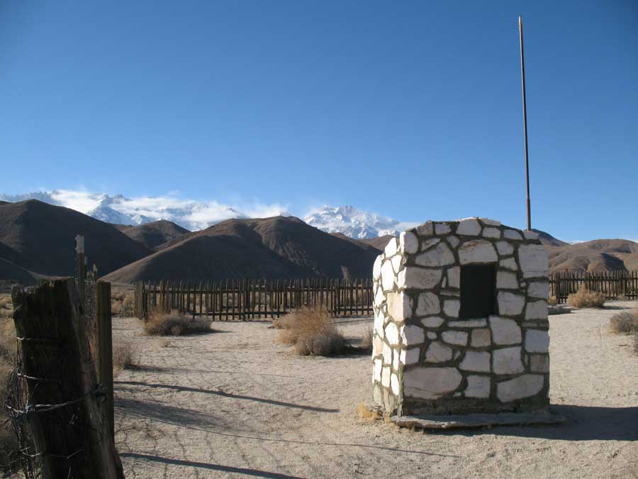
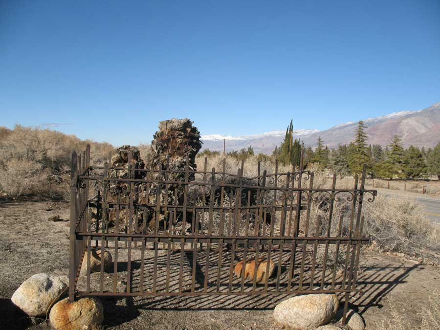
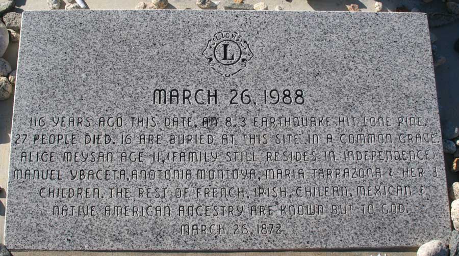
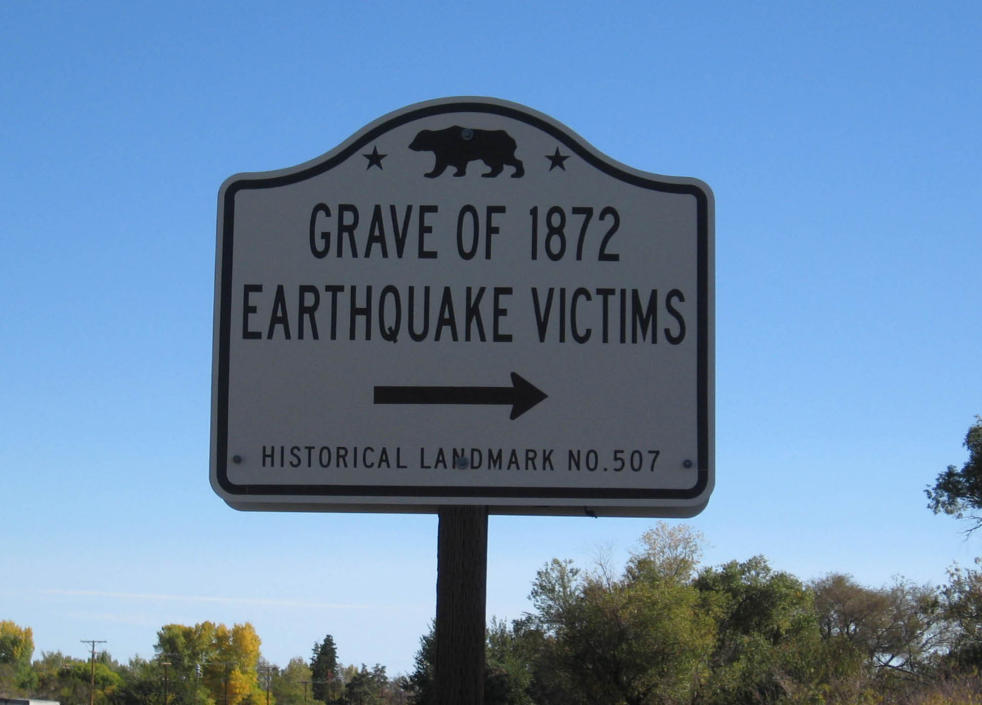
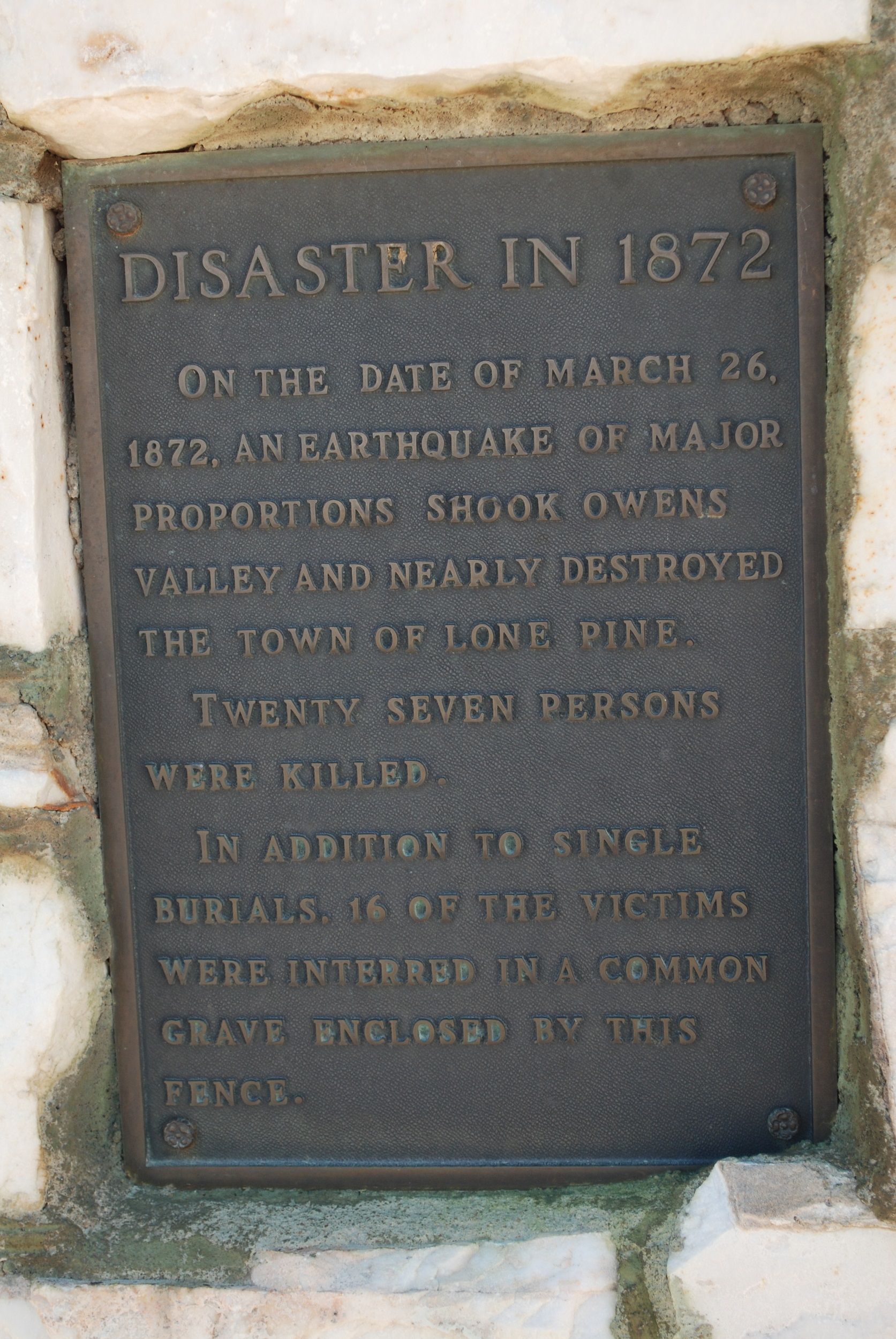
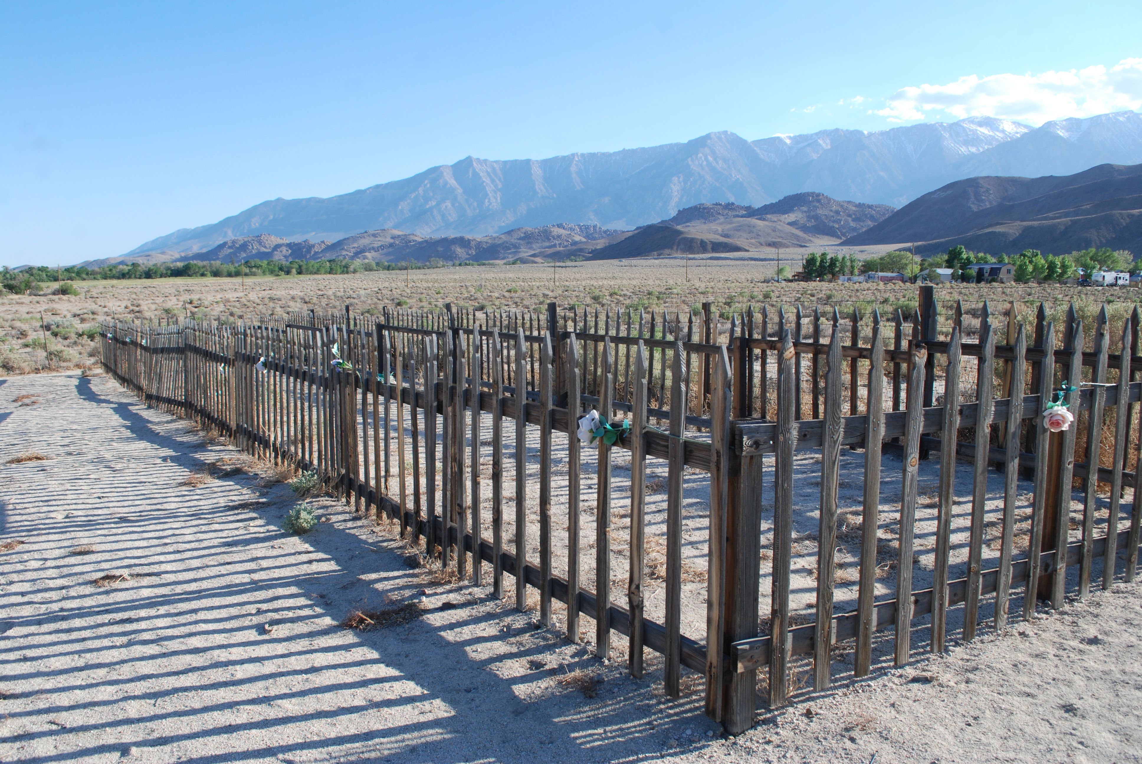
| Description | : | Monument And Mass Grave For 1872 Earthquake Victims The plaque on the monument reads: "On the date of March 26, 1872, an earthquake of much proportions shook Owens Valley and nearly destroyed the town of Lone Pine. Twenty seven persons were killed. In addition to single graves 16 of the victims were interred in a common grave eclipsed by this fence." The plaque laid before the flagpole, dedicated March 26, 1988, reads as follows; "116 years ago this date, an 8.3 earthquake hit Lone Pine. People died. 16 are buried at this site in a... Read More |
frequently asked questions (FAQ):
-
Where is 1872 California Earthquake Victims Graveyard?
1872 California Earthquake Victims Graveyard is located at 1435 North Main Street (US Hwy 395) Lone Pine, Inyo County ,California ,USA.
-
1872 California Earthquake Victims Graveyard cemetery's updated grave count on graveviews.com?
0 memorials
-
Where are the coordinates of the 1872 California Earthquake Victims Graveyard?
Latitude: 36.6183701
Longitude: -118.0686493
Nearby Cemetories:
1. Mount Whitney Cemetery
Lone Pine, Inyo County, USA
Coordinate: 36.6197014, -118.0663986
2. Old Lone Pine Cemetery
Lone Pine, Inyo County, USA
Coordinate: 36.6150017, -118.0417023
3. Pioneer Cemetery
Lone Pine, Inyo County, USA
Coordinate: 36.6011009, -118.0466995
4. Indian Cemetery
Lone Pine, Inyo County, USA
Coordinate: 36.5948800, -118.0781500
5. Manzanar Cemetery
Manzanar, Inyo County, USA
Coordinate: 36.7252930, -118.1629390
6. Independence Cemetery
Independence, Inyo County, USA
Coordinate: 36.8005981, -118.1939011
7. Cerro Gordo Swansea Cemetery
Keeler, Inyo County, USA
Coordinate: 36.4871330, -117.8664180
8. Keeler Cemetery
Keeler, Inyo County, USA
Coordinate: 36.4868698, -117.8663483
9. Old Independence Cemetery
Inyo County, USA
Coordinate: 36.8121986, -118.2055969
10. Camp Independence Cemetery
Independence, Inyo County, USA
Coordinate: 36.8358920, -118.2239520
11. Cartago Cemetery
Cartago, Inyo County, USA
Coordinate: 36.3104700, -118.0230500
12. McKellips Gravesite
Olancha, Inyo County, USA
Coordinate: 36.3486610, -117.7706110
13. Darwin Cemetery
Darwin, Inyo County, USA
Coordinate: 36.2674030, -117.6013930
14. Woodman of the World Cemetery
Big Pine, Inyo County, USA
Coordinate: 37.1441030, -118.2859750
15. Big Pine Cemetery
Big Pine, Inyo County, USA
Coordinate: 37.1663370, -118.2980640
16. Bear Creek Ranch Cemetery
Lindsay, Tulare County, USA
Coordinate: 36.2067200, -118.7338900
17. Little Lake Cemetery
Little Lake, Inyo County, USA
Coordinate: 35.9370150, -117.9079410
18. Three Rivers Cemetery
Three Rivers, Tulare County, USA
Coordinate: 36.4217987, -118.9047012
19. Kaweah Ecclesiastical Mortuary Church Cemetery
Kaweah, Tulare County, USA
Coordinate: 36.4749860, -118.9220910
20. Duncan-McDonald Cemetery
Springville, Tulare County, USA
Coordinate: 36.2013890, -118.7891670
21. Scottys Castle Gravesite
Beatty Junction, Inyo County, USA
Coordinate: 37.0336700, -117.3424800
22. Eshom Valley Cemetery
Badger, Tulare County, USA
Coordinate: 36.6328812, -118.9671478
23. Rice Family Cemetery
Bishop, Inyo County, USA
Coordinate: 37.2346400, -118.5645800
24. Skidoo Cemetery
Skidoo, Inyo County, USA
Coordinate: 36.4364586, -117.1473465