
| Memorials | : | 0 |
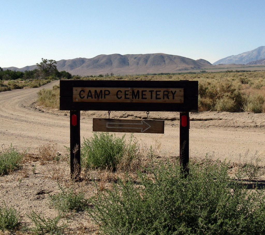
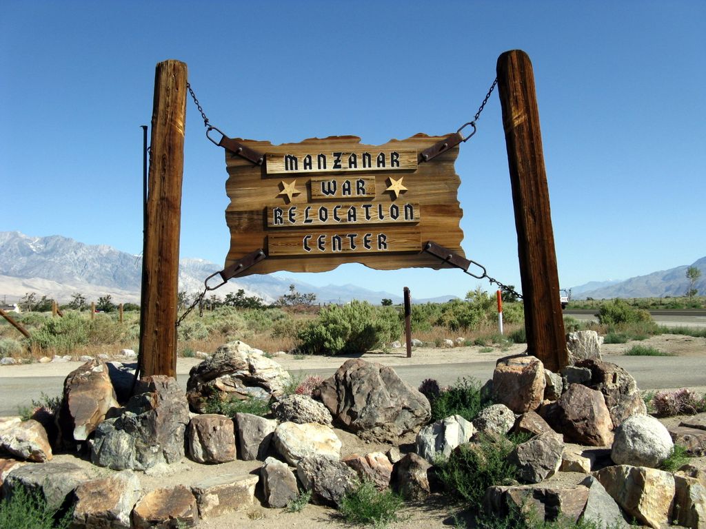
| Location | : | Manzanar, Inyo County, USA |
| Coordinate | : | 36.7252930, -118.1629390 |
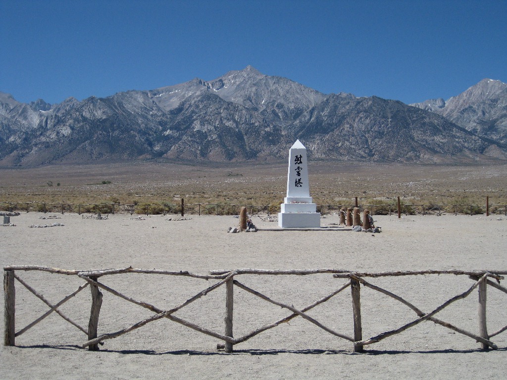
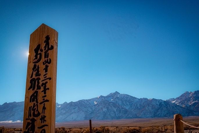
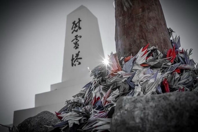
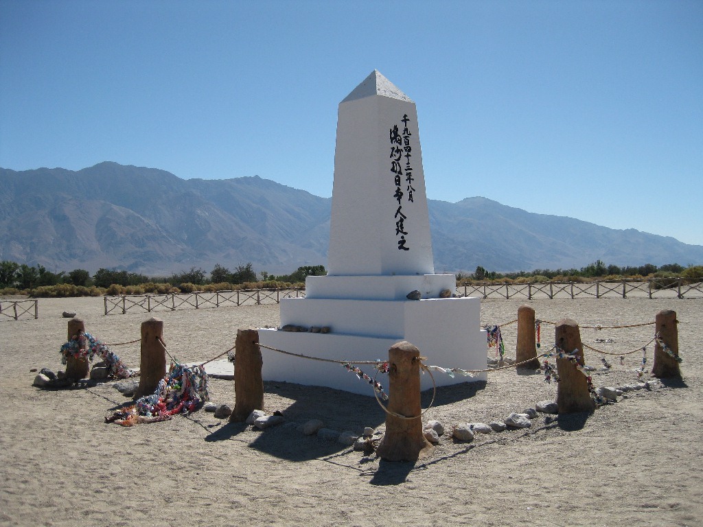
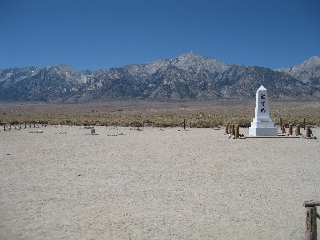
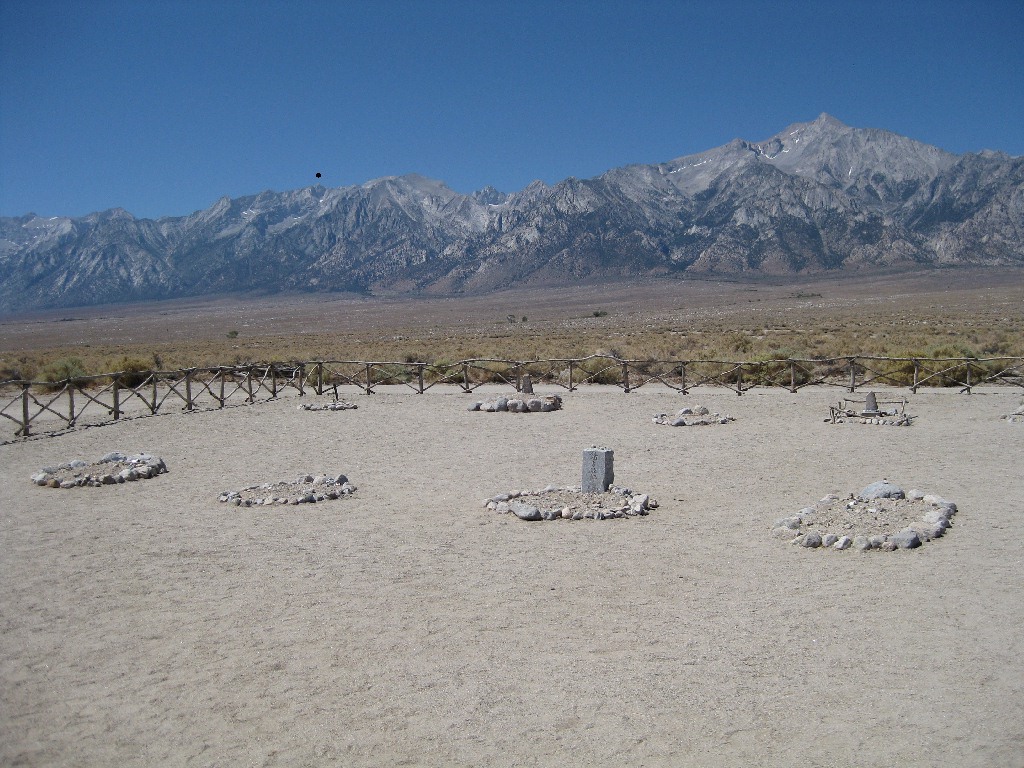
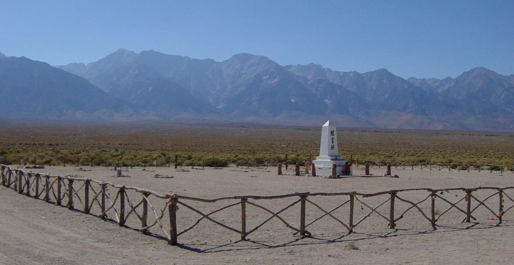
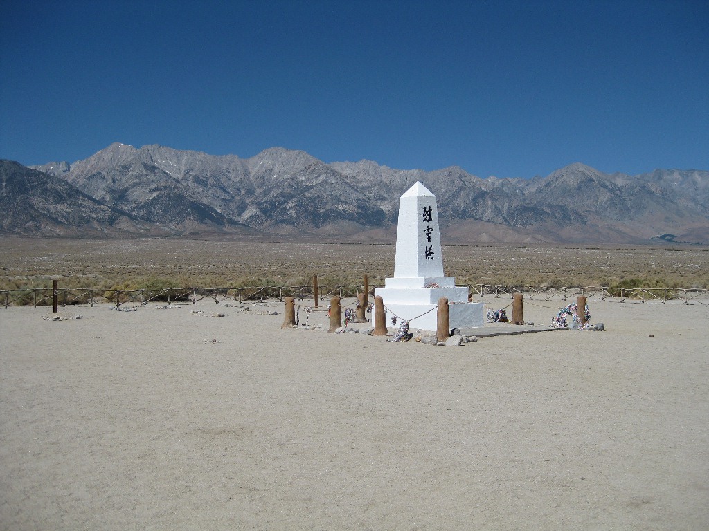
| Description | : | Manzanar Cemetery is within Manzanar National Historic Site. The second tallest mountain in California 14,389 foot Mount Williamson watches over Manzanar Cemetery from approximately 9.2 miles to the west. Manzanar means "apple orchard" in Spanish. In 1943 internee and Master stonemason for the Los Angeles Catholic diocese Ryozo Kado, along with block 9 residents and members of the Buddhist Young Peoples organization, constructed the Cemetery Memorial obelisk. The inscriptions on the monument were written by Manzanar's Buddhist minister Rev. Shinjo Nagatomi. The three characters on the front or east side of the memorial literally translate as "soul consoling tower". On the back... Read More |
frequently asked questions (FAQ):
-
Where is Manzanar Cemetery?
Manzanar Cemetery is located at 5001 Highway 395 Manzanar, Inyo County ,California , 93526USA.
-
Manzanar Cemetery cemetery's updated grave count on graveviews.com?
0 memorials
-
Where are the coordinates of the Manzanar Cemetery?
Latitude: 36.7252930
Longitude: -118.1629390
Nearby Cemetories:
1. Independence Cemetery
Independence, Inyo County, USA
Coordinate: 36.8005981, -118.1939011
2. Old Independence Cemetery
Inyo County, USA
Coordinate: 36.8121986, -118.2055969
3. Camp Independence Cemetery
Independence, Inyo County, USA
Coordinate: 36.8358920, -118.2239520
4. Mount Whitney Cemetery
Lone Pine, Inyo County, USA
Coordinate: 36.6197014, -118.0663986
5. 1872 California Earthquake Victims Graveyard
Lone Pine, Inyo County, USA
Coordinate: 36.6183701, -118.0686493
6. Old Lone Pine Cemetery
Lone Pine, Inyo County, USA
Coordinate: 36.6150017, -118.0417023
7. Indian Cemetery
Lone Pine, Inyo County, USA
Coordinate: 36.5948800, -118.0781500
8. Pioneer Cemetery
Lone Pine, Inyo County, USA
Coordinate: 36.6011009, -118.0466995
9. Cerro Gordo Swansea Cemetery
Keeler, Inyo County, USA
Coordinate: 36.4871330, -117.8664180
10. Keeler Cemetery
Keeler, Inyo County, USA
Coordinate: 36.4868698, -117.8663483
11. Cartago Cemetery
Cartago, Inyo County, USA
Coordinate: 36.3104700, -118.0230500
12. Woodman of the World Cemetery
Big Pine, Inyo County, USA
Coordinate: 37.1441030, -118.2859750
13. Big Pine Cemetery
Big Pine, Inyo County, USA
Coordinate: 37.1663370, -118.2980640
14. McKellips Gravesite
Olancha, Inyo County, USA
Coordinate: 36.3486610, -117.7706110
15. Rice Family Cemetery
Bishop, Inyo County, USA
Coordinate: 37.2346400, -118.5645800
16. Sunland Cemetery
Bishop, Inyo County, USA
Coordinate: 37.3292007, -118.4214020
17. Darwin Cemetery
Darwin, Inyo County, USA
Coordinate: 36.2674030, -117.6013930
18. Eshom Valley Cemetery
Badger, Tulare County, USA
Coordinate: 36.6328812, -118.9671478
19. East Line Street Cemetery
Bishop, Inyo County, USA
Coordinate: 37.3605995, -118.3555984
20. Kaweah Ecclesiastical Mortuary Church Cemetery
Kaweah, Tulare County, USA
Coordinate: 36.4749860, -118.9220910
21. West Line Street Cemetery
Bishop, Inyo County, USA
Coordinate: 37.3633003, -118.4060974
22. Three Rivers Cemetery
Three Rivers, Tulare County, USA
Coordinate: 36.4217987, -118.9047012
23. Saint Timothy's Anglican Church Columbarium
Bishop, Inyo County, USA
Coordinate: 37.3667190, -118.3995710
24. Bear Creek Ranch Cemetery
Lindsay, Tulare County, USA
Coordinate: 36.2067200, -118.7338900