
| Memorials | : | 5 |
| Location | : | Maitland, City of Cape Town Metropolitan Municipality, South Africa |
| Coordinate | : | -33.9190870, 18.5073370 |
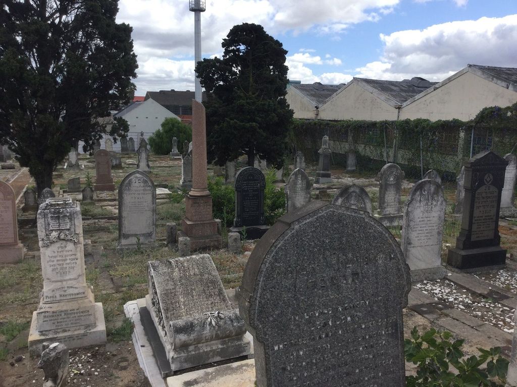
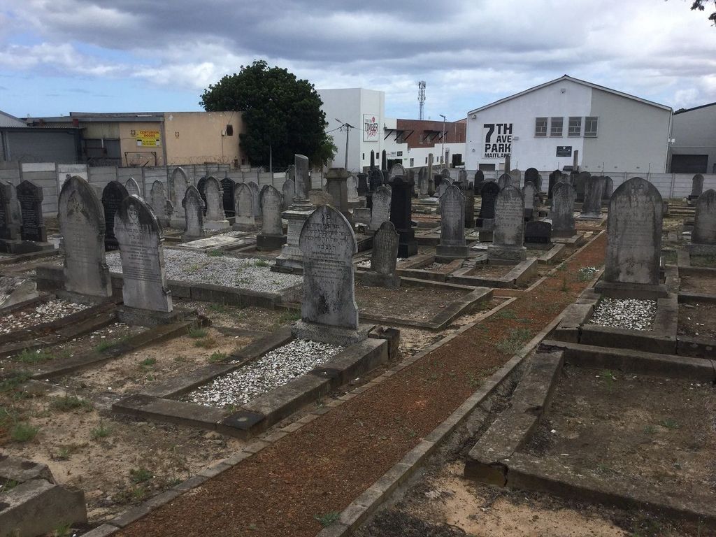
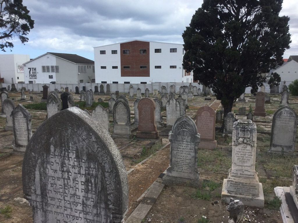
| Description | : | This cemetery was used by the Jewish community in Cape Town prior to the opening of Pinelands. Access to the cemetery can be arranged through the reception staff at Pinelands 2. |
frequently asked questions (FAQ):
-
Where is 7th Avenue Jewish Cemetery?
7th Avenue Jewish Cemetery is located at Voortrekker Rd Maitland, City of Cape Town Metropolitan Municipality ,Western Cape ,South Africa.
-
7th Avenue Jewish Cemetery cemetery's updated grave count on graveviews.com?
3 memorials
-
Where are the coordinates of the 7th Avenue Jewish Cemetery?
Latitude: -33.9190870
Longitude: 18.5073370
Nearby Cemetories:
1. Maitland Road Crematorium
Maitland, City of Cape Town Metropolitan Municipality, South Africa
Coordinate: -33.9197670, 18.5157690
2. Pinelands 1 Jewish Cemetery
Pinelands, City of Cape Town Metropolitan Municipality, South Africa
Coordinate: -33.9203900, 18.5253500
3. Pinelands 2 Jewish Cemetery
Cape Town, City of Cape Town Metropolitan Municipality, South Africa
Coordinate: -33.9208333, 18.5277778
4. Maitland Cemetery
Maitland, City of Cape Town Metropolitan Municipality, South Africa
Coordinate: -33.9161390, 18.5281300
5. Langa Cemetery
Langa, City of Cape Town Metropolitan Municipality, South Africa
Coordinate: -33.9405360, 18.5222970
6. Dutch Reformed Church Cemetery
Observatory, City of Cape Town Metropolitan Municipality, South Africa
Coordinate: -33.9407990, 18.4663200
7. St. Peter's Garden of Remembrance
Mowbray, City of Cape Town Metropolitan Municipality, South Africa
Coordinate: -33.9424300, 18.4674700
8. Mowbray Muslim Cemetery
Mowbray, City of Cape Town Metropolitan Municipality, South Africa
Coordinate: -33.9380880, 18.4618600
9. Albert Road Jewish Cemetery
Woodstock, City of Cape Town Metropolitan Municipality, South Africa
Coordinate: -33.9264645, 18.4490383
10. St. Thomas' Memorial Garden
Rondebosch, City of Cape Town Metropolitan Municipality, South Africa
Coordinate: -33.9627080, 18.4769790
11. Vygekraal Cemetery
Rylands Estate, City of Cape Town Metropolitan Municipality, South Africa
Coordinate: -33.9684560, 18.5259100
12. St. Paul's Churchyard
Rondebosch, City of Cape Town Metropolitan Municipality, South Africa
Coordinate: -33.9626390, 18.4691550
13. NG Kerk - Parow-Panorama Gedenkmuur
City of Cape Town Metropolitan Municipality, South Africa
Coordinate: -33.8831815, 18.5693328
14. St. Mark's Churchyard
Cape Town, City of Cape Town Metropolitan Municipality, South Africa
Coordinate: -33.9309500, 18.4312670
15. East Claremont Congregational Church Wall of Remembrance
Claremont, City of Cape Town Metropolitan Municipality, South Africa
Coordinate: -33.9815330, 18.4792830
16. Groote Kerk Kerkof
Cape Town, City of Cape Town Metropolitan Municipality, South Africa
Coordinate: -33.9247562, 18.4209082
17. Slave Lodge Cemetery
Cape Town, City of Cape Town Metropolitan Municipality, South Africa
Coordinate: -33.9251670, 18.4204500
18. Central Methodist Mission Churchyard
Cape Town, City of Cape Town Metropolitan Municipality, South Africa
Coordinate: -33.9228500, 18.4196500
19. St. George's Cathedral
Cape Town, City of Cape Town Metropolitan Municipality, South Africa
Coordinate: -33.9246700, 18.4191800
20. St. Mary's Cathedral Churchyard
Cape Town, City of Cape Town Metropolitan Municipality, South Africa
Coordinate: -33.9282430, 18.4195280
21. St. Saviour's Anglican Church Cemetery
Claremont, City of Cape Town Metropolitan Municipality, South Africa
Coordinate: -33.9835070, 18.4642180
22. Van Lier Gravesite
Newlands, City of Cape Town Metropolitan Municipality, South Africa
Coordinate: -33.9771390, 18.4523060
23. English Church Cemetery
Cape Town, City of Cape Town Metropolitan Municipality, South Africa
Coordinate: -33.9143350, 18.4184960
24. Von Buchenröder Cemetery
Claremont, City of Cape Town Metropolitan Municipality, South Africa
Coordinate: -33.9819016, 18.4600876