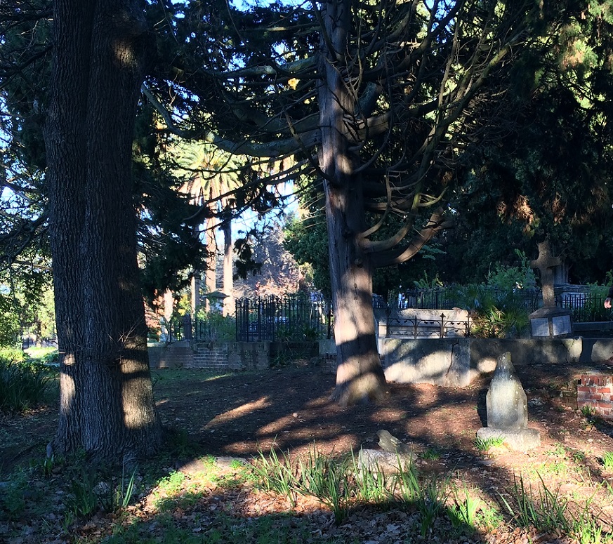
| Memorials | : | 12 |
| Location | : | Rondebosch, City of Cape Town Metropolitan Municipality, South Africa |
| Coordinate | : | -33.9626390, 18.4691550 |
| Description | : | The church and adjacent cemetery are located between Church Street and Main Road in Rondebosch. The church was established in 1834. According to the church website, the cemetery was only in use from about 1840 until the late 1880s. |
frequently asked questions (FAQ):
-
Where is St. Paul's Churchyard?
St. Paul's Churchyard is located at Rondebosch, City of Cape Town Metropolitan Municipality ,Western Cape ,South Africa.
-
St. Paul's Churchyard cemetery's updated grave count on graveviews.com?
12 memorials
-
Where are the coordinates of the St. Paul's Churchyard?
Latitude: -33.9626390
Longitude: 18.4691550
Nearby Cemetories:
1. St. Thomas' Memorial Garden
Rondebosch, City of Cape Town Metropolitan Municipality, South Africa
Coordinate: -33.9627080, 18.4769790
2. Van Lier Gravesite
Newlands, City of Cape Town Metropolitan Municipality, South Africa
Coordinate: -33.9771390, 18.4523060
3. St. Peter's Garden of Remembrance
Mowbray, City of Cape Town Metropolitan Municipality, South Africa
Coordinate: -33.9424300, 18.4674700
4. East Claremont Congregational Church Wall of Remembrance
Claremont, City of Cape Town Metropolitan Municipality, South Africa
Coordinate: -33.9815330, 18.4792830
5. Von Buchenröder Cemetery
Claremont, City of Cape Town Metropolitan Municipality, South Africa
Coordinate: -33.9819016, 18.4600876
6. St. Saviour's Anglican Church Cemetery
Claremont, City of Cape Town Metropolitan Municipality, South Africa
Coordinate: -33.9835070, 18.4642180
7. Dutch Reformed Church Cemetery
Observatory, City of Cape Town Metropolitan Municipality, South Africa
Coordinate: -33.9407990, 18.4663200
8. Mowbray Muslim Cemetery
Mowbray, City of Cape Town Metropolitan Municipality, South Africa
Coordinate: -33.9380880, 18.4618600
9. Church of the Good Shepherd
Bishopscourt, City of Cape Town Metropolitan Municipality, South Africa
Coordinate: -33.9870080, 18.4366400
10. Albert Road Jewish Cemetery
Woodstock, City of Cape Town Metropolitan Municipality, South Africa
Coordinate: -33.9264645, 18.4490383
11. Kenilworth Old Cemetery
Kenilworth, City of Cape Town Metropolitan Municipality, South Africa
Coordinate: -34.0017910, 18.4813760
12. Dutch Reformed Church Cemetery
Wynberg, City of Cape Town Metropolitan Municipality, South Africa
Coordinate: -34.0038970, 18.4676620
13. Church Street Methodist Church Cemetery
Wynberg, City of Cape Town Metropolitan Municipality, South Africa
Coordinate: -34.0039580, 18.4672820
14. St. John's Churchyard
Wynberg, City of Cape Town Metropolitan Municipality, South Africa
Coordinate: -34.0039720, 18.4667500
15. Kirstenbosch National Botanical Garden Gravesite
Glen Dirk, City of Cape Town Metropolitan Municipality, South Africa
Coordinate: -33.9895800, 18.4297900
16. Henry Harold Welch Pearson's Burial Site
Wynberg, City of Cape Town Metropolitan Municipality, South Africa
Coordinate: -33.9916670, 18.4305000
17. St. Mark's Churchyard
Cape Town, City of Cape Town Metropolitan Municipality, South Africa
Coordinate: -33.9309500, 18.4312670
18. Vygekraal Cemetery
Rylands Estate, City of Cape Town Metropolitan Municipality, South Africa
Coordinate: -33.9684560, 18.5259100
19. Langa Cemetery
Langa, City of Cape Town Metropolitan Municipality, South Africa
Coordinate: -33.9405360, 18.5222970
20. Corpus Christi Church Columbarium
Wynberg, City of Cape Town Metropolitan Municipality, South Africa
Coordinate: -34.0147710, 18.4715930
21. St. Mary's Cathedral Churchyard
Cape Town, City of Cape Town Metropolitan Municipality, South Africa
Coordinate: -33.9282430, 18.4195280
22. 7th Avenue Jewish Cemetery
Maitland, City of Cape Town Metropolitan Municipality, South Africa
Coordinate: -33.9190870, 18.5073370
23. Stephanus Johannes Hofmeijr Grave Site
Gardens, City of Cape Town Metropolitan Municipality, South Africa
Coordinate: -33.9370970, 18.4104240
24. Slave Lodge Cemetery
Cape Town, City of Cape Town Metropolitan Municipality, South Africa
Coordinate: -33.9251670, 18.4204500

