| Memorials | : | 12 |
| Location | : | Acton, Los Angeles County, USA |
| Phone | : | 661-269-1648 |
| Website | : | www.cityofacton.org/cemetery.html |
| Coordinate | : | 34.4791985, -118.2007980 |
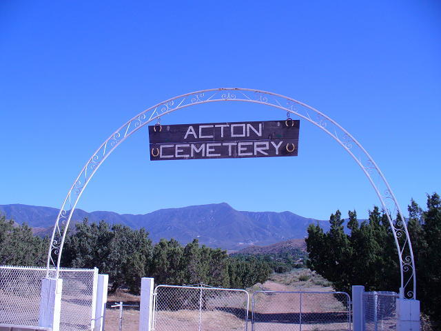
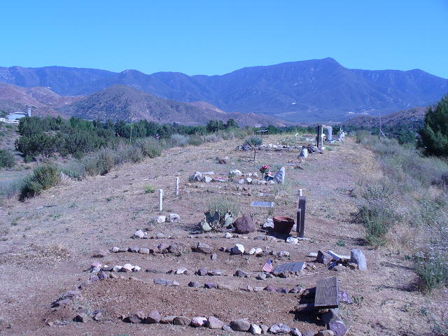
| Description | : | Pioneer cemetery that was opened in the 1870s or 1880s. The Acton Community Presbyterian Church in Acton has the interment records and will share whatever information they have. The cemetery is for Acton residents only. In order to qualify for burial, the family must prove that the deceased lived in Acton. |
frequently asked questions (FAQ):
-
Where is Acton Community Cemetery?
Acton Community Cemetery is located at 13900 Block of Aliso Street Acton, Los Angeles County ,California , 93510USA.
-
Acton Community Cemetery cemetery's updated grave count on graveviews.com?
9 memorials
-
Where are the coordinates of the Acton Community Cemetery?
Latitude: 34.4791985
Longitude: -118.2007980
Nearby Cemetories:
1. Mount Gleason Ranch Cemetery
Acton, Los Angeles County, USA
Coordinate: 34.4410480, -118.1980720
2. Vasquez Rocks Natural Area County Park Burial Site
Agua Dulce, Los Angeles County, USA
Coordinate: 34.4886600, -118.3214500
3. Desert Lawn Memorial Park
Palmdale, Los Angeles County, USA
Coordinate: 34.5525890, -118.0900880
4. Palmdale Cemetery
Palmdale, Los Angeles County, USA
Coordinate: 34.5592003, -118.0916977
5. Loomis Family Cemetery
Mount Wilson, Los Angeles County, USA
Coordinate: 34.3470200, -118.0488700
6. Good Shepherd Catholic Cemetery
Lancaster, Los Angeles County, USA
Coordinate: 34.6656400, -118.2541300
7. Colby Ranch Cemetery
Palmdale, Los Angeles County, USA
Coordinate: 34.2986200, -118.1115100
8. Mitchell-Dyer Family Cemetery
Santa Clarita, Los Angeles County, USA
Coordinate: 34.4210200, -118.4309600
9. Sand Canyon Ranch Burial Site
Santa Clarita, Los Angeles County, USA
Coordinate: 34.3766880, -118.4105940
10. Glen Haven Memorial Park
Sylmar, Los Angeles County, USA
Coordinate: 34.3085130, -118.3768380
11. Sholom Memorial Park
Sylmar, Los Angeles County, USA
Coordinate: 34.3051630, -118.3763500
12. Lancaster Cemetery
Lancaster, Los Angeles County, USA
Coordinate: 34.6977806, -118.1286087
13. Verdugo Hills Cemetery
Tujunga, Los Angeles County, USA
Coordinate: 34.2619019, -118.2822037
14. Joshua Memorial Park
Lancaster, Los Angeles County, USA
Coordinate: 34.6958008, -118.1141968
15. Pioneer Memorial Cemetery
Sylmar, Los Angeles County, USA
Coordinate: 34.3209305, -118.4481125
16. Brown Mountain Grave Site
Altadena, Los Angeles County, USA
Coordinate: 34.2161400, -118.1612160
17. Melody Ranch Burial Ground
Newhall, Los Angeles County, USA
Coordinate: 34.3833080, -118.5102620
18. Saint Andrews Abbey Cemetery
Valyermo, Los Angeles County, USA
Coordinate: 34.4521217, -117.8681335
19. Saint Georges Church Peace Garden
La Cañada Flintridge, Los Angeles County, USA
Coordinate: 34.2021700, -118.1960800
20. Eternal Valley Memorial Park
Newhall, Los Angeles County, USA
Coordinate: 34.3625336, -118.5077057
21. Ruiz-Perea Family Cemetery
Santa Clarita, Los Angeles County, USA
Coordinate: 34.4889170, -118.5458940
22. William S Hart Estate Burial Site
Newhall, Los Angeles County, USA
Coordinate: 34.3746600, -118.5249600
23. Eden Memorial Park
Mission Hills, Los Angeles County, USA
Coordinate: 34.2825012, -118.4657974
24. Mountain View Cemetery and Mausoleum
Altadena, Los Angeles County, USA
Coordinate: 34.1861000, -118.1481018


