
| Memorials | : | 0 |
| Location | : | Kinderhook, Columbia County, USA |
| Coordinate | : | 42.3954800, -73.7041900 |
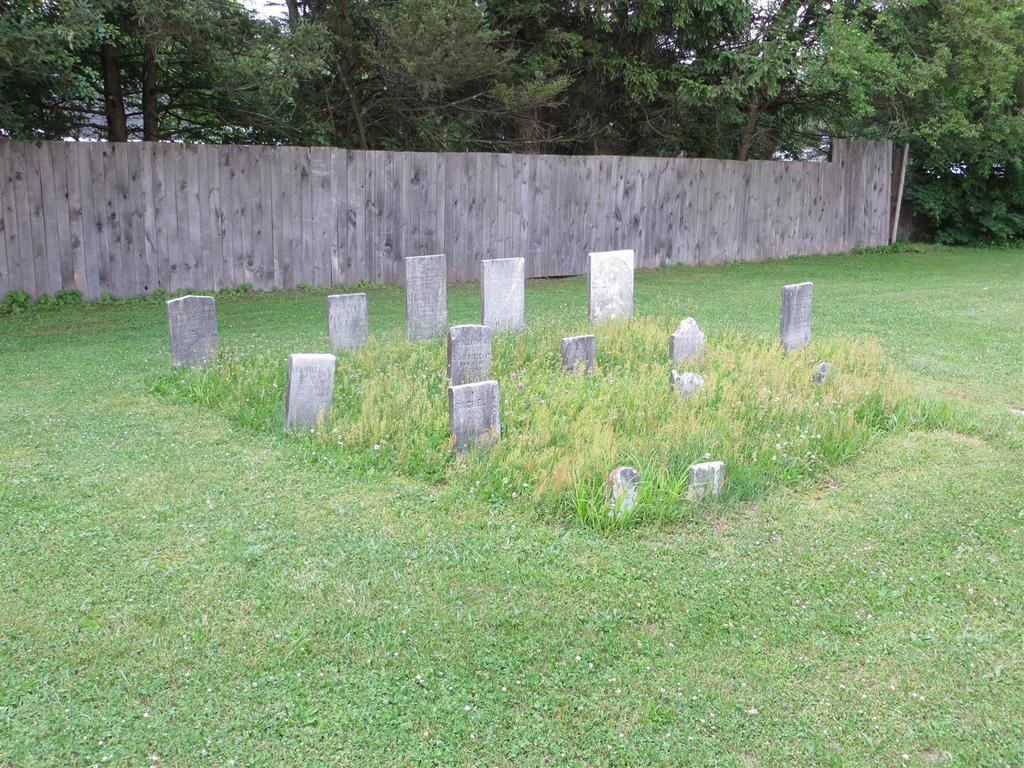
| Description | : | from the Columbia Paper The mystery of Mr. Rogers’ cemetery January 6, 2013 by EMILIA TEASDALE The small plot of land, with 15 gravestones dating as far back as 1840s, is a cemetery for “the people of color of Kinderhook.” The land was set aside for this use by John Rogers, an Irish immigrant to the village, who lived in a house across the street from the Dutch Reformed Church on Albany Avenue (Route 9) and owned the land that would be become Rothermel Park. Mr. Rogers asked the land be used for the cemetery in his will in 1813. Somewhere in Rothermel... Read More |
frequently asked questions (FAQ):
-
Where is African-Americans Cemetery?
African-Americans Cemetery is located at Rothermel Lane Kinderhook, Columbia County ,New York ,USA.
-
African-Americans Cemetery cemetery's updated grave count on graveviews.com?
0 memorials
-
Where are the coordinates of the African-Americans Cemetery?
Latitude: 42.3954800
Longitude: -73.7041900
Nearby Cemetories:
1. Saint Pauls Episcopal Church Cemetery
Kinderhook, Columbia County, USA
Coordinate: 42.3934500, -73.6983500
2. Kinderhook Reformed Church Cemetery
Kinderhook, Columbia County, USA
Coordinate: 42.4035606, -73.7033005
3. Saint John the Baptist Cemetery
Valatie, Columbia County, USA
Coordinate: 42.4128609, -73.6878662
4. Peter Van Ness Monument
Kinderhook, Columbia County, USA
Coordinate: 42.3706000, -73.7062000
5. Prospect Hill Cemetery
Valatie, Columbia County, USA
Coordinate: 42.4156609, -73.6835327
6. Woodlawn Cemetery
Valatie, Columbia County, USA
Coordinate: 42.4239006, -73.6680069
7. Van Alen-Clow Plot
Stuyvesant, Columbia County, USA
Coordinate: 42.4099000, -73.7654000
8. Holmes-Crocker-Gardinier Burial Plot
Valatie, Columbia County, USA
Coordinate: 42.3830833, -73.6391296
9. Stuyvesant Falls Cemetery
Stuyvesant Falls, Columbia County, USA
Coordinate: 42.3539009, -73.7416992
10. Lutheran Cemetery
Stuyvesant, Columbia County, USA
Coordinate: 42.3903809, -73.7727280
11. Pruyn Farm Cemetery
Kinderhook, Columbia County, USA
Coordinate: 42.4484500, -73.7117900
12. Saint Marys Cemetery
Stuyvesant Falls, Columbia County, USA
Coordinate: 42.3504858, -73.7432084
13. Saint Paul Cemetery
Stuyvesant Falls, Columbia County, USA
Coordinate: 42.3502998, -73.7435989
14. Firwood Cemetery
Stuyvesant, Columbia County, USA
Coordinate: 42.3894005, -73.7799988
15. Saint Joseph's Center Cemetery
Valatie, Columbia County, USA
Coordinate: 42.4520880, -73.7014560
16. Holy Cross Community Cemetery
Valatie, Columbia County, USA
Coordinate: 42.4537380, -73.7049740
17. Butler Cemetery
Stuyvesant, Columbia County, USA
Coordinate: 42.3867300, -73.7829500
18. Shufelt Cemetery
Ghent, Columbia County, USA
Coordinate: 42.3535995, -73.6445084
19. Foland-Kittle Cemetery
West Ghent, Columbia County, USA
Coordinate: 42.3352720, -73.6857950
20. White Mills Cemetery
Chatham, Columbia County, USA
Coordinate: 42.3674088, -73.6190643
21. Chatham Center Rural Cemetery
Chatham Center, Columbia County, USA
Coordinate: 42.4229393, -73.6176300
22. Son Railroad Plot
Chatham, Columbia County, USA
Coordinate: 42.3813780, -73.6096200
23. Shufelt Plot
Ghent, Columbia County, USA
Coordinate: 42.3336700, -73.6491500
24. Moses Son Burial Plot
Chatham, Columbia County, USA
Coordinate: 42.3910600, -73.6041000