
| Memorials | : | 0 |
| Location | : | Weed, Otero County, USA |
| Coordinate | : | 32.8119011, -105.4606018 |
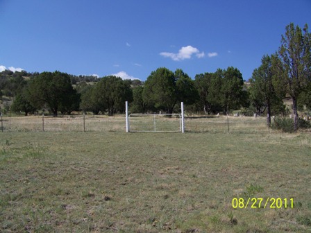
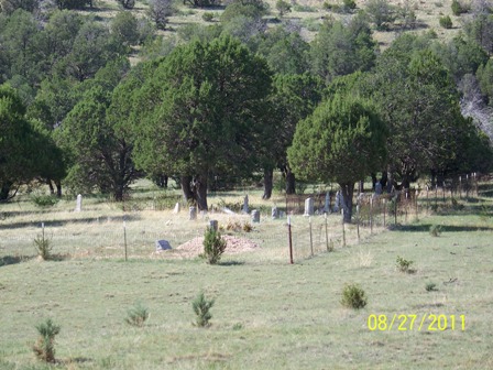
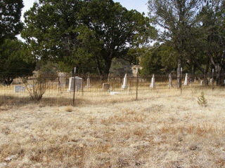
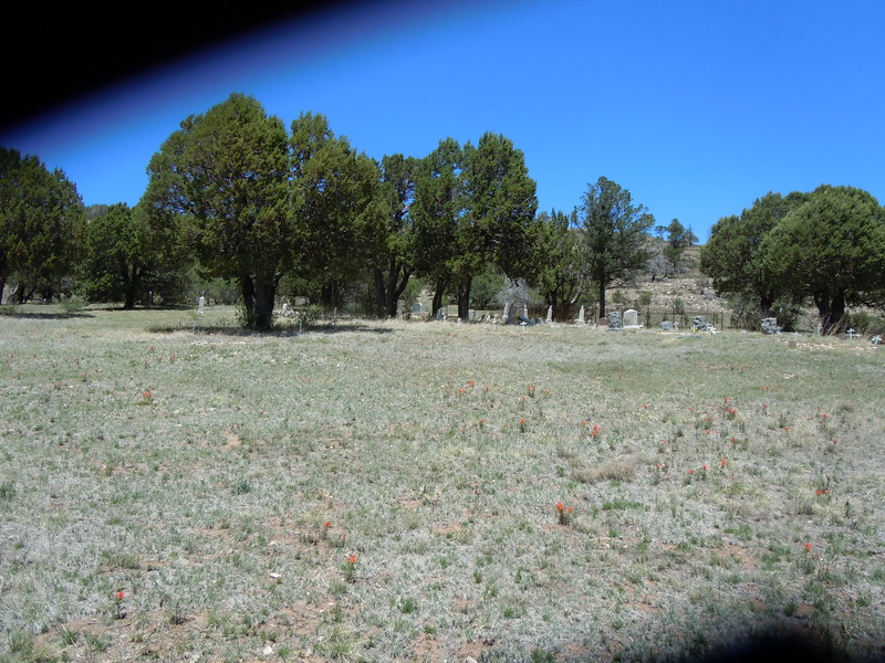
| Description | : | The cemetery is located off Miller Flats Road, on the west side. Go a little over 2 miles past NM 521 (Weed turn-off) southeast on NM 24 and turn left onto Miller Flats Road (Rd 212). It is almost 2 miles to where you turn left (west) towards the cemetery. It's about a quarter mile up the dirt path to the cemetery. There are many unmarked or unknown graves in this cemetery. They are marked with a numbering system on a cinder block and a white cross. |
frequently asked questions (FAQ):
-
Where is Agua Chiquita Cemetery?
Agua Chiquita Cemetery is located at Miller Flats Road Weed, Otero County ,New Mexico , 88354USA.
-
Agua Chiquita Cemetery cemetery's updated grave count on graveviews.com?
0 memorials
-
Where are the coordinates of the Agua Chiquita Cemetery?
Latitude: 32.8119011
Longitude: -105.4606018
Nearby Cemetories:
1. Weed Cemetery
Weed, Otero County, USA
Coordinate: 32.8025017, -105.5168991
2. Mayhill Cemetery
Mayhill, Otero County, USA
Coordinate: 32.8821983, -105.4863968
3. Mountain Acres Cemetery
Mayhill, Otero County, USA
Coordinate: 32.8908005, -105.4906006
4. Greenville Cemetery
Otero County, USA
Coordinate: 32.7957340, -105.5859740
5. Avis Cemetery
Otero County, USA
Coordinate: 32.6953011, -105.4625015
6. Cox Cemetery
Chaves County, USA
Coordinate: 32.7874985, -105.3071976
7. Jeffers Cemetery
Otero County, USA
Coordinate: 32.7158012, -105.5789032
8. Parker Posey Cemetery
Cloudcroft, Otero County, USA
Coordinate: 32.9347380, -105.6054980
9. James Canyon Cemetery
Mayhill, Otero County, USA
Coordinate: 32.9433000, -105.6194000
10. David Gentry Cemetery
Pinon, Otero County, USA
Coordinate: 32.6211170, -105.4030470
11. Pinon Cemetery
Pinon, Otero County, USA
Coordinate: 32.6250000, -105.3861008
12. Elk Cemetery
Elk, Chaves County, USA
Coordinate: 32.9356003, -105.2746964
13. Sixteen Springs Cemetery
Otero County, USA
Coordinate: 32.9897003, -105.5768967
14. Bass Cemetery
Otero County, USA
Coordinate: 32.9060730, -105.6831340
15. Baird Cemetery
Otero County, USA
Coordinate: 32.9542260, -105.6471740
16. Dunken Cemetery
Dunken, Chaves County, USA
Coordinate: 32.8094640, -105.2035600
17. Marcia Cemetery
Marcia, Otero County, USA
Coordinate: 32.8280556, -105.7552778
18. Timberon Memorial Park
Timberon, Otero County, USA
Coordinate: 32.6294900, -105.6810580
19. Seven Graves Cemetery
Cloudcroft, Otero County, USA
Coordinate: 32.9623740, -105.7431120
20. Mountain Park Cemetery
Mountain Park, Otero County, USA
Coordinate: 32.9428680, -105.8144890
21. New Mexico Museum of Space History
Alamogordo, Otero County, USA
Coordinate: 32.9210610, -105.9206700
22. Saint Jude Columbarium
Otero County, USA
Coordinate: 32.9055550, -105.9360150
23. Monte Vista Cemetery
Alamogordo, Otero County, USA
Coordinate: 32.8901787, -105.9434662
24. Immaculate Conception Catholic Cemetery
Alamogordo, Otero County, USA
Coordinate: 32.8900909, -105.9457474