
| Memorials | : | 0 |
| Location | : | Marcia, Otero County, USA |
| Coordinate | : | 32.8280556, -105.7552778 |
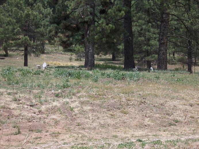
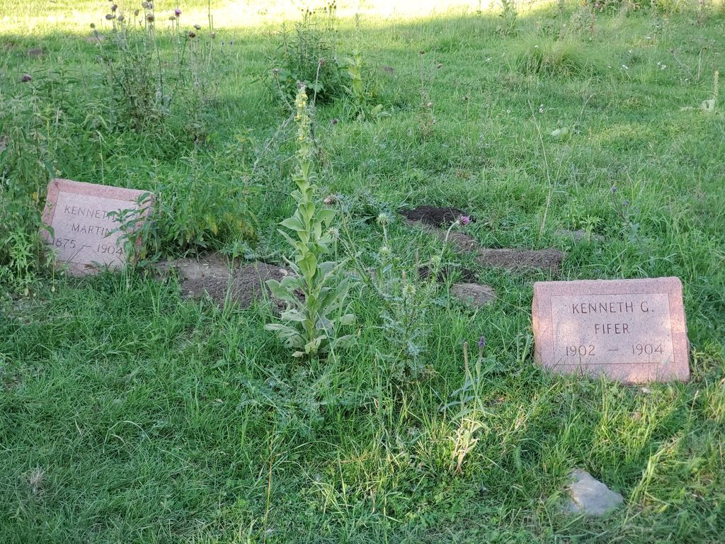
| Description | : | This old cemetery is now located on private property. It has suffered severely from the ravages of time, fire and livestock. Only a few graves are still marked by broken and tumbled stones. All of the wooden markers were lost during a forest fire a number of years ago. Sadly, it is another piece of our past that is being lost. Let those who sleep here never be forgotten. |
frequently asked questions (FAQ):
-
Where is Marcia Cemetery?
Marcia Cemetery is located at Marcia, Otero County ,New Mexico ,USA.
-
Marcia Cemetery cemetery's updated grave count on graveviews.com?
0 memorials
-
Where are the coordinates of the Marcia Cemetery?
Latitude: 32.8280556
Longitude: -105.7552778
Nearby Cemetories:
1. Bass Cemetery
Otero County, USA
Coordinate: 32.9060730, -105.6831340
2. Mountain Park Cemetery
Mountain Park, Otero County, USA
Coordinate: 32.9428680, -105.8144890
3. Seven Graves Cemetery
Cloudcroft, Otero County, USA
Coordinate: 32.9623740, -105.7431120
4. Greenville Cemetery
Otero County, USA
Coordinate: 32.7957340, -105.5859740
5. Baird Cemetery
Otero County, USA
Coordinate: 32.9542260, -105.6471740
6. James Canyon Cemetery
Mayhill, Otero County, USA
Coordinate: 32.9433000, -105.6194000
7. Parker Posey Cemetery
Cloudcroft, Otero County, USA
Coordinate: 32.9347380, -105.6054980
8. New Mexico Museum of Space History
Alamogordo, Otero County, USA
Coordinate: 32.9210610, -105.9206700
9. Monte Vista Cemetery
Alamogordo, Otero County, USA
Coordinate: 32.8901787, -105.9434662
10. Saint Jude Columbarium
Otero County, USA
Coordinate: 32.9055550, -105.9360150
11. Immaculate Conception Catholic Cemetery
Alamogordo, Otero County, USA
Coordinate: 32.8900909, -105.9457474
12. Saint Johns Columbarium
Alamogordo, Otero County, USA
Coordinate: 32.9015940, -105.9561990
13. Jeffers Cemetery
Otero County, USA
Coordinate: 32.7158012, -105.5789032
14. Little Chapel in the Desert Columbarium
Alamogordo, Otero County, USA
Coordinate: 32.9372670, -105.9419760
15. White Dove of the Desert Cemetery
Alamogordo, Otero County, USA
Coordinate: 32.9372770, -105.9419780
16. Boles Acres Cemetery
Boles Acres, Otero County, USA
Coordinate: 32.8061390, -105.9850210
17. Weed Cemetery
Weed, Otero County, USA
Coordinate: 32.8025017, -105.5168991
18. Timberon Memorial Park
Timberon, Otero County, USA
Coordinate: 32.6294900, -105.6810580
19. Sixteen Springs Cemetery
Otero County, USA
Coordinate: 32.9897003, -105.5768967
20. La Luz Community Cemetery
La Luz, Otero County, USA
Coordinate: 32.9789660, -105.9493910
21. Our Lady of the Light Catholic Cemetery
La Luz, Otero County, USA
Coordinate: 32.9790340, -105.9500560
22. Mountain Acres Cemetery
Mayhill, Otero County, USA
Coordinate: 32.8908005, -105.4906006
23. Mayhill Cemetery
Mayhill, Otero County, USA
Coordinate: 32.8821983, -105.4863968
24. Agua Chiquita Cemetery
Weed, Otero County, USA
Coordinate: 32.8119011, -105.4606018