
| Memorials | : | 1 |
| Location | : | Otero County, USA |
| Coordinate | : | 32.7957340, -105.5859740 |
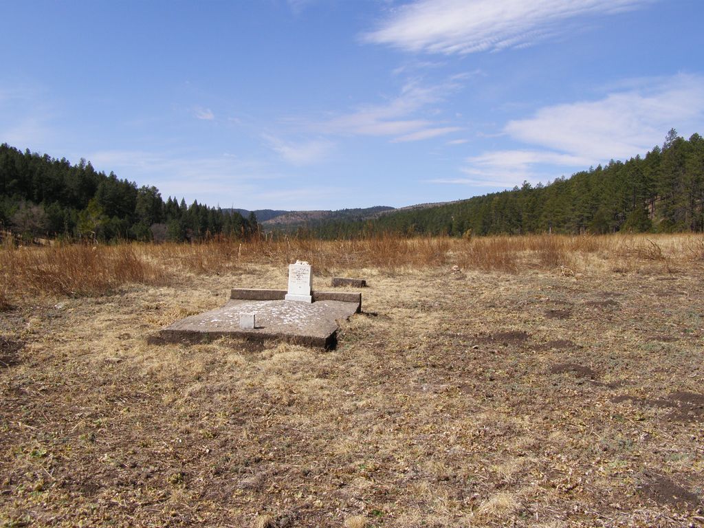
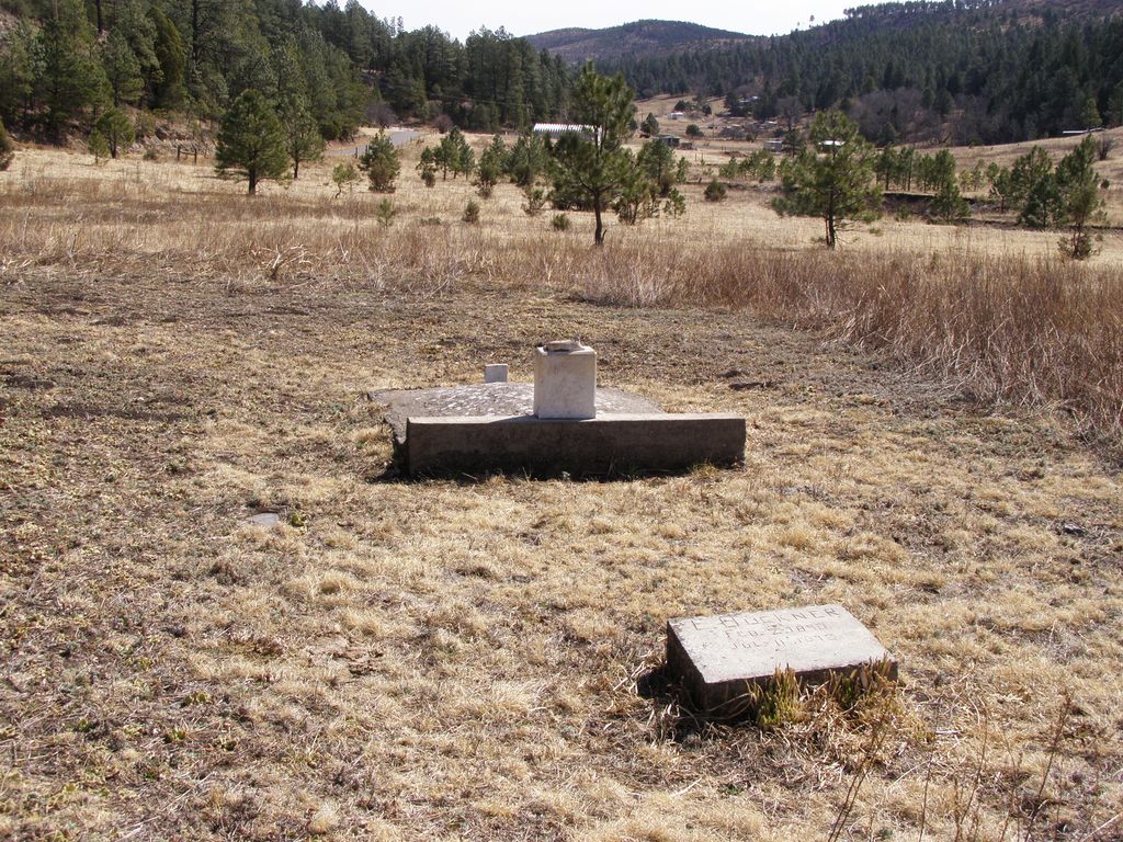
| Description | : | Approximately two miles west of the village of Sacramento, New Mexico and roughly 50 feet south of County Road 521, there are three markers which identify the area as a cemetery. A stone marker at the head of a concrete slab reads, "Anna Gilmore Green, wife of John L. Green. Born March 30, 1848, Died August 16, 1892." Nearby is a flat concrete stone inscribed, "E. Buckner Feb 2, 1890 - July 11, 1892. The third marker, a flat bronze plaque reads. Greenville Cemetery 1890-1910. It then includes the names and dates listed above on the... Read More |
frequently asked questions (FAQ):
-
Where is Greenville Cemetery?
Greenville Cemetery is located at Otero County ,New Mexico ,USA.
-
Greenville Cemetery cemetery's updated grave count on graveviews.com?
1 memorials
-
Where are the coordinates of the Greenville Cemetery?
Latitude: 32.7957340
Longitude: -105.5859740
Nearby Cemetories:
1. Weed Cemetery
Weed, Otero County, USA
Coordinate: 32.8025017, -105.5168991
2. Jeffers Cemetery
Otero County, USA
Coordinate: 32.7158012, -105.5789032
3. Agua Chiquita Cemetery
Weed, Otero County, USA
Coordinate: 32.8119011, -105.4606018
4. Mayhill Cemetery
Mayhill, Otero County, USA
Coordinate: 32.8821983, -105.4863968
5. Mountain Acres Cemetery
Mayhill, Otero County, USA
Coordinate: 32.8908005, -105.4906006
6. Bass Cemetery
Otero County, USA
Coordinate: 32.9060730, -105.6831340
7. Parker Posey Cemetery
Cloudcroft, Otero County, USA
Coordinate: 32.9347380, -105.6054980
8. Avis Cemetery
Otero County, USA
Coordinate: 32.6953011, -105.4625015
9. Marcia Cemetery
Marcia, Otero County, USA
Coordinate: 32.8280556, -105.7552778
10. James Canyon Cemetery
Mayhill, Otero County, USA
Coordinate: 32.9433000, -105.6194000
11. Baird Cemetery
Otero County, USA
Coordinate: 32.9542260, -105.6471740
12. Timberon Memorial Park
Timberon, Otero County, USA
Coordinate: 32.6294900, -105.6810580
13. Sixteen Springs Cemetery
Otero County, USA
Coordinate: 32.9897003, -105.5768967
14. Seven Graves Cemetery
Cloudcroft, Otero County, USA
Coordinate: 32.9623740, -105.7431120
15. David Gentry Cemetery
Pinon, Otero County, USA
Coordinate: 32.6211170, -105.4030470
16. Cox Cemetery
Chaves County, USA
Coordinate: 32.7874985, -105.3071976
17. Pinon Cemetery
Pinon, Otero County, USA
Coordinate: 32.6250000, -105.3861008
18. Mountain Park Cemetery
Mountain Park, Otero County, USA
Coordinate: 32.9428680, -105.8144890
19. Elk Cemetery
Elk, Chaves County, USA
Coordinate: 32.9356003, -105.2746964
20. New Mexico Museum of Space History
Alamogordo, Otero County, USA
Coordinate: 32.9210610, -105.9206700
21. Saint Jude Columbarium
Otero County, USA
Coordinate: 32.9055550, -105.9360150
22. Monte Vista Cemetery
Alamogordo, Otero County, USA
Coordinate: 32.8901787, -105.9434662
23. Immaculate Conception Catholic Cemetery
Alamogordo, Otero County, USA
Coordinate: 32.8900909, -105.9457474
24. Dunken Cemetery
Dunken, Chaves County, USA
Coordinate: 32.8094640, -105.2035600