
| Memorials | : | 542 |
| Location | : | Upper Hutt City, New Zealand |
| Phone | : | (04) 526 7030 |
| Website | : | www.upperhuttcity.com/Services/Akatarawa-Cemetery/Cemetery-Database |
| Coordinate | : | -41.0876320, 175.1025870 |
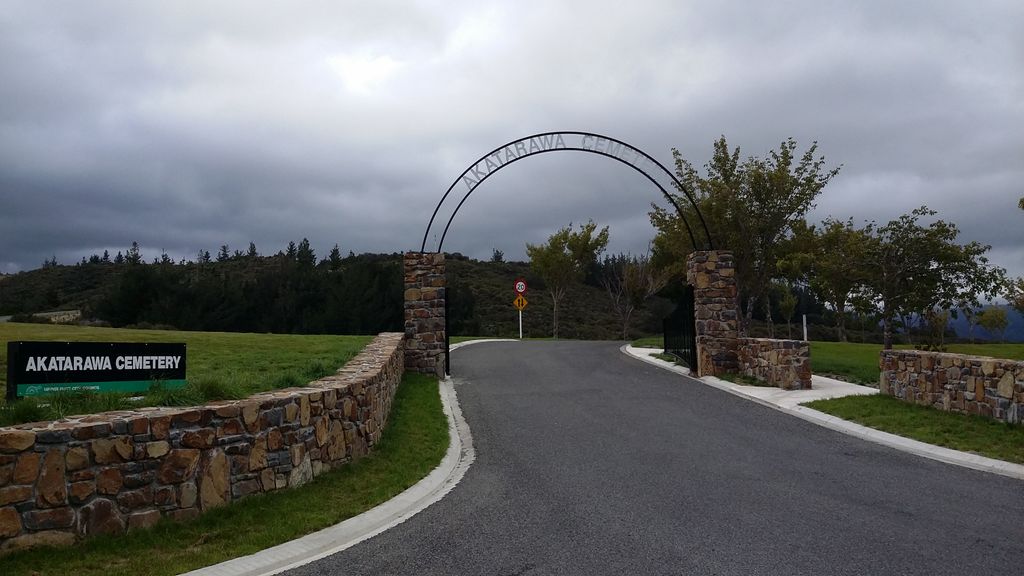
| Description | : | Akatarawa Valley is in the Tararua Ranges It provides a link from the upper reaches of the Hutt Valley to Waikanae on the Kapiti Coast through rugged hill country. The valley is lowly populated and contains the localities of Reikorangi and Cloustonville. The Sexton is able to provide advice on where people are buried, interments, reserve plots as well as responding to genealogy enquiries The Cemetery can be contacted on: - (04) 526 7030 during office hours and - (04) 971 9453 after hours. Gates open daily at 8am and close at 5pm (8pm during daylight saving) |
frequently asked questions (FAQ):
-
Where is Akatarawa Cemetery?
Akatarawa Cemetery is located at Akatarawa Rd, Upper Hutt 39km north of Upper Hutt City ,Wellington , 5140New Zealand.
-
Akatarawa Cemetery cemetery's updated grave count on graveviews.com?
542 memorials
-
Where are the coordinates of the Akatarawa Cemetery?
Latitude: -41.0876320
Longitude: 175.1025870


Nearby Cemetories:
1. St. Joseph's Church Cemetery
Upper Hutt, Upper Hutt City, New Zealand
Coordinate: -41.1243380, 175.0686570
2. Wallaceville Cemetery
Wallaceville, Upper Hutt City, New Zealand
Coordinate: -41.1359900, 175.0743300
3. St. John's Anglican Churchyard Cemetery
Trentham, Upper Hutt City, New Zealand
Coordinate: -41.1303100, 175.0443500
4. Battle Hill Burial Ground
Wellington, Wellington City, New Zealand
Coordinate: -41.0578590, 174.9352810
5. St Josephs Catholic Cemetery
Pauatahanui, Porirua City, New Zealand
Coordinate: -41.1135060, 174.9196220
6. Saint Albans Burial Ground
Pauatahanui, Porirua City, New Zealand
Coordinate: -41.1067240, 174.9179340
7. Pauatahanui Burial Ground
Pauatahanui, Porirua City, New Zealand
Coordinate: -41.1068190, 174.9173310
8. Christ Church Anglican Cemetery
Taita, Lower Hutt City, New Zealand
Coordinate: -41.1820960, 174.9600920
9. MacKay Family Cemetery
Kapiti Coast District, New Zealand
Coordinate: -40.9726800, 174.9833330
10. Taita Lawn Cemetery
Naenae, Lower Hutt City, New Zealand
Coordinate: -41.1968900, 174.9634900
11. Bradey Grave
Whitby, Porirua City, New Zealand
Coordinate: -41.1173161, 174.9056161
12. Mira Family Urupā
Paraparaumu, Kapiti Coast District, New Zealand
Coordinate: -40.9753380, 174.9643460
13. Taita Old Cemetery
Naenae, Lower Hutt City, New Zealand
Coordinate: -41.1945700, 174.9564000
14. Knox Presbyterian Church Cemetery
Lower Hutt, Lower Hutt City, New Zealand
Coordinate: -41.1965430, 174.9579920
15. Featherston Cemetery
Featherston, South Wairarapa District, New Zealand
Coordinate: -41.1217800, 175.3144160
16. Featherston Soldiers Cemetery
Featherston, South Wairarapa District, New Zealand
Coordinate: -41.1212630, 175.3147170
17. Pukerua Bay Urupā
Pukerua Bay, Porirua City, New Zealand
Coordinate: -41.0300425, 174.8969530
18. Awa Tapu Cemetery
Paraparaumu, Kapiti Coast District, New Zealand
Coordinate: -40.9328870, 175.0122070
19. Waiorongomai Cemetery
South Wairarapa District, New Zealand
Coordinate: -41.2535785, 175.1567108
20. Whenua Tapu Cemetery
Porirua, Porirua City, New Zealand
Coordinate: -41.0550200, 174.8757150
21. Boulcott Farm Cemetery
Lower Hutt, Lower Hutt City, New Zealand
Coordinate: -41.2030590, 174.9272750
22. Plimmerton Urupā
Plimmerton, Porirua City, New Zealand
Coordinate: -41.0822790, 174.8641890
23. Hongoeka Urupā
Plimmerton, Porirua City, New Zealand
Coordinate: -41.0651560, 174.8525070
24. St. James Churchyard
Lower Hutt, Lower Hutt City, New Zealand
Coordinate: -41.2128840, 174.9003910