
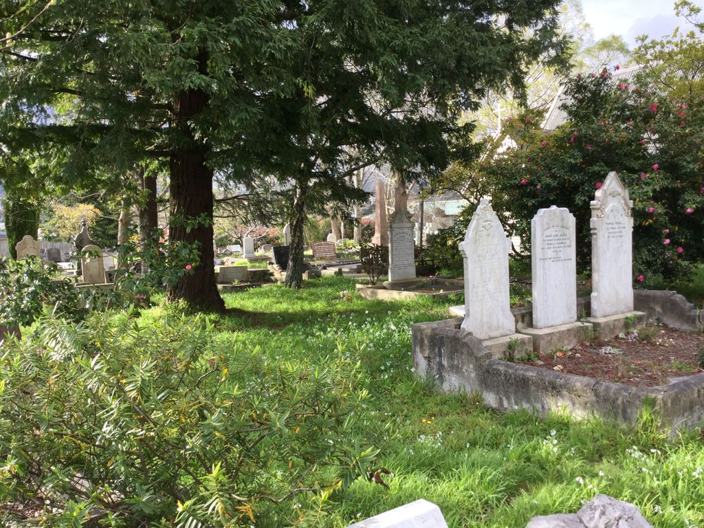
| Memorials | : | 137 |
| Location | : | Trentham, Upper Hutt City, New Zealand |
| Coordinate | : | -41.1303100, 175.0443500 |
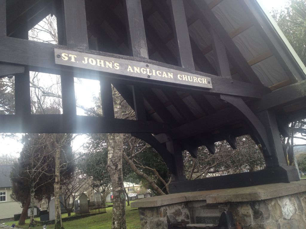
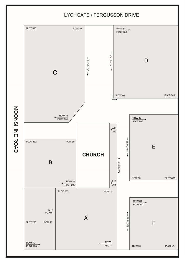
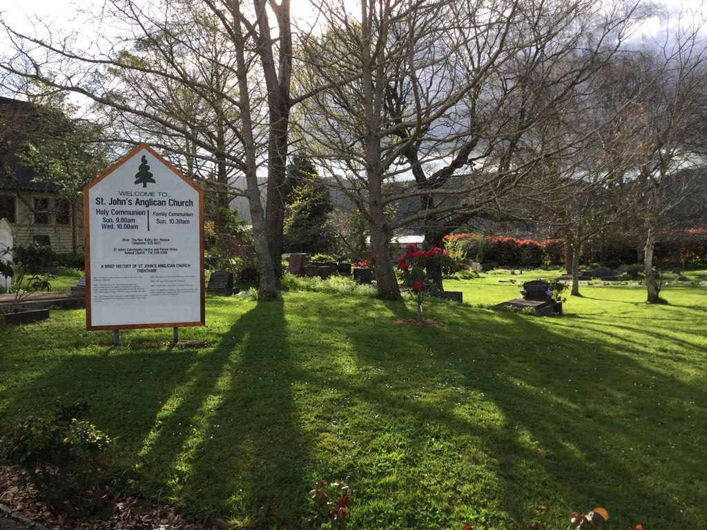
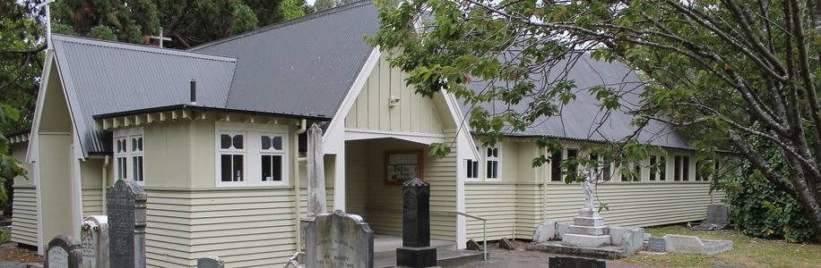
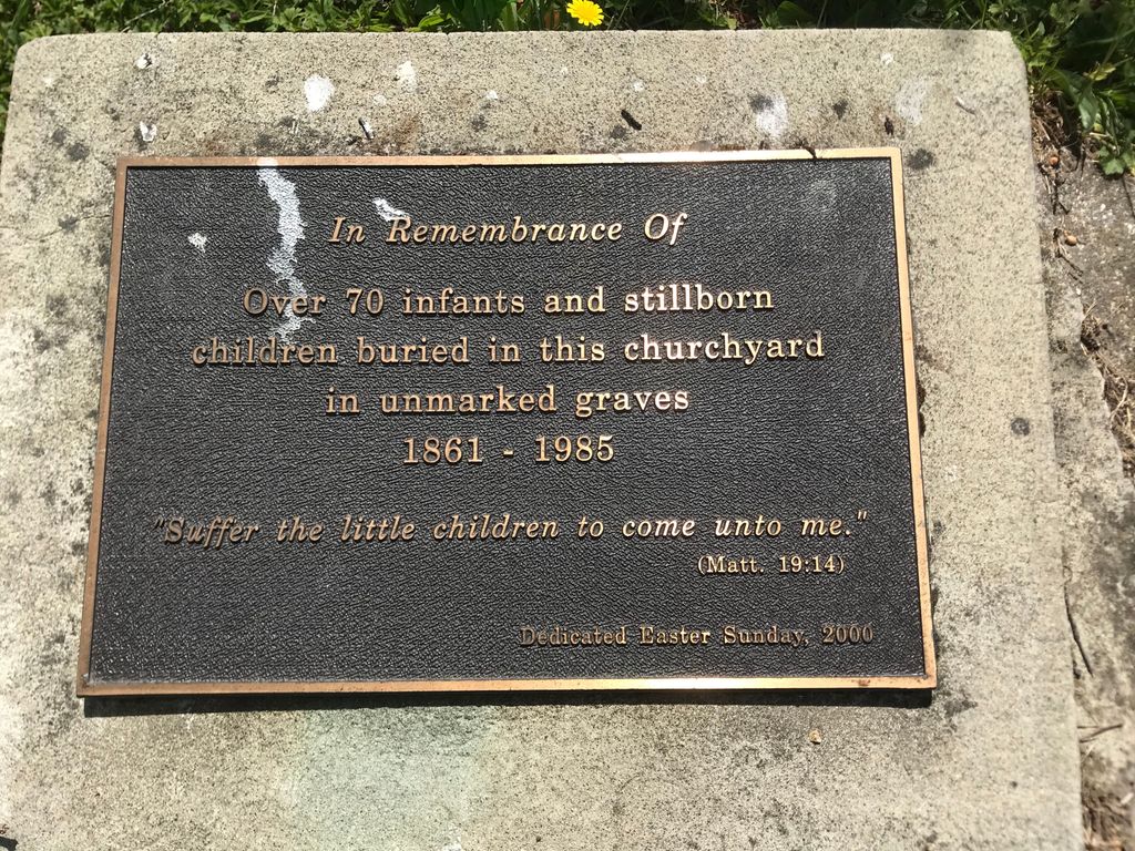
| Description | : | Location Information The cemetery is located at the junction of Moonshine Road and Fergusson Drive, Trentham. Historical Information Trentham Camp was the first of the New Zealand Reinforcement Camps; it ultimately contained accommodation for 4,500 men in huts, and 2,000 under canvas. In January, 1916, it became the training ground for Infantry, and Engineers in particular. The Remount Depot was at Upper Hutt, near Trentham. Burials from these camps were carried out mainly at Karori Public Cemetery, Wellington. |
frequently asked questions (FAQ):
-
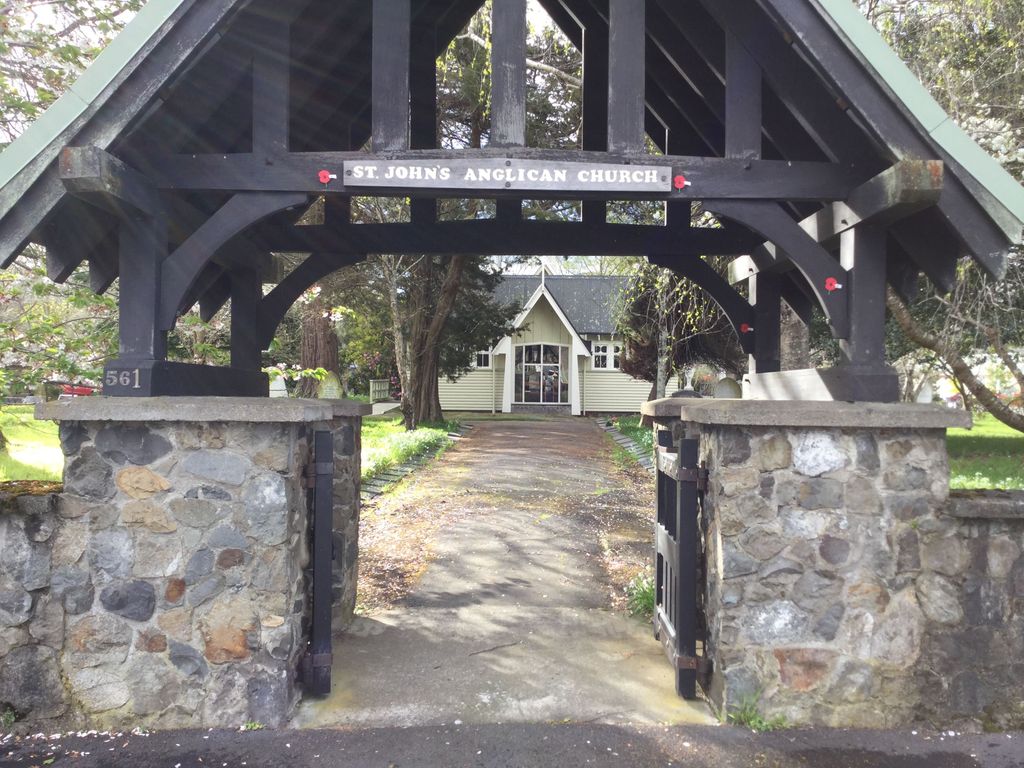
Where is St. John's Anglican Churchyard Cemetery?
St. John's Anglican Churchyard Cemetery is located at Moonshine Road and Fergusson Drive Trentham, Upper Hutt City ,Wellington , 5018New Zealand.
-
St. John's Anglican Churchyard Cemetery cemetery's updated grave count on graveviews.com?
134 memorials
-
Where are the coordinates of the St. John's Anglican Churchyard Cemetery?
Latitude: -41.1303100
Longitude: 175.0443500


Nearby Cemetories:
1. St. Joseph's Church Cemetery
Upper Hutt, Upper Hutt City, New Zealand
Coordinate: -41.1243380, 175.0686570
2. Wallaceville Cemetery
Wallaceville, Upper Hutt City, New Zealand
Coordinate: -41.1359900, 175.0743300
3. Akatarawa Cemetery
Upper Hutt City, New Zealand
Coordinate: -41.0876320, 175.1025870
4. Christ Church Anglican Cemetery
Taita, Lower Hutt City, New Zealand
Coordinate: -41.1820960, 174.9600920
5. Taita Lawn Cemetery
Naenae, Lower Hutt City, New Zealand
Coordinate: -41.1968900, 174.9634900
6. Taita Old Cemetery
Naenae, Lower Hutt City, New Zealand
Coordinate: -41.1945700, 174.9564000
7. Knox Presbyterian Church Cemetery
Lower Hutt, Lower Hutt City, New Zealand
Coordinate: -41.1965430, 174.9579920
8. St Josephs Catholic Cemetery
Pauatahanui, Porirua City, New Zealand
Coordinate: -41.1135060, 174.9196220
9. Saint Albans Burial Ground
Pauatahanui, Porirua City, New Zealand
Coordinate: -41.1067240, 174.9179340
10. Pauatahanui Burial Ground
Pauatahanui, Porirua City, New Zealand
Coordinate: -41.1068190, 174.9173310
11. Bradey Grave
Whitby, Porirua City, New Zealand
Coordinate: -41.1173161, 174.9056161
12. Battle Hill Burial Ground
Wellington, Wellington City, New Zealand
Coordinate: -41.0578590, 174.9352810
13. Boulcott Farm Cemetery
Lower Hutt, Lower Hutt City, New Zealand
Coordinate: -41.2030590, 174.9272750
14. St. James Churchyard
Lower Hutt, Lower Hutt City, New Zealand
Coordinate: -41.2128840, 174.9003910
15. Bridge Street Cemetery
Lower Hutt, Lower Hutt City, New Zealand
Coordinate: -41.2117740, 174.8969660
16. Plimmerton Urupā
Plimmerton, Porirua City, New Zealand
Coordinate: -41.0822790, 174.8641890
17. Woodlands Farm Cemetery
Wainuiomata, Lower Hutt City, New Zealand
Coordinate: -41.2587540, 174.9549250
18. Whenua Tapu Cemetery
Porirua, Porirua City, New Zealand
Coordinate: -41.0550200, 174.8757150
19. Owhiti Urupā
Seaview, Lower Hutt City, New Zealand
Coordinate: -41.2358800, 174.9044500
20. Waiorongomai Cemetery
South Wairarapa District, New Zealand
Coordinate: -41.2535785, 175.1567108
21. Pukerua Bay Urupā
Pukerua Bay, Porirua City, New Zealand
Coordinate: -41.0300425, 174.8969530
22. Porirua Cemetery
Porirua, Porirua City, New Zealand
Coordinate: -41.1453640, 174.8420300
23. Wainuiomata Remembrance Garden
Wainuiomata, Lower Hutt City, New Zealand
Coordinate: -41.2762300, 174.9696800
24. Mataiwhetu St Urupā
Takapuwahia, Porirua City, New Zealand
Coordinate: -41.1208070, 174.8364500