
| Memorials | : | 4 |
| Location | : | Lower Hutt, Lower Hutt City, New Zealand |
| Coordinate | : | -41.1965430, 174.9579920 |
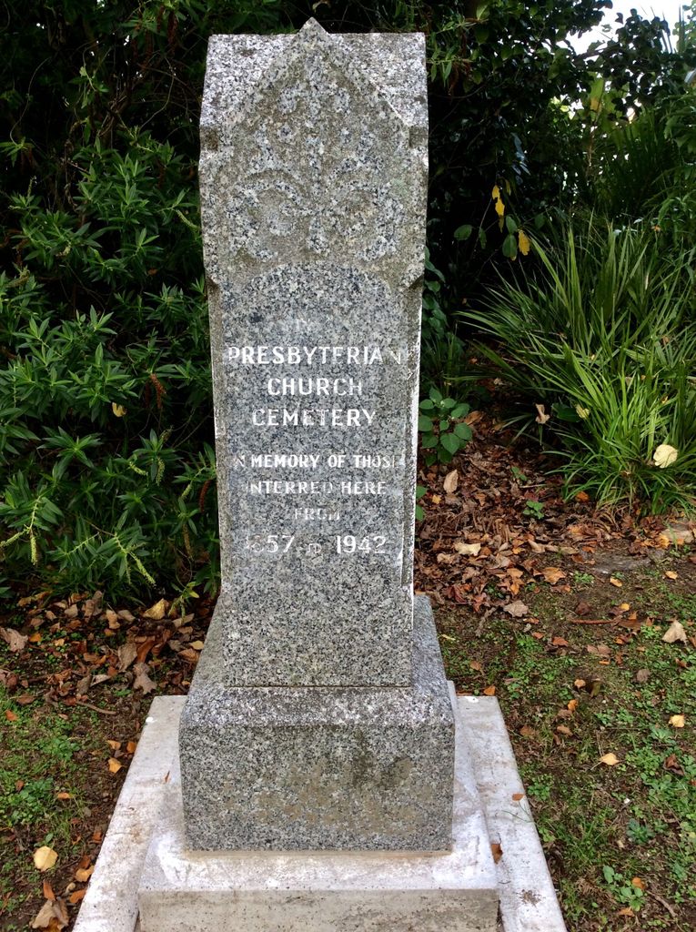
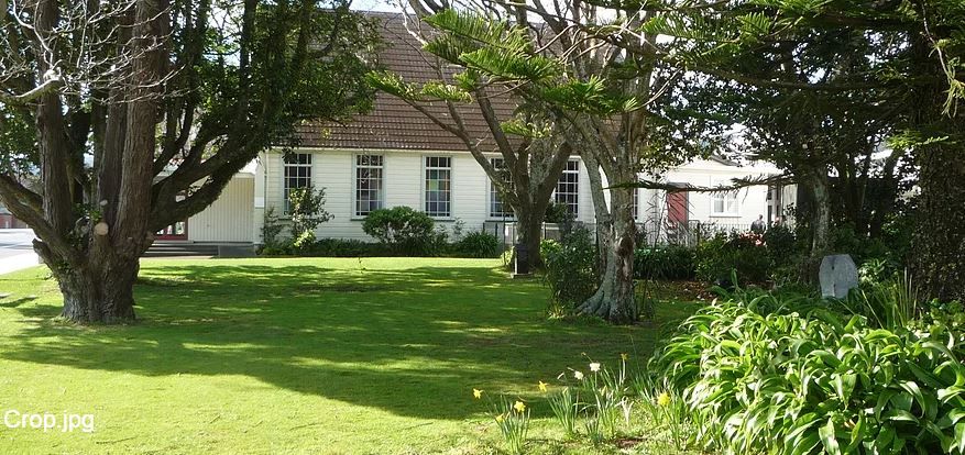
| Description | : | The Knox Presbyterian Church, situated at 574 High Street, Lower Hutt was once known as the Blackbridge Cemetery, when the church began in 1840. The first church was built in 1858 and was opened in April 1890. The first burials took place in the later 1800's . There had been no burials after 1913, nor any likelihood of further burials. However the church property trustees found it difficult to keep the cemetery in tidy condition and so sought an amendment to the Presbyterian Church property act of 1885 to remove all headstones, monuments and grave surrounds from... Read More |
frequently asked questions (FAQ):
-
Where is Knox Presbyterian Church Cemetery?
Knox Presbyterian Church Cemetery is located at Lower Hutt, Lower Hutt City ,Wellington ,New Zealand.
-
Knox Presbyterian Church Cemetery cemetery's updated grave count on graveviews.com?
3 memorials
-
Where are the coordinates of the Knox Presbyterian Church Cemetery?
Latitude: -41.1965430
Longitude: 174.9579920
Nearby Cemetories:
1. Taita Old Cemetery
Naenae, Lower Hutt City, New Zealand
Coordinate: -41.1945700, 174.9564000
2. Taita Lawn Cemetery
Naenae, Lower Hutt City, New Zealand
Coordinate: -41.1968900, 174.9634900
3. Christ Church Anglican Cemetery
Taita, Lower Hutt City, New Zealand
Coordinate: -41.1820960, 174.9600920
4. Boulcott Farm Cemetery
Lower Hutt, Lower Hutt City, New Zealand
Coordinate: -41.2030590, 174.9272750
5. St. James Churchyard
Lower Hutt, Lower Hutt City, New Zealand
Coordinate: -41.2128840, 174.9003910
6. Bridge Street Cemetery
Lower Hutt, Lower Hutt City, New Zealand
Coordinate: -41.2117740, 174.8969660
7. Owhiti Urupā
Seaview, Lower Hutt City, New Zealand
Coordinate: -41.2358800, 174.9044500
8. Woodlands Farm Cemetery
Wainuiomata, Lower Hutt City, New Zealand
Coordinate: -41.2587540, 174.9549250
9. Korokoro Catholic Cemetery
Lower Hutt, Lower Hutt City, New Zealand
Coordinate: -41.2210110, 174.8702590
10. Te Puni Urupā
Petone, Lower Hutt City, New Zealand
Coordinate: -41.2254898, 174.8686975
11. Wainuiomata Remembrance Garden
Wainuiomata, Lower Hutt City, New Zealand
Coordinate: -41.2762300, 174.9696800
12. Sinclair Cemetery
Wainuiomata, Lower Hutt City, New Zealand
Coordinate: -41.2770470, 174.9697580
13. Homedale Methodist Cemetery
Wainuiomata, Lower Hutt City, New Zealand
Coordinate: -41.2780500, 174.9527000
14. St Josephs Catholic Cemetery
Pauatahanui, Porirua City, New Zealand
Coordinate: -41.1135060, 174.9196220
15. Bradey Grave
Whitby, Porirua City, New Zealand
Coordinate: -41.1173161, 174.9056161
16. Somes Island
Wellington, Wellington City, New Zealand
Coordinate: -41.2548630, 174.8650830
17. St. John's Anglican Churchyard Cemetery
Trentham, Upper Hutt City, New Zealand
Coordinate: -41.1303100, 175.0443500
18. Saint Albans Burial Ground
Pauatahanui, Porirua City, New Zealand
Coordinate: -41.1067240, 174.9179340
19. Pauatahanui Burial Ground
Pauatahanui, Porirua City, New Zealand
Coordinate: -41.1068190, 174.9173310
20. Porirua Cemetery
Porirua, Porirua City, New Zealand
Coordinate: -41.1453640, 174.8420300
21. Grasslees Reserve
Tawa, Wellington City, New Zealand
Coordinate: -41.1647415, 174.8284302
22. Tawa Flat Cemetery
Tawa, Wellington City, New Zealand
Coordinate: -41.1580600, 174.8281800
23. Wallaceville Cemetery
Wallaceville, Upper Hutt City, New Zealand
Coordinate: -41.1359900, 175.0743300
24. St. Joseph's Church Cemetery
Upper Hutt, Upper Hutt City, New Zealand
Coordinate: -41.1243380, 175.0686570