
| Memorials | : | 0 |
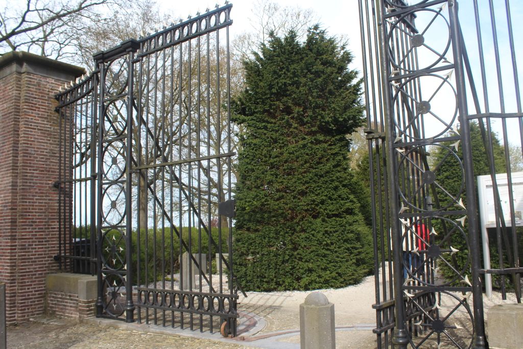
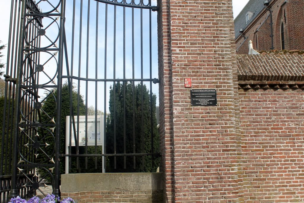
| Location | : | Edam, Edam-Volendam Municipality, Netherlands |
| Coordinate | : | 52.5157000, 5.0469140 |
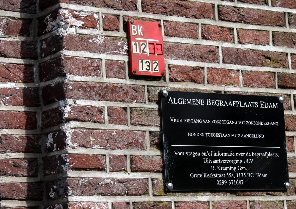
| Description | : | Napoleon banned burials inside the church. This cemetery antedates that 1830 ban. |
frequently asked questions (FAQ):
-
Where is Algemene Begraafplaats Edam?
Algemene Begraafplaats Edam is located at Uitvaartverzorging UEV, R. Kreuning Gzn., Grote Kerkstrat 55a, Edam, Edam-Volendam Municipality ,Noord-Holland , 1135 BCNetherlands.
-
Algemene Begraafplaats Edam cemetery's updated grave count on graveviews.com?
0 memorials
-
Where are the coordinates of the Algemene Begraafplaats Edam?
Latitude: 52.5157000
Longitude: 5.0469140
Nearby Cemetories:
1. Grote Kerk Edam
Edam, Edam-Volendam Municipality, Netherlands
Coordinate: 52.5151700, 5.0480100
2. Joodse Begraafplaats
Monnickendam, Waterland Municipality, Netherlands
Coordinate: 52.4573790, 5.0389150
3. Purmerend Kerkhof Overweersepolderdijk
Purmerend, Purmerend Municipality, Netherlands
Coordinate: 52.5129800, 4.9491800
4. Begraafplaats Kloosterstraat
Monnickendam, Waterland Municipality, Netherlands
Coordinate: 52.4565046, 5.0339401
5. Broek in Waterland
Broek in Waterland, Waterland Municipality, Netherlands
Coordinate: 52.4361853, 4.9920615
6. Middenbeemster Algemene Begraafplaats
Middenbeemster, Beemster Municipality, Netherlands
Coordinate: 52.5481000, 4.9075300
7. Rooms-Katholieke Begraafplaats
Westbeemster, Beemster Municipality, Netherlands
Coordinate: 52.5666656, 4.9000001
8. Ransdorp Algemene Begraafplaats
Ransdorp, Amsterdam Municipality, Netherlands
Coordinate: 52.3929000, 4.9938600
9. Rooms Katholieke Begraafplaats
De Goorn, Koggenland Municipality, Netherlands
Coordinate: 52.6267350, 4.9455000
10. Schellinkhout Protestant Churchyard
Schellinkhout, Drechterland Municipality, Netherlands
Coordinate: 52.6345800, 5.1218900
11. Begraafplaats Kerkbuurt Oostzaan
Oostzaan, Oostzaan Municipality, Netherlands
Coordinate: 52.4408907, 4.8769738
12. Nieuwe Algemene Begraafplaats
Hoorn Municipality, Netherlands
Coordinate: 52.6459000, 5.0378800
13. Hoorn General Cemetery
Hoorn, Hoorn Municipality, Netherlands
Coordinate: 52.6461800, 5.0486800
14. De Nieuwe Noorder
Amsterdam, Amsterdam Municipality, Netherlands
Coordinate: 52.4065600, 4.9266200
15. Rooms Katholieke Begraafplaats
Hoorn, Hoorn Municipality, Netherlands
Coordinate: 52.6494000, 5.0737800
16. Drieboomlaan
Hoorn, Hoorn Municipality, Netherlands
Coordinate: 52.6524706, 5.0707404
17. Buiksloot Kerkhof
Amsterdam, Amsterdam Municipality, Netherlands
Coordinate: 52.4017192, 4.9165272
18. Kerkhof Nieuwendam Nieuwendam
Nieuwendam, Amsterdam Municipality, Netherlands
Coordinate: 52.3919138, 4.9409809
19. Durgerdam Kerkhof
Durgerdam, Amsterdam Municipality, Netherlands
Coordinate: 52.3783100, 4.9880600
20. Rooms Katholieke Begraafplaats
Ursem, Koggenland Municipality, Netherlands
Coordinate: 52.6267350, 4.8897360
21. Algemene Begraafplaats Zaandijk
Zaandijk, Zaanstad Municipality, Netherlands
Coordinate: 52.4706700, 4.8041270
22. Zaandam Crematorium and General Cemetery
Zaandam, Zaanstad Municipality, Netherlands
Coordinate: 52.4252200, 4.8398700
23. Begraafplaats en Crematorium Almere Stad
Almere-Stad, Almere Municipality, Netherlands
Coordinate: 52.3819142, 5.1880932
24. Almere Stadsbegraafplaats
Almere, Almere Municipality, Netherlands
Coordinate: 52.3816400, 5.1880900