
| Memorials | : | 0 |
| Location | : | Hoorn Municipality, Netherlands |
| Coordinate | : | 52.6459000, 5.0378800 |
| Description | : | The Berkhouterweg General Cemetery was opened in 1969. The cemetery is divided into a general section (including a section of Islamic graves), a Roman Catholic section and a Jewish section. The Jewish cemetery at Hoorn was officially inaugurated in 1778; it was cleared away in 1969 to make way for road construction. Gravestones and the remains of the dead were exhumed and moved to this cemetery. |
frequently asked questions (FAQ):
-
Where is Nieuwe Algemene Begraafplaats?
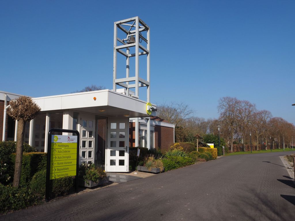
Nieuwe Algemene Begraafplaats is located at Berkhouterweg 26 Hoorn Municipality ,Noord-Holland , 1624 NTNetherlands.
-
Nieuwe Algemene Begraafplaats cemetery's updated grave count on graveviews.com?
0 memorials
-
Where are the coordinates of the Nieuwe Algemene Begraafplaats?
Latitude: 52.6459000
Longitude: 5.0378800
Nearby Cemetories:
1. Hoorn General Cemetery
Hoorn, Hoorn Municipality, Netherlands
Coordinate: 52.6461800, 5.0486800
2. Drieboomlaan
Hoorn, Hoorn Municipality, Netherlands
Coordinate: 52.6524706, 5.0707404
3. Rooms Katholieke Begraafplaats
Hoorn, Hoorn Municipality, Netherlands
Coordinate: 52.6494000, 5.0737800
4. Wognum Protestant Churchyard
Wognum, Medemblik Municipality, Netherlands
Coordinate: 52.6802100, 5.0260100
5. Schellinkhout Protestant Churchyard
Schellinkhout, Drechterland Municipality, Netherlands
Coordinate: 52.6345800, 5.1218900
6. Rooms Katholieke Begraafplaats
De Goorn, Koggenland Municipality, Netherlands
Coordinate: 52.6267350, 4.9455000
7. Spanbroek Churchyard
Spanbroek, Opmeer Municipality, Netherlands
Coordinate: 52.6980200, 4.9442730
8. Rooms Katholieke Begraafplaats
Ursem, Koggenland Municipality, Netherlands
Coordinate: 52.6267350, 4.8897360
9. Twisk Churchyard
Twisk, Medemblik Municipality, Netherlands
Coordinate: 52.7442300, 5.0603400
10. Veenhuizen Churchyard
Veenhuizen, Heerhugowaard Municipality, Netherlands
Coordinate: 52.7027900, 4.8905700
11. Rooms-Katholieke Begraafplaats
Westbeemster, Beemster Municipality, Netherlands
Coordinate: 52.5666656, 4.9000001
12. Algemene Begraafplaats Opperdoes
Opperdoes, Medemblik Municipality, Netherlands
Coordinate: 52.7638451, 5.0742310
13. Middenbeemster Algemene Begraafplaats
Middenbeemster, Beemster Municipality, Netherlands
Coordinate: 52.5481000, 4.9075300
14. Medemblik General Cemetery
Medemblik, Medemblik Municipality, Netherlands
Coordinate: 52.7664000, 5.1051200
15. Andijk Western General Cemetery
Andijk, Medemblik Municipality, Netherlands
Coordinate: 52.7413700, 5.1819400
16. Algemene Begraafplaats Edam
Edam, Edam-Volendam Municipality, Netherlands
Coordinate: 52.5157000, 5.0469140
17. Grote Kerk Edam
Edam, Edam-Volendam Municipality, Netherlands
Coordinate: 52.5151700, 5.0480100
18. Rooms-Katholiek Kerkhof Welgelegen
Medemblik, Medemblik Municipality, Netherlands
Coordinate: 52.7717300, 5.0996890
19. Winkel Protestant Churchyard
Winkel, Hollands Kroon Municipality, Netherlands
Coordinate: 52.7588800, 4.9132200
20. Stompetoren Churchyard
Stompetoren, Alkmaar Municipality, Netherlands
Coordinate: 52.6115300, 4.8197300
21. Bovenkarspel General Cemetery
Bovenkarspel, Stede Broec Municipality, Netherlands
Coordinate: 52.6994300, 5.2488900
22. Purmerend Kerkhof Overweersepolderdijk
Purmerend, Purmerend Municipality, Netherlands
Coordinate: 52.5129800, 4.9491800
23. Joodse Begraafplaats
Enkhuizen Municipality, Netherlands
Coordinate: 52.7000800, 5.2778000
24. Andijk Eastern General Cemetery
Andijk, Medemblik Municipality, Netherlands
Coordinate: 52.7451600, 5.2369700