
| Memorials | : | 0 |
| Location | : | Stock, Chelmsford Borough, England |
| Coordinate | : | 51.6610560, 0.4381230 |
| Description | : | Stock is a village and civil parish in Essex, England, located approximately 6 miles south of the county town of Chelmsford. The village, on the outskirts of Billericay, used to be called Stock Harvard and the ecclesiastical parish is still known by that name. At 318 feet above sea level, it is one of the highest points in Essex lying on a range of hills running north-eastward from Brentwood to Danbury. The origins of the village itself are uncertain and the origin of the village's name is still open to dispute but to derive it from the Saxon "stocce",... Read More |
frequently asked questions (FAQ):
-
Where is All Saints Churchyard?
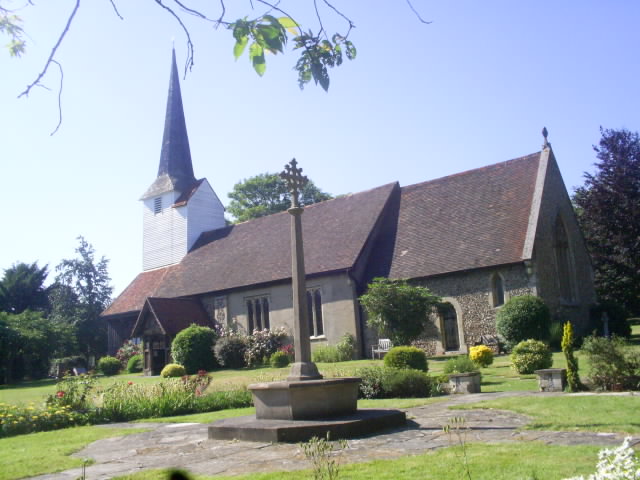
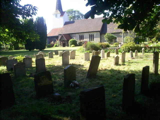
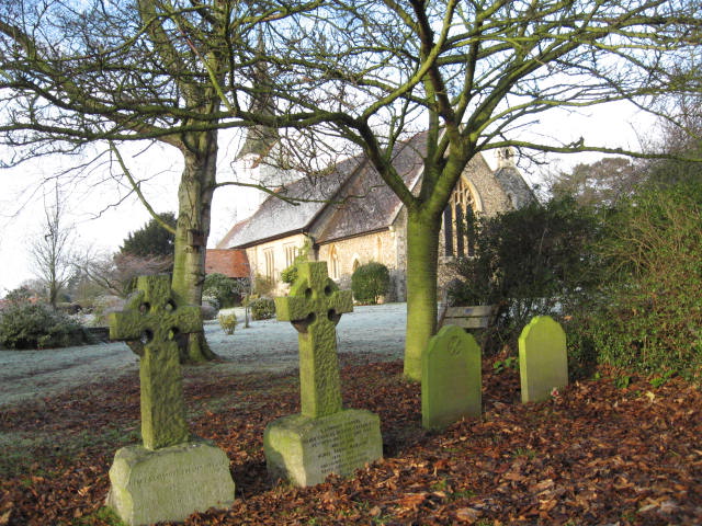
All Saints Churchyard is located at Stock, Chelmsford Borough ,Essex ,England.
-
All Saints Churchyard cemetery's updated grave count on graveviews.com?
0 memorials
-
Where are the coordinates of the All Saints Churchyard?
Latitude: 51.6610560
Longitude: 0.4381230
Nearby Cemetories:
1. St Mary Churchyard
Buttsbury, Chelmsford Borough, England
Coordinate: 51.6617020, 0.4043050
2. St Margaret Churchyard
Margaretting, Chelmsford Borough, England
Coordinate: 51.6777980, 0.4069230
3. Ramsden Heath Chapelyard
Ramsden Heath, Chelmsford Borough, England
Coordinate: 51.6361400, 0.4713000
4. Roman Catholic Cemetery
Ingatestone, Brentwood Borough, England
Coordinate: 51.6702910, 0.3861230
5. St. Edmund and St. Mary Churchyard
Ingatestone, Brentwood Borough, England
Coordinate: 51.6708850, 0.3861950
6. Ingatestone United Reformed Church
Ingatestone, Brentwood Borough, England
Coordinate: 51.6696110, 0.3827140
7. St. Mary Magdalen Churchyard
Billericay, Basildon District, England
Coordinate: 51.6259230, 0.4180810
8. Ss John the Evangelist and Erconwald
Ingatestone, Brentwood Borough, England
Coordinate: 51.6645740, 0.3749410
9. St. Giles Churchyard
Mountnessing, Brentwood Borough, England
Coordinate: 51.6438000, 0.3804700
10. Billericay United Reformed Churchyard
Billericay, Basildon District, England
Coordinate: 51.6225460, 0.4187040
11. St Michael and All Angels Churchyard
Galleywood, Chelmsford Borough, England
Coordinate: 51.6993100, 0.4640600
12. St Mary and St Edward Churchyard
West Hanningfield, Chelmsford Borough, England
Coordinate: 51.6703800, 0.5076560
13. St Mary the Virgin Churchyard
Fryerning, Brentwood Borough, England
Coordinate: 51.6758350, 0.3682350
14. Ingatestone and Fryerning Cemetery
Ingatestone, Brentwood Borough, England
Coordinate: 51.6751630, 0.3678700
15. St. Mary the Virgin Churchyard
Ramsden Bellhouse, Basildon District, England
Coordinate: 51.6210300, 0.4821470
16. St. Margaret's Churchyard
Downham, Chelmsford Borough, England
Coordinate: 51.6295580, 0.4981670
17. St Peter Churchyard
South Hanningfield, Chelmsford Borough, England
Coordinate: 51.6541900, 0.5204060
18. St Mary Churchyard
Ramsden Crays, Basildon District, England
Coordinate: 51.6123140, 0.4656740
19. Hylands Park
Writtle, Chelmsford Borough, England
Coordinate: 51.7135700, 0.4354200
20. St. Mary Magdalene Churchyard
Great Burstead, Basildon District, England
Coordinate: 51.6039050, 0.4252480
21. St Mary Churchyard
Widford, Chelmsford Borough, England
Coordinate: 51.7187030, 0.4511340
22. Great Burstead Cemetery
Great Burstead, Basildon District, England
Coordinate: 51.6030660, 0.4287890
23. All Saints Churchyard
Hutton, Brentwood Borough, England
Coordinate: 51.6241150, 0.3608210
24. St Mary the Virgin Churchyard
Little Burstead, Basildon District, England
Coordinate: 51.5980180, 0.4074970