
| Memorials | : | 0 |
| Location | : | Ingatestone, Brentwood Borough, England |
| Coordinate | : | 51.6645740, 0.3749410 |
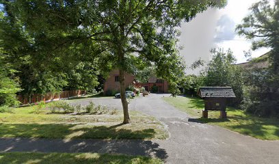
| Description | : | Founded 1703. There are no interments here. This place of worship is in Ingatestone parish which is part of the Brentwood Roman Catholic deanery A 1930s neo-Tudor brick church, its design reflecting that of nearby Ingatestone Hall, the chapel of which served the oldest mission in the Diocese. The benefactors were Sebastian Henry Petre and T.G. Havers. The church has several memorials to members of the Petre family and contains furnishings from the Hall chapel. Sir William Petre rebuilt Ingatestone Hall in c.1539, marking the beginning of the presence of the Catholic Petre family in Ingatestone. The Hall had several chapels from the... Read More |
frequently asked questions (FAQ):
-
Where is Ss John the Evangelist and Erconwald?
Ss John the Evangelist and Erconwald is located at Roman Road Ingatestone, Brentwood Borough ,Essex , CM4 9AAEngland.
-
Ss John the Evangelist and Erconwald cemetery's updated grave count on graveviews.com?
0 memorials
-
Where are the coordinates of the Ss John the Evangelist and Erconwald?
Latitude: 51.6645740
Longitude: 0.3749410
Nearby Cemetories:
1. Ingatestone United Reformed Church
Ingatestone, Brentwood Borough, England
Coordinate: 51.6696110, 0.3827140
2. Roman Catholic Cemetery
Ingatestone, Brentwood Borough, England
Coordinate: 51.6702910, 0.3861230
3. St. Edmund and St. Mary Churchyard
Ingatestone, Brentwood Borough, England
Coordinate: 51.6708850, 0.3861950
4. Ingatestone and Fryerning Cemetery
Ingatestone, Brentwood Borough, England
Coordinate: 51.6751630, 0.3678700
5. St Mary the Virgin Churchyard
Fryerning, Brentwood Borough, England
Coordinate: 51.6758350, 0.3682350
6. St Mary Churchyard
Buttsbury, Chelmsford Borough, England
Coordinate: 51.6617020, 0.4043050
7. St. Giles Churchyard
Mountnessing, Brentwood Borough, England
Coordinate: 51.6438000, 0.3804700
8. St Margaret Churchyard
Margaretting, Chelmsford Borough, England
Coordinate: 51.6777980, 0.4069230
9. All Saints Churchyard
Stock, Chelmsford Borough, England
Coordinate: 51.6610560, 0.4381230
10. All Saints Churchyard
Hutton, Brentwood Borough, England
Coordinate: 51.6241150, 0.3608210
11. St. Mary Magdalen Churchyard
Billericay, Basildon District, England
Coordinate: 51.6259230, 0.4180810
12. St Mary the Virgin Churchyard
Shenfield, Brentwood Borough, England
Coordinate: 51.6320590, 0.3185650
13. Billericay United Reformed Churchyard
Billericay, Basildon District, England
Coordinate: 51.6225460, 0.4187040
14. Hylands Park
Writtle, Chelmsford Borough, England
Coordinate: 51.7135700, 0.4354200
15. Brentwood Cathedral Burial Grounds
Brentwood, Brentwood Borough, England
Coordinate: 51.6196720, 0.3064440
16. St Thomas of Canterbury Churchyard
Brentwood, Brentwood Borough, England
Coordinate: 51.6196970, 0.3046240
17. St Nicholas Churchyard
Ingrave, Brentwood Borough, England
Coordinate: 51.6035800, 0.3425560
18. St Michael and All Angels Churchyard
Galleywood, Chelmsford Borough, England
Coordinate: 51.6993100, 0.4640600
19. Ramsden Heath Chapelyard
Ramsden Heath, Chelmsford Borough, England
Coordinate: 51.6361400, 0.4713000
20. Bentley Cemetery and Crematorium
Brentwood Borough, England
Coordinate: 51.6424381, 0.2740605
21. St. Nicholas Churchyard
Kelvedon Hatch, Brentwood Borough, England
Coordinate: 51.6675310, 0.2674380
22. St. Peter and St. Paul Churchyard
Stondon Massey, Brentwood Borough, England
Coordinate: 51.6910510, 0.2738590
23. St. Mary Magdalene Churchyard
Great Burstead, Basildon District, England
Coordinate: 51.6039050, 0.4252480
24. Herongate Wood Cemetery
Herongate, Brentwood Borough, England
Coordinate: 51.5959206, 0.3759600