
| Memorials | : | 0 |
| Location | : | Ingatestone, Brentwood Borough, England |
| Coordinate | : | 51.6708850, 0.3861950 |
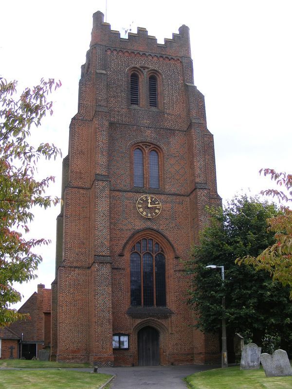
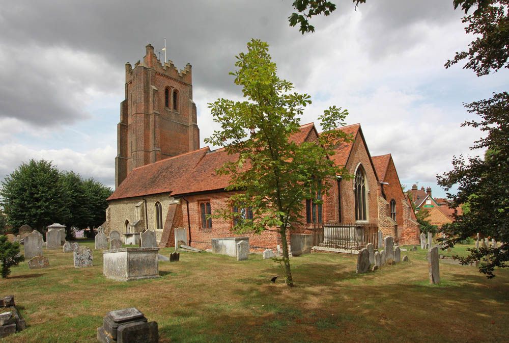
| Description | : | See history of St. Edmund and St. Mary Church in Ingatestone. Ging ad Petram (the parcel of land by the stone) was a Saxon settlement of 430 acres and a dozen peasants listed in the Doomsday Survey as ‘belonging always to St. Mary at Berking'. It was to form part of the later parish of Ingatestone. It is unknown whether a Saxon Church stood on the site, but a small Norman Church was built between 1080 and 1100.The dedication is to St. Edmund, the East Saxon King, captured and martyred by the Danes in 870AD and canonised in 960AD and to... Read More |
frequently asked questions (FAQ):
-
Where is St. Edmund and St. Mary Churchyard?
St. Edmund and St. Mary Churchyard is located at High Street Ingatestone, Brentwood Borough ,Essex , CM4 9DNEngland.
-
St. Edmund and St. Mary Churchyard cemetery's updated grave count on graveviews.com?
0 memorials
-
Where are the coordinates of the St. Edmund and St. Mary Churchyard?
Latitude: 51.6708850
Longitude: 0.3861950
Nearby Cemetories:
1. Roman Catholic Cemetery
Ingatestone, Brentwood Borough, England
Coordinate: 51.6702910, 0.3861230
2. Ingatestone United Reformed Church
Ingatestone, Brentwood Borough, England
Coordinate: 51.6696110, 0.3827140
3. Ss John the Evangelist and Erconwald
Ingatestone, Brentwood Borough, England
Coordinate: 51.6645740, 0.3749410
4. Ingatestone and Fryerning Cemetery
Ingatestone, Brentwood Borough, England
Coordinate: 51.6751630, 0.3678700
5. St Mary the Virgin Churchyard
Fryerning, Brentwood Borough, England
Coordinate: 51.6758350, 0.3682350
6. St Mary Churchyard
Buttsbury, Chelmsford Borough, England
Coordinate: 51.6617020, 0.4043050
7. St Margaret Churchyard
Margaretting, Chelmsford Borough, England
Coordinate: 51.6777980, 0.4069230
8. St. Giles Churchyard
Mountnessing, Brentwood Borough, England
Coordinate: 51.6438000, 0.3804700
9. All Saints Churchyard
Stock, Chelmsford Borough, England
Coordinate: 51.6610560, 0.4381230
10. St. Mary Magdalen Churchyard
Billericay, Basildon District, England
Coordinate: 51.6259230, 0.4180810
11. All Saints Churchyard
Hutton, Brentwood Borough, England
Coordinate: 51.6241150, 0.3608210
12. Billericay United Reformed Churchyard
Billericay, Basildon District, England
Coordinate: 51.6225460, 0.4187040
13. Hylands Park
Writtle, Chelmsford Borough, England
Coordinate: 51.7135700, 0.4354200
14. St Michael and All Angels Churchyard
Galleywood, Chelmsford Borough, England
Coordinate: 51.6993100, 0.4640600
15. St Mary the Virgin Churchyard
Shenfield, Brentwood Borough, England
Coordinate: 51.6320590, 0.3185650
16. St Mary Churchyard
Widford, Chelmsford Borough, England
Coordinate: 51.7187030, 0.4511340
17. Ramsden Heath Chapelyard
Ramsden Heath, Chelmsford Borough, England
Coordinate: 51.6361400, 0.4713000
18. All Saints Churchyard
Writtle, Chelmsford Borough, England
Coordinate: 51.7289110, 0.4275960
19. Chelmsford Cemetery and Crematorium
Chelmsford, Chelmsford Borough, England
Coordinate: 51.7260140, 0.4568840
20. Brentwood Cathedral Burial Grounds
Brentwood, Brentwood Borough, England
Coordinate: 51.6196720, 0.3064440
21. St. Mary Magdalene Churchyard
Great Burstead, Basildon District, England
Coordinate: 51.6039050, 0.4252480
22. St Thomas of Canterbury Churchyard
Brentwood, Brentwood Borough, England
Coordinate: 51.6196970, 0.3046240
23. St. Peter and St. Paul Churchyard
Stondon Massey, Brentwood Borough, England
Coordinate: 51.6910510, 0.2738590
24. St Nicholas Churchyard
Ingrave, Brentwood Borough, England
Coordinate: 51.6035800, 0.3425560