
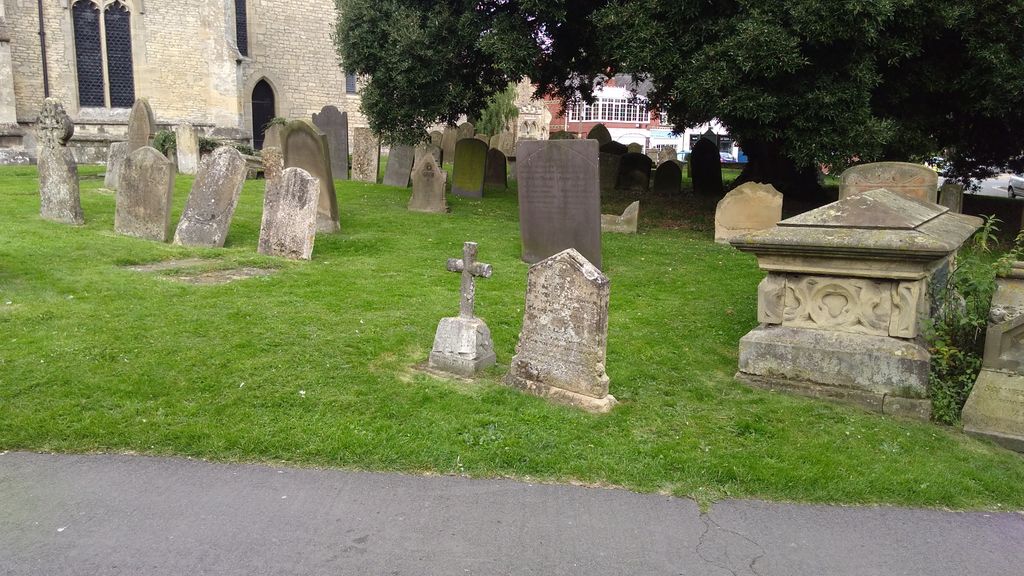
| Memorials | : | 1 |
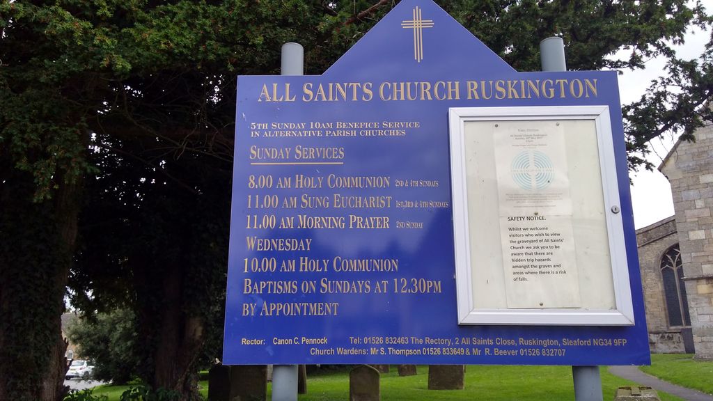
| Location | : | Ruskington, North Kesteven District, England |
| Coordinate | : | 53.0460330, -0.3866280 |
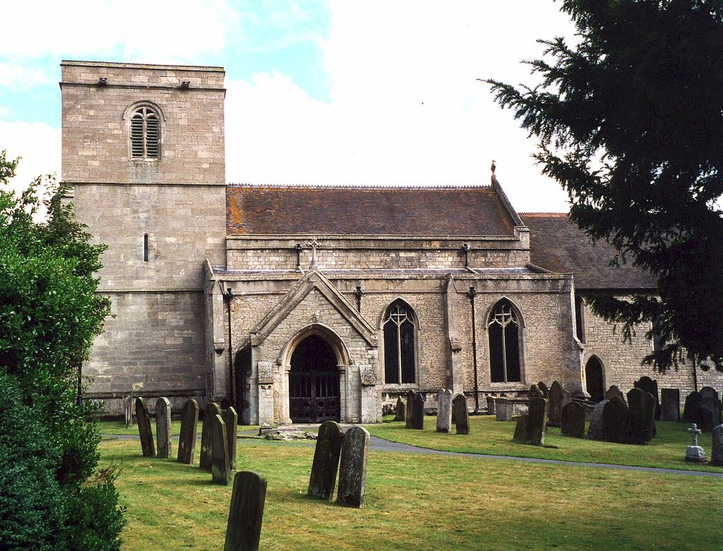
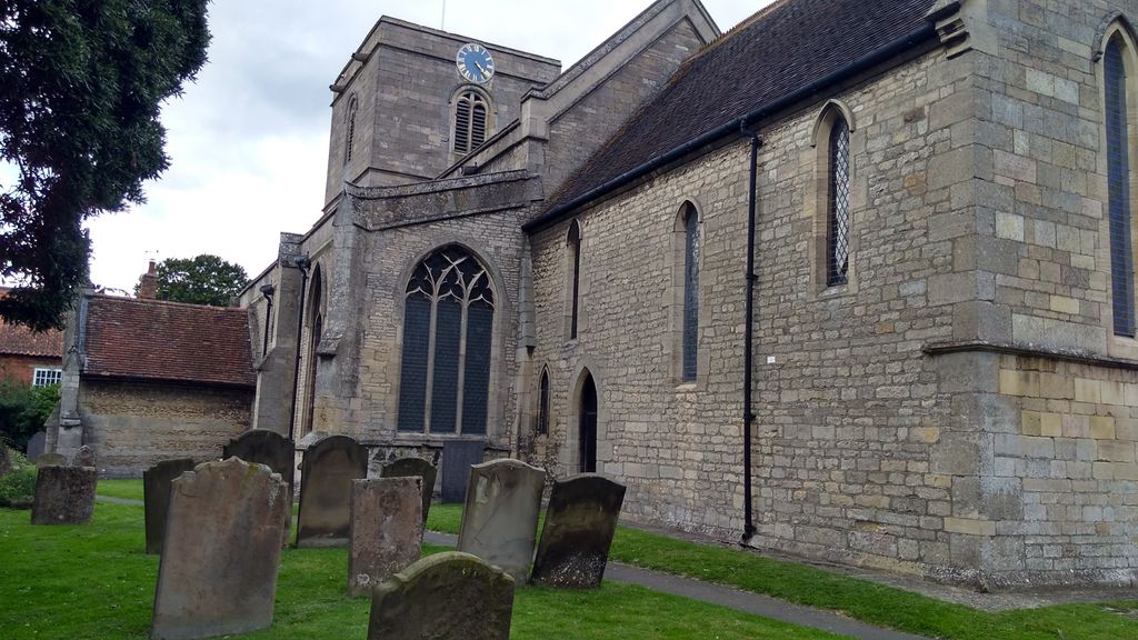
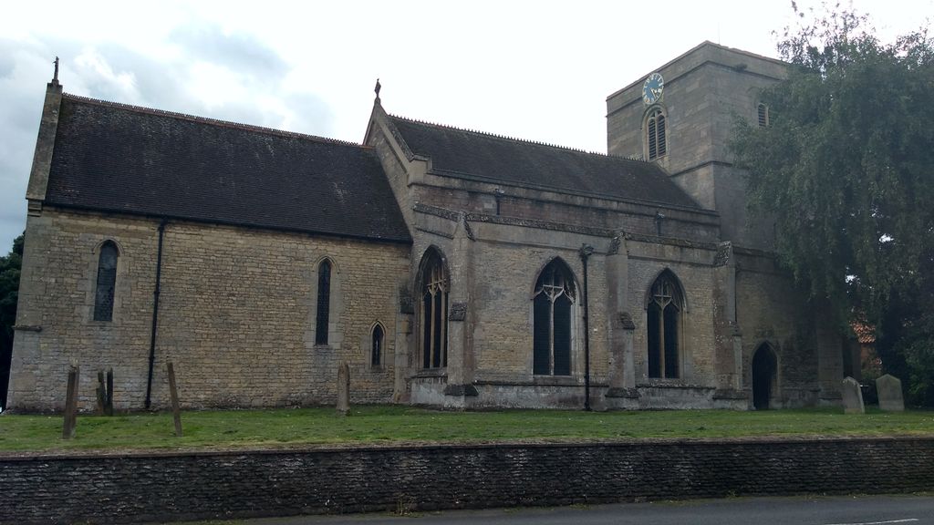
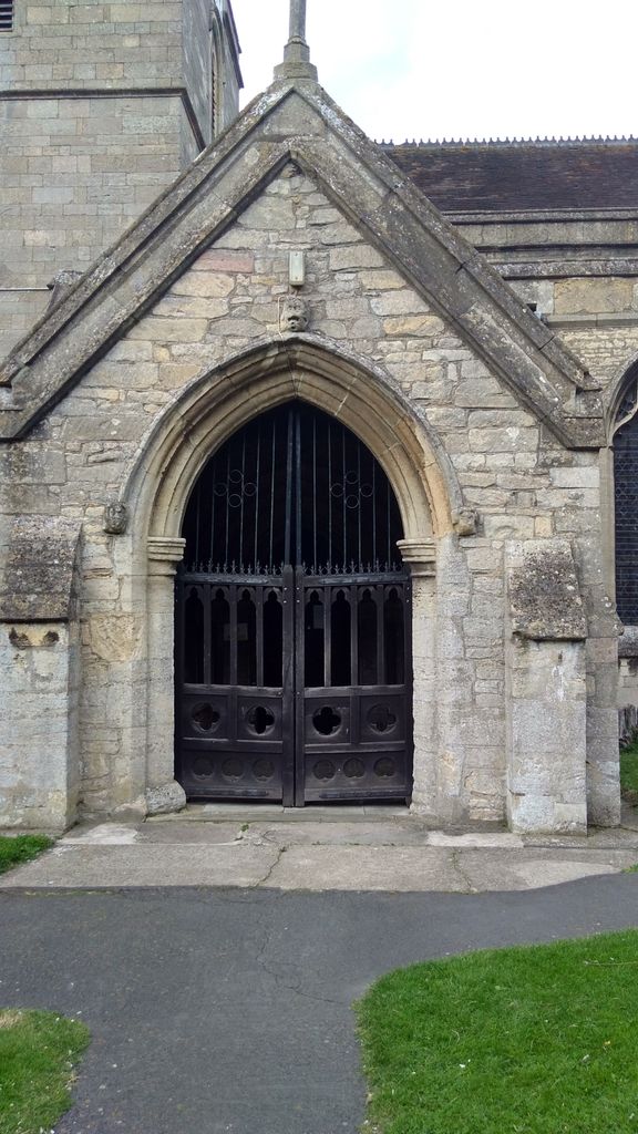
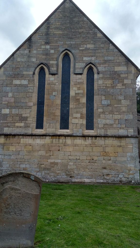
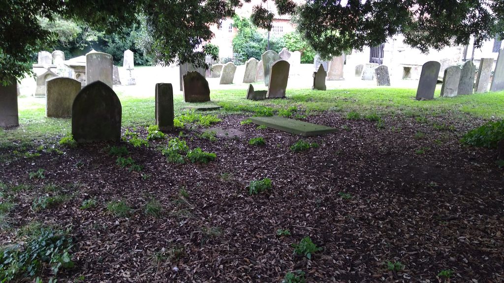
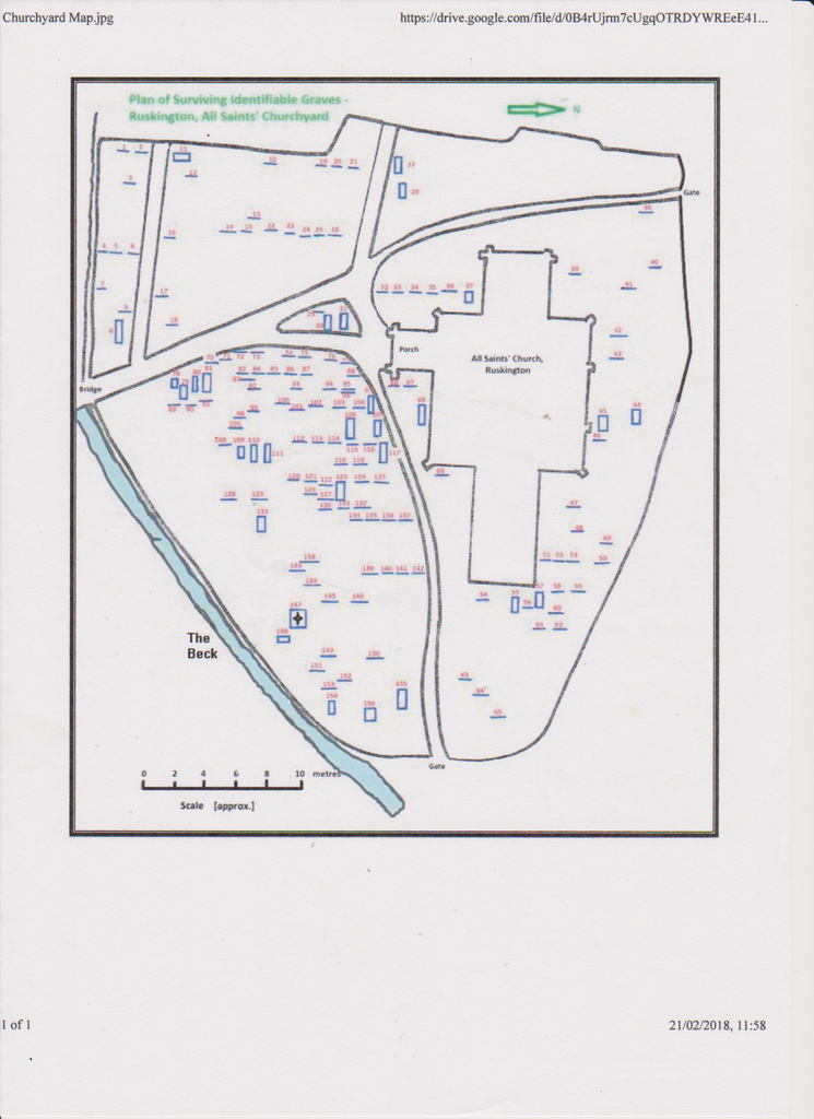
| Description | : | All Saints Parish Church, is a Norman Church that was built in 1086, replacing an earlier, Anglo Saxon, wooden structure. Parts of the tower are believed to remain from this date but the Chancel portion was built in the 13/14th century. The Tower was damaged in 1618 and rebuilt in 1620. |
frequently asked questions (FAQ):
-
Where is All Saints Churchyard?
All Saints Churchyard is located at Ruskington, North Kesteven District ,Lincolnshire ,England.
-
All Saints Churchyard cemetery's updated grave count on graveviews.com?
1 memorials
-
Where are the coordinates of the All Saints Churchyard?
Latitude: 53.0460330
Longitude: -0.3866280
Nearby Cemetories:
1. Anwick Church Lane Churchyard Extension
Anwick, North Kesteven District, England
Coordinate: 53.0420800, -0.3397200
2. St Edith's Church
Anwick, North Kesteven District, England
Coordinate: 53.0414520, -0.3391170
3. St Andrew Churchyard
Leasingham, North Kesteven District, England
Coordinate: 53.0239040, -0.4262600
4. St Thomas Becket Churchyard
Digby, North Kesteven District, England
Coordinate: 53.0796030, -0.3882980
5. All Saints Churchyard
Brauncewell, North Kesteven District, England
Coordinate: 53.0587900, -0.4418200
6. Sleaford Cemetery
Sleaford, North Kesteven District, England
Coordinate: 53.0027590, -0.4056790
7. St Andrew Churchyard
Cranwell, North Kesteven District, England
Coordinate: 53.0370660, -0.4612070
8. St. Denys Churchyard
Kirkby la Thorpe, North Kesteven District, England
Coordinate: 53.0008270, -0.3636800
9. St Denys Churchyard
Sleaford, North Kesteven District, England
Coordinate: 52.9996510, -0.4088960
10. St. Andrew's Churchyard
Asgarby, North Kesteven District, England
Coordinate: 52.9941750, -0.3383450
11. Holy Cross Churchyard
Kirkby Green, North Kesteven District, England
Coordinate: 53.1062300, -0.3808000
12. Holy Cross Churchyard
Scopwick, North Kesteven District, England
Coordinate: 53.1089480, -0.4032690
13. St. Oswald's Churchyard
Howell, North Kesteven District, England
Coordinate: 53.0016300, -0.3100400
14. St Botolph Churchyard
Quarrington, North Kesteven District, England
Coordinate: 52.9872010, -0.4312350
15. Saint Luke Churchyard
North Kyme, North Kesteven District, England
Coordinate: 53.0591550, -0.2808970
16. Holy Cross Churchyard Extension
Scopwick, North Kesteven District, England
Coordinate: 53.1105880, -0.4044990
17. St. Oswald Churchyard
Walcott, North Kesteven District, England
Coordinate: 53.0944560, -0.3128500
18. St Oswald Churchyard
Walcott, North Kesteven District, England
Coordinate: 53.0945800, -0.3125240
19. St Peter's Churchyard
North Rauceby, North Kesteven District, England
Coordinate: 53.0056400, -0.4796500
20. Billinghay Cemetery
Billinghay, North Kesteven District, England
Coordinate: 53.0806340, -0.2852800
21. St. Andrew's Churchyard
Timberland, North Kesteven District, England
Coordinate: 53.1095985, -0.3267715
22. St. Andrew's Churchyard
Timberland, North Kesteven District, England
Coordinate: 53.1095985, -0.3267715
23. St. Michael and All Angels Churchyard
Billinghay, North Kesteven District, England
Coordinate: 53.0791130, -0.2746370
24. St Michael Church Cemetery
Billinghay, North Kesteven District, England
Coordinate: 53.0796800, -0.2748100