
| Memorials | : | 25 |
| Location | : | Moor Monkton, Harrogate Borough, England |
| Coordinate | : | 53.9976300, -1.2223700 |
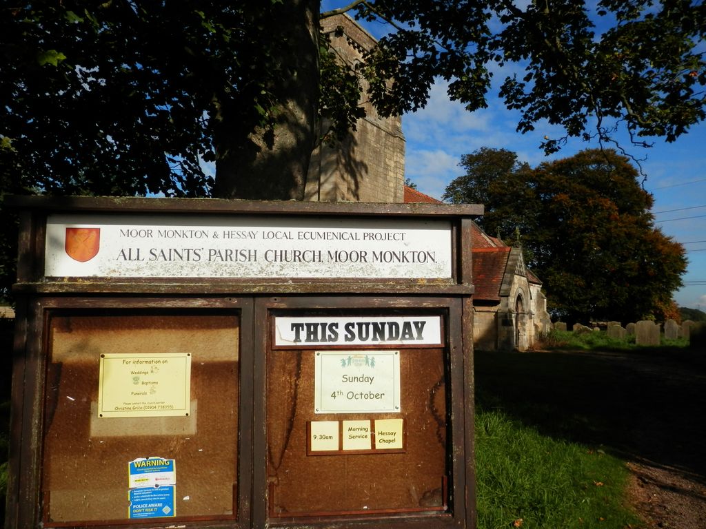
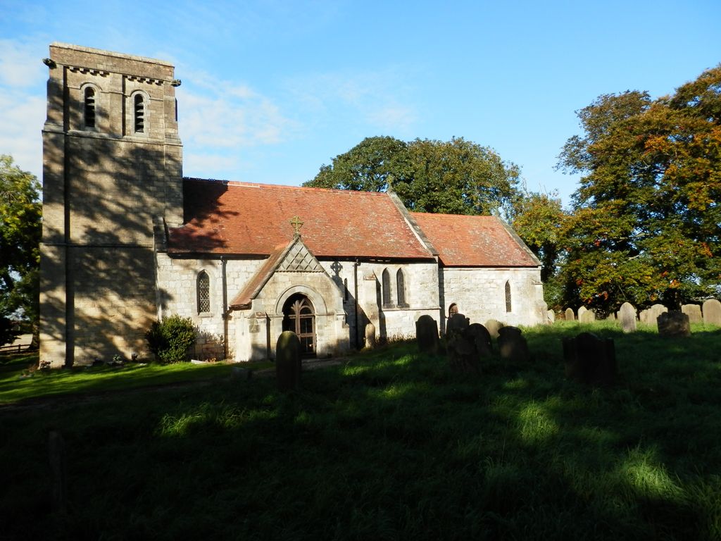
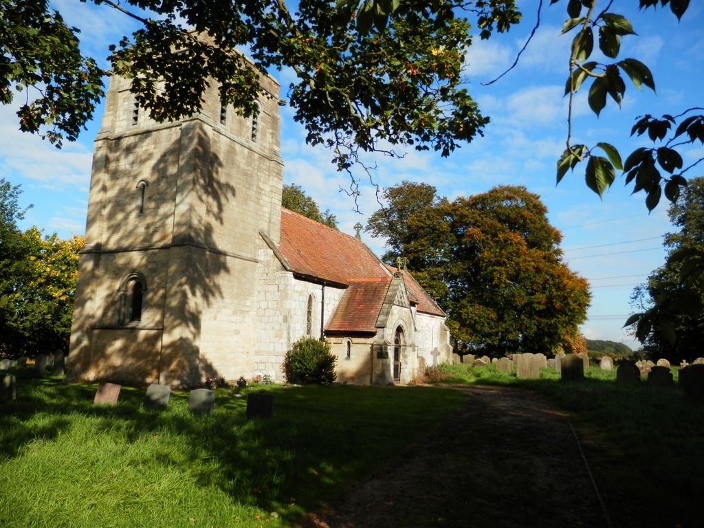
| Description | : | Moor Monkton is a village and civil parish in the Harrogate district of North Yorkshire, England. It is situated on the River Ouse and 7 miles (11 km) north-west from York city centre. The parish church, dedicated to All Saints, dates in part from the 12th century. It was restored in 1879 by James Fowler, who probably added the chancel east window, and one at the south of the nave. It is outside the village in Church Lane, the only road into the village, off the A59 (York to Harrogate) Road. The small churchyard is still in use. |
frequently asked questions (FAQ):
-
Where is All Saints Churchyard?
All Saints Churchyard is located at Church Lane Moor Monkton, Harrogate Borough ,North Yorkshire ,England.
-
All Saints Churchyard cemetery's updated grave count on graveviews.com?
1 memorials
-
Where are the coordinates of the All Saints Churchyard?
Latitude: 53.9976300
Longitude: -1.2223700
Nearby Cemetories:
1. St Mary Priory Churchyard
Nun Monkton, Harrogate Borough, England
Coordinate: 54.0149100, -1.2212150
2. St John's the Baptist Church
Hessay, York Unitary Authority, England
Coordinate: 53.9767283, -1.2027246
3. Marston Moor Battlefield Burial Pits
Long Marston, Harrogate Borough, England
Coordinate: 53.9713910, -1.2578580
4. All Saints Churchyard
Newton-on-Ouse, Hambleton District, England
Coordinate: 54.0324800, -1.2210800
5. St. John the Baptist Churchyard
Kirk Hammerton, Harrogate Borough, England
Coordinate: 53.9936690, -1.2918740
6. All Saints Churchyard
Rufforth, York Unitary Authority, England
Coordinate: 53.9568390, -1.1975690
7. Holy Evangelists Churchyard
Shipton, Hambleton District, England
Coordinate: 54.0234400, -1.1572300
8. All Saints Churchyard
Upper Poppleton, York Unitary Authority, England
Coordinate: 53.9776970, -1.1510780
9. St Thomas Churchyard
Green Hammerton, Harrogate Borough, England
Coordinate: 54.0055000, -1.3007000
10. All Saints Churchyard
Long Marston, Harrogate Borough, England
Coordinate: 53.9506990, -1.2319230
11. St Everilda Churchyard
Nether Poppleton, York Unitary Authority, England
Coordinate: 53.9882060, -1.1403710
12. Church of the Epiphany Churchyard
Tockwith, Harrogate Borough, England
Coordinate: 53.9653480, -1.2909130
13. St. Giles' Churchyard
Skelton, York Unitary Authority, England
Coordinate: 54.0019111, -1.1342660
14. St Helen Churchyard
Bilton, Harrogate Borough, England
Coordinate: 53.9474910, -1.2761090
15. Skelton Parish Council Cemetery
Skelton, York Unitary Authority, England
Coordinate: 54.0070970, -1.1150970
16. Ascension Churchyard
Whixley, Harrogate Borough, England
Coordinate: 54.0186370, -1.3269930
17. Moorlands Nature Reserve
Skelton, York Unitary Authority, England
Coordinate: 54.0226680, -1.1201180
18. St Stephen Churchyard
Acomb, York Unitary Authority, England
Coordinate: 53.9558840, -1.1289100
19. Holy Trinity Churchyard
Little Ouseburn, Harrogate Borough, England
Coordinate: 54.0440712, -1.3101200
20. St John the Baptist Churchyard
Healaugh, Selby District, England
Coordinate: 53.9249590, -1.2424500
21. St Mary the Virgin Churchyard
Great Ouseburn, Harrogate Borough, England
Coordinate: 54.0488052, -1.3125230
22. St Mary Churchyard
Askham Richard, York Unitary Authority, England
Coordinate: 53.9254100, -1.1836800
23. St Stephen Churchyard
Aldwark, Hambleton District, England
Coordinate: 54.0640600, -1.2875000
24. St John the Baptist Churchyard
Hunsingore, Harrogate Borough, England
Coordinate: 53.9765050, -1.3481850