
| Memorials | : | 0 |
| Location | : | Dickens County, USA |
| Coordinate | : | 33.7193985, -100.8242035 |
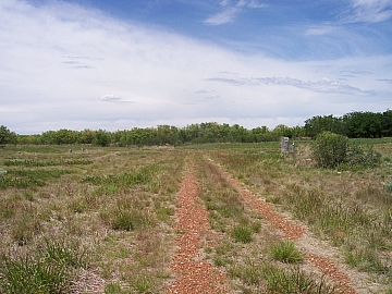
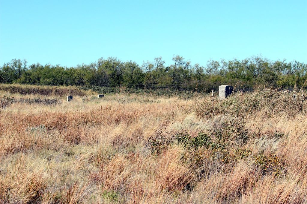
| Description | : | The land was owned by the Matador Land and Cattle Company and they deeded it to the Elders of the Amity Church of Christ for Church and cemetery purposes only. If it is used for any other purposes, it reverts back to said company. LOCATION: From Dickens at intersection Hwy 82 and Hwy 70, go north 7 miles on Hwy 70, turn right (east) at County Road 232 and go one mile to the junction of CR 232 and CR 235. Cemetery on north corner of intersection. Oldest grave is SARGENT INFANT GIRL Died: Feb 21, 1904 |
frequently asked questions (FAQ):
-
Where is Amity Cemetery?
Amity Cemetery is located at Dickens County ,Texas ,USA.
-
Amity Cemetery cemetery's updated grave count on graveviews.com?
0 memorials
-
Where are the coordinates of the Amity Cemetery?
Latitude: 33.7193985
Longitude: -100.8242035


Nearby Cemetories:
1. Afton Cemetery
Afton, Dickens County, USA
Coordinate: 33.7658310, -100.8059050
2. Dickens Cemetery
Dickens, Dickens County, USA
Coordinate: 33.6236550, -100.8214260
3. Mayo Cemetery
Dickens, Dickens County, USA
Coordinate: 33.5970250, -100.7127960
4. Espuela Cemetery
Dickens County, USA
Coordinate: 33.5750008, -100.8949966
5. McAdoo Cemetery
McAdoo, Dickens County, USA
Coordinate: 33.7252998, -101.0214005
6. Spur Cemetery
Spur, Dickens County, USA
Coordinate: 33.4774704, -100.8379898
7. Antelope Cemetery
Floyd County, USA
Coordinate: 33.8692017, -101.0980988
8. Steele Hill Cemetery
Spur, Dickens County, USA
Coordinate: 33.4211390, -100.7882370
9. Mount Zion Cemetery
Crosby County, USA
Coordinate: 33.6533700, -101.1922100
10. Dougherty Cemetery
Dougherty, Floyd County, USA
Coordinate: 33.9503070, -101.0851670
11. Crosbyton Cemetery
Crosbyton, Crosby County, USA
Coordinate: 33.6577988, -101.2099991
12. Red Mud Cemetery
Spur, Dickens County, USA
Coordinate: 33.4265120, -100.9987710
13. Rock House Cemetery
Mount Blanco, Crosby County, USA
Coordinate: 33.8016080, -101.2487020
14. Lakeview Cemetery
Floyd County, USA
Coordinate: 33.8741989, -101.2577972
15. Buck Creek Cemetery
Paducah, Cottle County, USA
Coordinate: 33.9322380, -100.3640400
16. Forest Lawn Cemetery
Floydada, Floyd County, USA
Coordinate: 33.9752600, -101.2729840
17. Rushing Chapel Cemetery
Floyd County, USA
Coordinate: 34.0558014, -101.2202988
18. Ralls Cemetery
Ralls, Crosby County, USA
Coordinate: 33.6732521, -101.4008408
19. Emma Cemetery
Crosby County, USA
Coordinate: 33.6114970, -101.4123950
20. Cone Cemetery
Cone, Crosby County, USA
Coordinate: 33.7971992, -101.4216995
21. Floyd County Memorial Park
Floydada, Floyd County, USA
Coordinate: 34.0031600, -101.3262000
22. Shinnery Cemetery
Paducah, Cottle County, USA
Coordinate: 33.8483009, -100.2367020
23. Floydada Cemetery
Floydada, Floyd County, USA
Coordinate: 34.0058000, -101.3265300
24. Garden of Memories Cemetery
Paducah, Cottle County, USA
Coordinate: 34.0064011, -100.2910995