
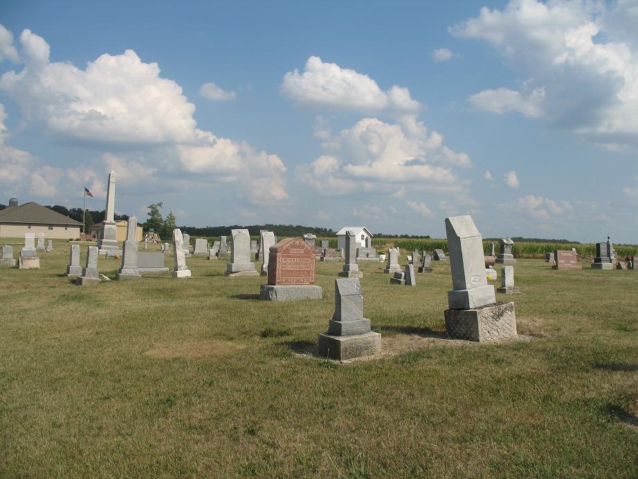
| Memorials | : | 31 |
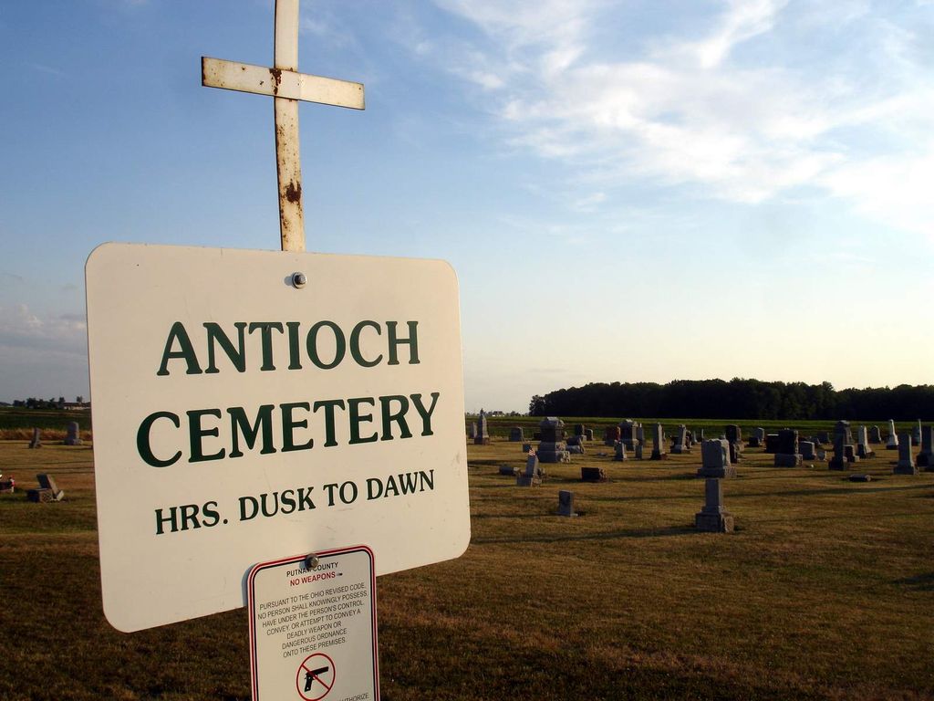
| Location | : | Monterey Township, Putnam County, USA |
| Coordinate | : | 40.9757996, -84.3431015 |
| Description | : | The cemetery is located on the south side of County Road N about 0.2 miles west of its intersection with County Road 25M. The cemetery is located in Monterey Township, Putnam County, Ohio, and is # 10122 (Antioch Cemetery / Union Cemetery) in “Ohio Cemeteries 1803-2003”, compiled by the Ohio Genealogical Society. The cemetery is registered with the Ohio Division of Real Estate and Professional Licensing (ODRE) as Antioch Cemetery with registration license number CGR.0000980699. The U.S. Geological Survey (USGS) Geographic Names Information System (GNIS) feature ID for the cemetery is 1071343 (Antioch Cemetery / Union Cemetery). |
frequently asked questions (FAQ):
-
Where is Antioch Cemetery?
Antioch Cemetery is located at County Road N Monterey Township, Putnam County ,Ohio , 45827USA.
-
Antioch Cemetery cemetery's updated grave count on graveviews.com?
30 memorials
-
Where are the coordinates of the Antioch Cemetery?
Latitude: 40.9757996
Longitude: -84.3431015
Nearby Cemetories:
1. Dotson Cemetery
Monterey Township, Putnam County, USA
Coordinate: 40.9841995, -84.3946991
2. Fought Cemetery
Mandale, Paulding County, USA
Coordinate: 41.0121994, -84.3842010
3. Young Cemetery
Paulding County, USA
Coordinate: 41.0121994, -84.3855972
4. Saint Marys Cemetery
Ottoville, Putnam County, USA
Coordinate: 40.9261017, -84.3399963
5. Saint Barbaras Catholic Church Cemetery
Cloverdale, Putnam County, USA
Coordinate: 41.0184410, -84.2974091
6. Hammons Cemetery
Ottoville, Putnam County, USA
Coordinate: 40.9223370, -84.3701410
7. Holden Cemetery
Jackson Township, Putnam County, USA
Coordinate: 41.0006060, -84.2740720
8. Cascade Cemetery
Cloverdale, Putnam County, USA
Coordinate: 41.0182470, -84.2901990
9. Myers Cemetery
Perry Township, Putnam County, USA
Coordinate: 41.0175589, -84.2890091
10. Wetherell Cemetery
Cloverdale, Putnam County, USA
Coordinate: 40.9963540, -84.2665100
11. Carlton Cemetery
Paulding County, USA
Coordinate: 41.0303001, -84.3827972
12. Boutwell Cemetery
Paulding County, USA
Coordinate: 41.0327988, -84.3807983
13. Comer Cemetery
Jackson Township, Putnam County, USA
Coordinate: 41.0031013, -84.2649994
14. Mellinger Cemetery
Paulding County, USA
Coordinate: 41.0363998, -84.3918991
15. Franconia Cemetery
Dupont, Putnam County, USA
Coordinate: 41.0393982, -84.2936020
16. New Bethany Cemetery
Dupont, Putnam County, USA
Coordinate: 41.0483017, -84.3139038
17. Fairview Cemetery
Dupont, Putnam County, USA
Coordinate: 41.0522003, -84.3182983
18. Saint Joseph Cemetery
Fort Jennings, Putnam County, USA
Coordinate: 40.9056015, -84.2928009
19. Auglaize Chapel Church of God Cemetery
Paulding County, USA
Coordinate: 41.0480995, -84.3882980
20. Middle Creek Zion Baptist Church Cemetery
Roselms, Paulding County, USA
Coordinate: 41.0340004, -84.4179993
21. Mount Calvary Cemetery
Fort Jennings, Putnam County, USA
Coordinate: 40.8986015, -84.3035965
22. Middle Creek Cemetery
Grover Hill, Paulding County, USA
Coordinate: 41.0050011, -84.4509964
23. Oak Grove Cemetery
Paulding County, USA
Coordinate: 41.0629997, -84.3460007
24. Wilson Cemetery
Paulding County, USA
Coordinate: 41.0518990, -84.4052963