
| Memorials | : | 25 |
| Location | : | Roselms, Paulding County, USA |
| Coordinate | : | 41.0340004, -84.4179993 |
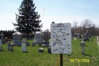
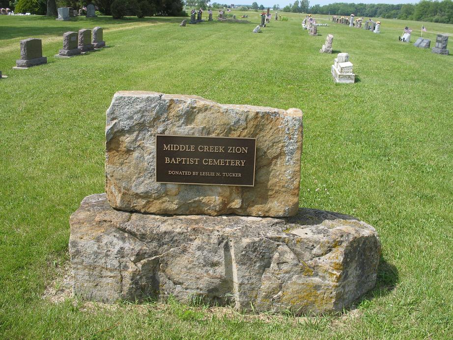
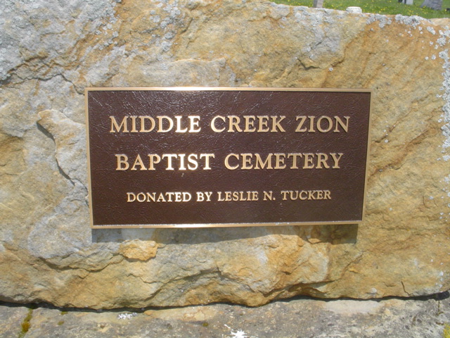
| Description | : | The Middle Creek Zion Baptist Church (Black) Cemetery is located one mile north and about one-quarter mile east of Roselms on the east bank of Middle Creek in the Southwest Quarter of Section 16 of Washington Township. On January 2, 1889, William and Margaret Patterson deeded one acre of land to the township trustees for this cemetery; the deed is recorded in Volume 48, page 357, Paulding County Record of Deeds. The cemetery is located across the road to the north from the Middle Creek Zion Baptist Church. Many of the Black settlers of Washington Township are buried... Read More |
frequently asked questions (FAQ):
-
Where is Middle Creek Zion Baptist Church Cemetery?
Middle Creek Zion Baptist Church Cemetery is located at Roselms, Paulding County ,Ohio ,USA.
-
Middle Creek Zion Baptist Church Cemetery cemetery's updated grave count on graveviews.com?
21 memorials
-
Where are the coordinates of the Middle Creek Zion Baptist Church Cemetery?
Latitude: 41.0340004
Longitude: -84.4179993
Nearby Cemetories:
1. Mellinger Cemetery
Paulding County, USA
Coordinate: 41.0363998, -84.3918991
2. Wilson Cemetery
Paulding County, USA
Coordinate: 41.0518990, -84.4052963
3. Auglaize Chapel Church of God Cemetery
Paulding County, USA
Coordinate: 41.0480995, -84.3882980
4. Carlton Cemetery
Paulding County, USA
Coordinate: 41.0303001, -84.3827972
5. Boutwell Cemetery
Paulding County, USA
Coordinate: 41.0327988, -84.3807983
6. Harrell Cemetery
Paulding County, USA
Coordinate: 41.0572970, -84.3939360
7. Young Cemetery
Paulding County, USA
Coordinate: 41.0121994, -84.3855972
8. Fought Cemetery
Mandale, Paulding County, USA
Coordinate: 41.0121994, -84.3842010
9. Mount Zion Cemetery
Latty, Paulding County, USA
Coordinate: 41.0536003, -84.4582977
10. Middle Creek Cemetery
Grover Hill, Paulding County, USA
Coordinate: 41.0050011, -84.4509964
11. Little Auglaize Cemetery
Melrose, Paulding County, USA
Coordinate: 41.0780572, -84.4196320
12. Dotson Cemetery
Monterey Township, Putnam County, USA
Coordinate: 40.9841995, -84.3946991
13. Oak Grove Cemetery
Paulding County, USA
Coordinate: 41.0629997, -84.3460007
14. Switzer Cemetery
Melrose, Paulding County, USA
Coordinate: 41.1030312, -84.4227982
15. Oakwood Cemetery
Oakwood, Paulding County, USA
Coordinate: 41.0998370, -84.3807000
16. Fairview Cemetery
Dupont, Putnam County, USA
Coordinate: 41.0522003, -84.3182983
17. Fort Brown Cemetery
Melrose, Paulding County, USA
Coordinate: 41.1116420, -84.4146810
18. Prairie Chapel Cemetery
Oakwood, Paulding County, USA
Coordinate: 41.0999985, -84.3625031
19. New Bethany Cemetery
Dupont, Putnam County, USA
Coordinate: 41.0483017, -84.3139038
20. Kingery Cemetery
Paulding County, USA
Coordinate: 41.1138992, -84.4107971
21. Antioch Cemetery
Monterey Township, Putnam County, USA
Coordinate: 40.9757996, -84.3431015
22. Bowholtz Cemetery
Oakwood, Paulding County, USA
Coordinate: 41.1074982, -84.4705963
23. Saint Barbaras Catholic Church Cemetery
Cloverdale, Putnam County, USA
Coordinate: 41.0184410, -84.2974091
24. Franconia Cemetery
Dupont, Putnam County, USA
Coordinate: 41.0393982, -84.2936020