
| Memorials | : | 0 |
| Location | : | Reno County, USA |
| Coordinate | : | 37.7850490, -97.7360050 |
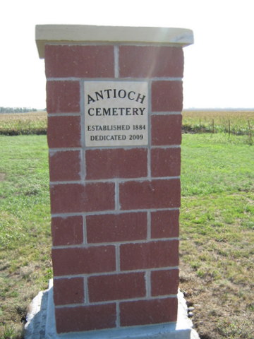
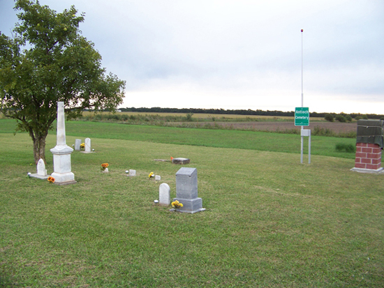
| Description | : | Location: 1/2 mile south of the intersection of E. Silver Lake Road and Rayl Road in the southeast corner of Reno County. Note that Silver Lake Road is 61st Street North in Sedgwick County. Or travel about 2 1/2 miles north of the town of St. Joe/Ost on Rayl Road (E. Maple Grove Rd. and Rayl Rd.). The cemetery is on the east side of the road. It is one acre in size. Legal description is; the S. W. corner of the N. W. quarter of Section 14, T26, R4W. This property was deeded on December 27, 1884 to be... Read More |
frequently asked questions (FAQ):
-
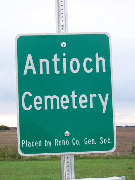
Where is Antioch Cemetery?
Antioch Cemetery is located at Reno County ,Kansas ,USA.
-
Antioch Cemetery cemetery's updated grave count on graveviews.com?
0 memorials
-
Where are the coordinates of the Antioch Cemetery?
Latitude: 37.7850490
Longitude: -97.7360050
Nearby Cemetories:
1. Saint Joseph Church Cemetery
Ost, Reno County, USA
Coordinate: 37.7485100, -97.7316550
2. Saint Joseph Cemetery
Andale, Sedgwick County, USA
Coordinate: 37.7938004, -97.6376038
3. Haven Priest Cemetery
Haven, Reno County, USA
Coordinate: 37.8685989, -97.7457962
4. Mount Hope Cemetery
Mount Hope, Sedgwick County, USA
Coordinate: 37.8546982, -97.6744003
5. Mulkey Cemetery
Garden Plain, Sedgwick County, USA
Coordinate: 37.7071495, -97.6878967
6. Mount Vernon Cemetery
Mount Vernon, Kingman County, USA
Coordinate: 37.7043991, -97.8158035
7. Pleasant Hill Cemetery
Reno County, USA
Coordinate: 37.7569008, -97.8621979
8. Saint Marys Cemetery
Garden Plain, Sedgwick County, USA
Coordinate: 37.7068300, -97.6430500
9. Saint Rose Cemetery
Mount Vernon, Kingman County, USA
Coordinate: 37.7175598, -97.8449936
10. Saint Pauls Lutheran Church Cemetery
Haven, Reno County, USA
Coordinate: 37.8974410, -97.7939490
11. Saint Paul Lutheran Cemetery
Cheney, Sedgwick County, USA
Coordinate: 37.6628000, -97.7424500
12. Saint Anthony Cemetery
Garden Plain, Sedgwick County, USA
Coordinate: 37.6535988, -97.6838989
13. Calvary Methodist Cemetery
Garden Plain, Sedgwick County, USA
Coordinate: 37.6528015, -97.6841965
14. Pioneer Cemetery
Cheney, Sedgwick County, USA
Coordinate: 37.6471300, -97.7861400
15. Saint Marks Cemetery
Saint Marks, Sedgwick County, USA
Coordinate: 37.7363014, -97.5613022
16. Star Cemetery
Patterson, Harvey County, USA
Coordinate: 37.9263687, -97.6833878
17. Sacred Heart Catholic Cemetery
Colwich, Sedgwick County, USA
Coordinate: 37.7798004, -97.5447006
18. Eldridge Cemetery
Colwich, Sedgwick County, USA
Coordinate: 37.8166008, -97.5372009
19. Laurel Cemetery
Haven, Reno County, USA
Coordinate: 37.9268990, -97.8394012
20. Valley Township Cemetery
Haven, Reno County, USA
Coordinate: 37.9491550, -97.7474530
21. Hunt Cemetery
Patterson, Harvey County, USA
Coordinate: 37.9413000, -97.6657000
22. Fairview Cemetery
Cheney, Sedgwick County, USA
Coordinate: 37.6194000, -97.7861023
23. Pleasant Ridge Cemetery
Goddard, Sedgwick County, USA
Coordinate: 37.6777992, -97.5627975
24. Yoder Amish Cemetery
Yoder, Reno County, USA
Coordinate: 37.9412330, -97.8389500