
| Memorials | : | 41 |
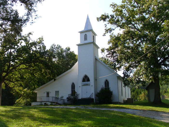
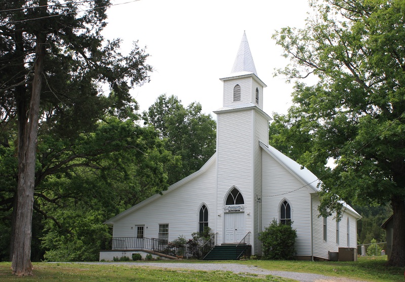
| Location | : | Mosheim, Greene County, USA |
| Coordinate | : | 36.2486040, -82.9983890 |
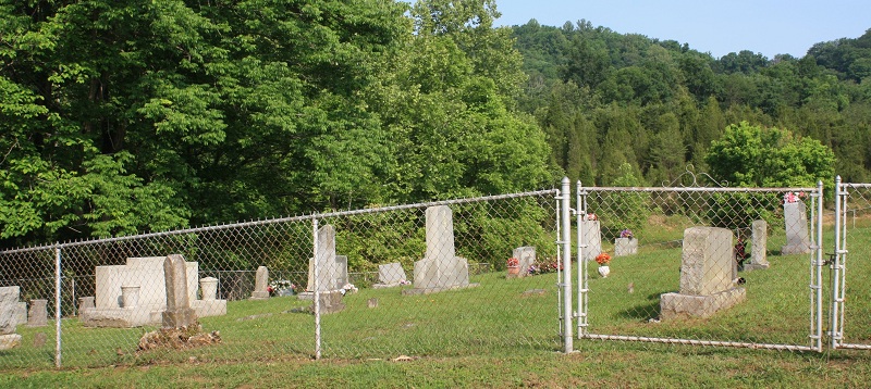
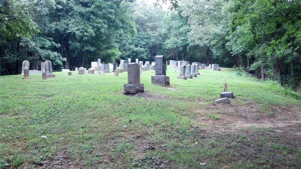
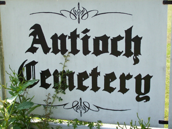
| Description | : | This church has small cemeteries in two different locations on the property. There is a small cemetery directly behind the church. There is also a small cemetery which can't be seen from the church. If you are facing the church, the second cemetery is behind the playground and picnic area and is up the hill and in the woods. There is a metal gate at the entrance of this cemetery. The majority of the graves for this church are in this portion of the cemetery. |
frequently asked questions (FAQ):
-
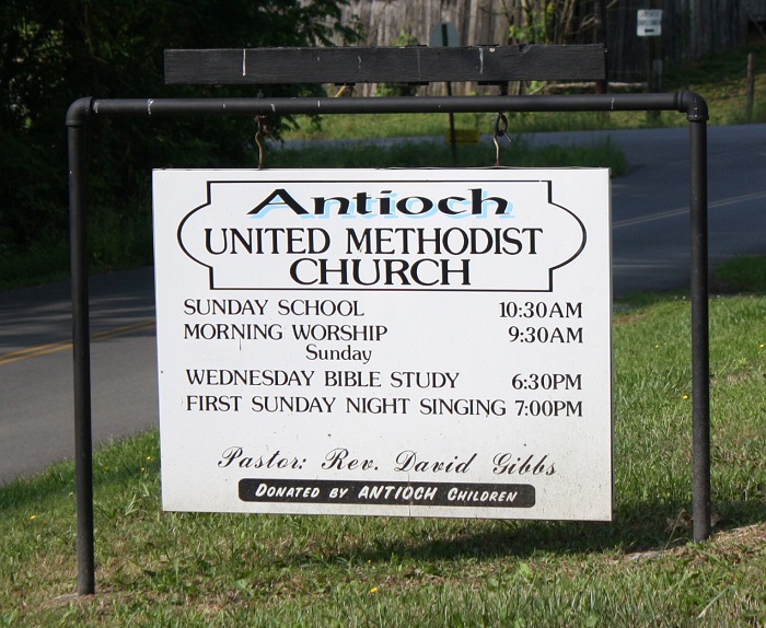
Where is Antioch United Methodist Church Cemetery?
Antioch United Methodist Church Cemetery is located at 4320 Marvin Rd Mosheim, Greene County ,Tennessee ,USA.
-
Antioch United Methodist Church Cemetery cemetery's updated grave count on graveviews.com?
41 memorials
-
Where are the coordinates of the Antioch United Methodist Church Cemetery?
Latitude: 36.2486040
Longitude: -82.9983890
Nearby Cemetories:
1. Mount Sinai United Methodist Church Cemetery
Mosheim, Greene County, USA
Coordinate: 36.2405260, -82.9829440
2. Pilot Knob Cemetery
Greene County, USA
Coordinate: 36.2711600, -82.9917500
3. Brown Cemetery
Greene County, USA
Coordinate: 36.2522011, -83.0271988
4. Weems Chapel Cemetery
Mosheim, Greene County, USA
Coordinate: 36.2255760, -83.0091490
5. Carpenter's Chapel Cemetery
Mosheim, Greene County, USA
Coordinate: 36.2200890, -82.9935800
6. Brotherton Cemetery
Greene County, USA
Coordinate: 36.2789001, -82.9800034
7. Mount Carmel United Methodist Church Cemetery
Mosheim, Greene County, USA
Coordinate: 36.2508210, -82.9526230
8. Speedwell Missionary Baptist Church Cemetery
Bulls Gap, Hawkins County, USA
Coordinate: 36.2897400, -83.0096100
9. Harmons Valley United Methodist Church Cemetery
Mosheim, Greene County, USA
Coordinate: 36.2042656, -83.0018234
10. Old Harmons Valley Cemetery
Mosheim, Greene County, USA
Coordinate: 36.2033005, -82.9991989
11. Coward Cemetery
Hawkins County, USA
Coordinate: 36.2963982, -83.0124969
12. Harmon Historic Cemetery
Midway, Greene County, USA
Coordinate: 36.2006380, -83.0134990
13. Short Road Civil War Burial Site
Bulls Gap, Hawkins County, USA
Coordinate: 36.2997400, -82.9959200
14. Philippi Missionary Baptist Church Cemetery
Mosheim, Greene County, USA
Coordinate: 36.2313300, -83.0587400
15. Dotson Cemetery
Hawkins County, USA
Coordinate: 36.3011017, -83.0141983
16. Couch Cemetery
Hawkins County, USA
Coordinate: 36.3025017, -83.0066986
17. Long and Berry Cemetery
Bulls Gap, Hawkins County, USA
Coordinate: 36.2931640, -83.0411480
18. Couch-Patterson Cemetery
Greene County, USA
Coordinate: 36.2971992, -82.9582977
19. Ed Berry Cemetery
Hawkins County, USA
Coordinate: 36.2983017, -83.0408020
20. Trinity Pentecostal Church Cemetery
Bulls Gap, Hawkins County, USA
Coordinate: 36.2792650, -83.0636510
21. Carters Chapel United Methodist Church Cemetery
Greene County, USA
Coordinate: 36.2452800, -82.9224610
22. Brown Springs Baptist Church Cemetery
Mosheim, Greene County, USA
Coordinate: 36.2032660, -82.9424770
23. Old Rader Cemetery
Mohawk, Greene County, USA
Coordinate: 36.2165160, -83.0674820
24. Riley Cemetery
Mohawk, Greene County, USA
Coordinate: 36.2036800, -83.0564100