
| Memorials | : | 75 |
| Location | : | Mosheim, Greene County, USA |
| Coordinate | : | 36.2032660, -82.9424770 |
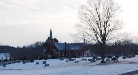
| Description | : | This church's cemetery is in two locations on the church grounds. As you drive up to the church, you'll see the newer and largest section of graves to the right of the church. In order to find the "older" part of the cemetery, you have to drive to the left of the church almost to the back. You'll see graves off to the left. These graves can't be seen unless you drive far enough up the church driveway. |
frequently asked questions (FAQ):
-
Where is Brown Springs Baptist Church Cemetery?
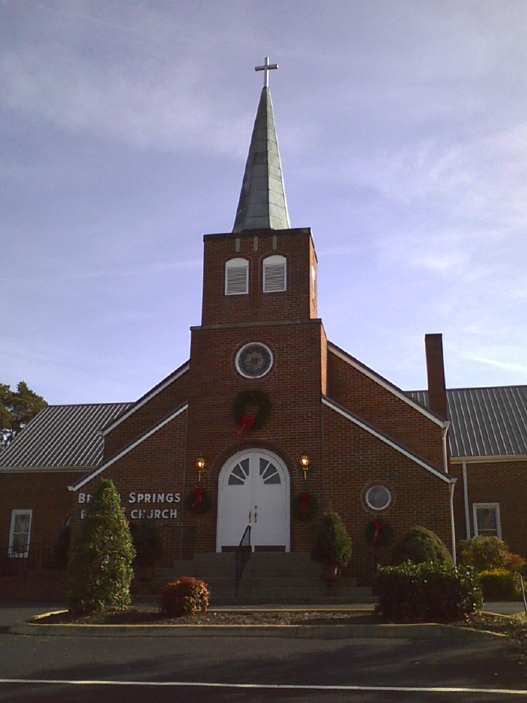
Brown Springs Baptist Church Cemetery is located at 78 Brown Springs Lane Mosheim, Greene County ,Tennessee ,USA.
-
Brown Springs Baptist Church Cemetery cemetery's updated grave count on graveviews.com?
75 memorials
-
Where are the coordinates of the Brown Springs Baptist Church Cemetery?
Latitude: 36.2032660
Longitude: -82.9424770
Nearby Cemetories:
1. Mosheim Central Cemetery
Mosheim, Greene County, USA
Coordinate: 36.1906900, -82.9574800
2. Blue Springs Cemetery
Mosheim, Greene County, USA
Coordinate: 36.1899500, -82.9580200
3. White Cemetery
Mosheim, Greene County, USA
Coordinate: 36.1895465, -82.9620014
4. West Greene Cemetery
Mosheim, Greene County, USA
Coordinate: 36.1836580, -82.9692210
5. McMillian Free Will Baptist Church Cemetery
Midway, Greene County, USA
Coordinate: 36.1704730, -82.9792030
6. Mount Pleasant Methodist Church Cemetery
Greeneville, Greene County, USA
Coordinate: 36.1693670, -82.9067280
7. Carpenter's Chapel Cemetery
Mosheim, Greene County, USA
Coordinate: 36.2200890, -82.9935800
8. Carters Station UMC Cemetery
Mosheim, Greene County, USA
Coordinate: 36.2395860, -82.9099840
9. Carters Chapel United Methodist Church Cemetery
Greene County, USA
Coordinate: 36.2452800, -82.9224610
10. J.H. Anderson Cemetery
Greene County, USA
Coordinate: 36.2139300, -82.8874800
11. Old Harmons Valley Cemetery
Mosheim, Greene County, USA
Coordinate: 36.2033005, -82.9991989
12. Carters Station UMC Churchyard
Mosheim, Greene County, USA
Coordinate: 36.2410380, -82.9098200
13. New Bethel Cumberland Presbyterian Cemetery
Greene County, USA
Coordinate: 36.1954060, -82.8839970
14. Harmons Valley United Methodist Church Cemetery
Mosheim, Greene County, USA
Coordinate: 36.2042656, -83.0018234
15. Mount Carmel United Methodist Church Cemetery
Mosheim, Greene County, USA
Coordinate: 36.2508210, -82.9526230
16. Old Ailshie Cemetery
Midway, Greene County, USA
Coordinate: 36.1663147, -82.9830512
17. Mount Sinai United Methodist Church Cemetery
Mosheim, Greene County, USA
Coordinate: 36.2405260, -82.9829440
18. Midway Cumberland Presbyterian Cemetery
Midway, Greene County, USA
Coordinate: 36.1753800, -82.9946700
19. Saint Joseph Chapel Cemetery
Midway, Greene County, USA
Coordinate: 36.1806100, -83.0070800
20. Harmon Historic Cemetery
Midway, Greene County, USA
Coordinate: 36.2006380, -83.0134990
21. Trobaugh-Myers Cemetery
Greeneville, Greene County, USA
Coordinate: 36.1651400, -82.8889710
22. Weems Chapel Cemetery
Mosheim, Greene County, USA
Coordinate: 36.2255760, -83.0091490
23. Antioch United Methodist Church Cemetery
Mosheim, Greene County, USA
Coordinate: 36.2486040, -82.9983890
24. Hartmans Chapel United Methodist Church Cemetery
Mosheim, Greene County, USA
Coordinate: 36.1397430, -82.9554420